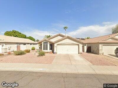
2547 N 131st Ln Goodyear, AZ 85395
Palm Valley NeighborhoodEstimated Value: $351,705 - $448,000
--
Bed
3
Baths
1,686
Sq Ft
$238/Sq Ft
Est. Value
About This Home
This home is located at 2547 N 131st Ln, Goodyear, AZ 85395 and is currently estimated at $401,176, approximately $237 per square foot. 2547 N 131st Ln is a home located in Maricopa County with nearby schools including Palm Valley Elementary School, Wigwam Creek Middle School, and Valor Preparatory Academy.
Ownership History
Date
Name
Owned For
Owner Type
Purchase Details
Closed on
Jan 22, 1998
Sold by
Greystone Homes Inc
Bought by
Mireles Frank and Mireles Pauline M
Current Estimated Value
Home Financials for this Owner
Home Financials are based on the most recent Mortgage that was taken out on this home.
Original Mortgage
$112,200
Interest Rate
6.9%
Mortgage Type
VA
Create a Home Valuation Report for This Property
The Home Valuation Report is an in-depth analysis detailing your home's value as well as a comparison with similar homes in the area
Home Values in the Area
Average Home Value in this Area
Purchase History
| Date | Buyer | Sale Price | Title Company |
|---|---|---|---|
| Mireles Frank | $110,023 | First American Title |
Source: Public Records
Mortgage History
| Date | Status | Borrower | Loan Amount |
|---|---|---|---|
| Open | Mireles Frank | $182,910 | |
| Closed | Mireles Frank | $195,280 | |
| Closed | Mireles Frank | $197,303 | |
| Closed | Mireles Frank | $91,500 | |
| Closed | Mireles Frank | $100,000 | |
| Closed | Mireles Frank | $48,000 | |
| Closed | Mireles Frank | $108,243 | |
| Closed | Mireles Frank | $112,200 |
Source: Public Records
Tax History Compared to Growth
Tax History
| Year | Tax Paid | Tax Assessment Tax Assessment Total Assessment is a certain percentage of the fair market value that is determined by local assessors to be the total taxable value of land and additions on the property. | Land | Improvement |
|---|---|---|---|---|
| 2025 | $1,878 | $17,930 | -- | -- |
| 2024 | $1,807 | $17,076 | -- | -- |
| 2023 | $1,807 | $28,860 | $5,770 | $23,090 |
| 2022 | $1,742 | $21,910 | $4,380 | $17,530 |
| 2021 | $1,817 | $20,920 | $4,180 | $16,740 |
| 2020 | $1,780 | $18,600 | $3,720 | $14,880 |
| 2019 | $1,718 | $17,360 | $3,470 | $13,890 |
| 2018 | $1,698 | $17,170 | $3,430 | $13,740 |
| 2017 | $1,611 | $15,680 | $3,130 | $12,550 |
| 2016 | $1,548 | $14,580 | $2,910 | $11,670 |
| 2015 | $1,436 | $13,700 | $2,740 | $10,960 |
Source: Public Records
Map
Nearby Homes
- 13145 W Cambridge Ave
- 2685 N 132nd Dr
- 12914 W Wilshire Dr
- 12901 W Wilshire Dr
- 12858 W Wilshire Dr
- 13348 W Cambridge Ave
- 12825 W Virginia Ave
- 12821 W La Reata Ave
- 12814 W Edgemont Ave
- 13350 W La Reata Ave
- 1870 N 128th Dr
- 13033 W Avalon Dr
- 12962 W Catalina Dr
- 12745 W Monte Vista Rd
- 12739 W Merrell St
- 13533 W Cypress St
- 13034 W Cheery Lynn Rd
- 13196 W Coronado Rd
- 12629 W Cambridge Ave
- 13562 W Cypress St
- 2547 N 131st Ln
- 2537 N 131st Ln
- 2557 N 131st Ln
- 13142 W Cambridge Ave
- 2600 N 131st Dr
- 13185 W Windsor Ave
- 2548 N 131st Ln
- 13179 W Windsor Ave
- 2538 N 131st Ln
- 2558 N 131st Ln
- 2618 N 131st Dr
- 13175 W Windsor Ave
- 2568 N 131st Ln
- 13155 W Cambridge Ave
- 13128 W Cambridge Ave
- 13169 W Windsor Ave
- 2576 N 131st Ln
- 2516 N 131st Ln
- 13133 W Cambridge Ave
- 13122 W Cambridge Ave