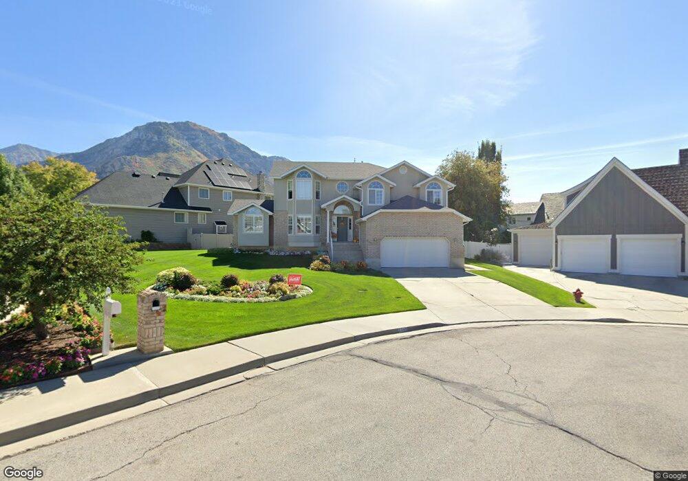
2548 N 530 E Provo, UT 84604
Rock Canyon NeighborhoodEstimated Value: $756,188 - $937,000
5
Beds
4
Baths
2,569
Sq Ft
$329/Sq Ft
Est. Value
About This Home
This home is located at 2548 N 530 E, Provo, UT 84604 and is currently estimated at $845,297, approximately $329 per square foot. 2548 N 530 E is a home located in Utah County with nearby schools including Rock Canyon Elementary School, Centennial Middle School, and Timpview High School.
Ownership History
Date
Name
Owned For
Owner Type
Purchase Details
Closed on
Mar 3, 2025
Sold by
Atkinson Scott Leroy
Bought by
Family Forever Trust and Atkinson
Current Estimated Value
Purchase Details
Closed on
Jan 21, 2025
Sold by
Atkinson Family Trust and Atkinson Scott Leroy
Bought by
Atkinson Scott Leroy
Purchase Details
Closed on
Aug 22, 2018
Sold by
Atkinson Scott L and Atkinson Mary E
Bought by
Atkinson Scott Leroy and Atkinson Mary Elizabeth
Purchase Details
Closed on
Apr 26, 2018
Sold by
Atkison Scott L and Atkison Mary E
Bought by
Atkinson Scott Leroy and Atkinson Mary Elizabeth
Create a Home Valuation Report for This Property
The Home Valuation Report is an in-depth analysis detailing your home's value as well as a comparison with similar homes in the area
Home Values in the Area
Average Home Value in this Area
Purchase History
| Date | Buyer | Sale Price | Title Company |
|---|---|---|---|
| Family Forever Trust | -- | None Listed On Document | |
| Atkinson Scott Leroy | -- | None Listed On Document | |
| Atkinson Scott Leroy | -- | None Available | |
| Atkinson Scott Leroy | -- | None Available |
Source: Public Records
Tax History
| Year | Tax Paid | Tax Assessment Tax Assessment Total Assessment is a certain percentage of the fair market value that is determined by local assessors to be the total taxable value of land and additions on the property. | Land | Improvement |
|---|---|---|---|---|
| 2025 | $3,837 | $381,205 | -- | -- |
| 2024 | $3,837 | $377,685 | $0 | $0 |
| 2023 | $3,935 | $381,810 | $0 | $0 |
| 2022 | $3,696 | $361,625 | $0 | $0 |
| 2021 | $3,332 | $568,600 | $301,900 | $266,700 |
| 2020 | $3,275 | $524,000 | $262,500 | $261,500 |
| 2019 | $3,149 | $524,000 | $262,500 | $261,500 |
| 2018 | $2,821 | $476,100 | $248,700 | $227,400 |
| 2017 | $2,484 | $230,340 | $0 | $0 |
| 2016 | $2,445 | $211,310 | $0 | $0 |
| 2015 | $2,419 | $211,310 | $0 | $0 |
| 2014 | $2,072 | $188,650 | $0 | $0 |
Source: Public Records
Map
Nearby Homes
- 2774 N 370 E
- 788 E 2680 N
- 2254 N 390 E
- 240 E 2230 N Unit 7
- 2735 N Country Club Dr
- 758 E 3030 N
- 3025 N 250 E
- 186 E 2100 N
- 182 E 2090 N
- 1108 E 2620 N
- 1960 N Canyon Rd
- 3013 N 100 W
- 3129 Cherokee Ln
- 2939 N Marrcrest Dr W
- 1801 N 650 E
- 3057 N 100 W
- 2999 N Marrcrest West Dr
- 360 Sumac Ln
- 223 W 2230 N Unit 14
- 3221 Shadowbrook Cir
Your Personal Tour Guide
Ask me questions while you tour the home.