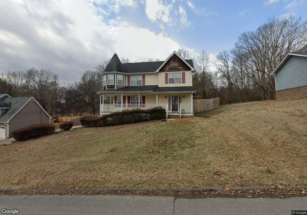
2548 W Wind Dr Soddy Daisy, TN 37379
Estimated Value: $368,000 - $400,000
3
Beds
3
Baths
2,076
Sq Ft
$185/Sq Ft
Est. Value
About This Home
This home is located at 2548 W Wind Dr, Soddy Daisy, TN 37379 and is currently estimated at $383,668, approximately $184 per square foot. 2548 W Wind Dr is a home located in Hamilton County with nearby schools including Loftis Middle School.
Ownership History
Date
Name
Owned For
Owner Type
Purchase Details
Closed on
Mar 29, 2004
Sold by
Boyd Christopher B and Boyd Alisa G
Bought by
Voiles Carson D and Trujillo Bethany
Current Estimated Value
Home Financials for this Owner
Home Financials are based on the most recent Mortgage that was taken out on this home.
Original Mortgage
$144,000
Interest Rate
5.53%
Mortgage Type
Unknown
Purchase Details
Closed on
Apr 13, 1999
Sold by
Christian David A and Christian Melody A
Bought by
Boyd Christopher B and Boyd Alisa G
Home Financials for this Owner
Home Financials are based on the most recent Mortgage that was taken out on this home.
Original Mortgage
$124,999
Interest Rate
7.37%
Create a Home Valuation Report for This Property
The Home Valuation Report is an in-depth analysis detailing your home's value as well as a comparison with similar homes in the area
Home Values in the Area
Average Home Value in this Area
Purchase History
| Date | Buyer | Sale Price | Title Company |
|---|---|---|---|
| Voiles Carson D | $160,000 | -- | |
| Boyd Christopher B | $124,999 | First Title |
Source: Public Records
Mortgage History
| Date | Status | Borrower | Loan Amount |
|---|---|---|---|
| Closed | Voiles Carson D | $144,000 | |
| Previous Owner | Boyd Christopher B | $124,999 |
Source: Public Records
Tax History
| Year | Tax Paid | Tax Assessment Tax Assessment Total Assessment is a certain percentage of the fair market value that is determined by local assessors to be the total taxable value of land and additions on the property. | Land | Improvement |
|---|---|---|---|---|
| 2025 | $1,475 | $97,300 | $0 | $0 |
| 2024 | $1,423 | $63,625 | $0 | $0 |
| 2023 | $1,432 | $63,625 | $0 | $0 |
| 2022 | $1,432 | $63,625 | $0 | $0 |
| 2021 | $1,432 | $63,625 | $0 | $0 |
| 2020 | $1,379 | $49,550 | $0 | $0 |
| 2019 | $1,379 | $49,550 | $0 | $0 |
| 2018 | $1,379 | $49,550 | $0 | $0 |
| 2017 | $1,370 | $49,550 | $0 | $0 |
| 2016 | $1,251 | $0 | $0 | $0 |
| 2015 | $1,251 | $44,900 | $0 | $0 |
| 2014 | $1,251 | $0 | $0 | $0 |
Source: Public Records
Map
Nearby Homes
- 2309 Watershore Dr
- 9824 Waterside Way
- 11326 Cape View
- 10105 Hixson Pike
- 10015 Bear Trail Dr
- 10115 Bear Trail Dr
- 11111 Hixson Pike
- 1724 Magnum Ln
- 2234 N Fork Dr
- 10160 Hunters Hollow Dr
- 10166 Hunters Hollow Dr
- 2109 Millard Rd
- 2228 Lakesite Dr
- 2404 Horseshoe Dr
- 9309 Dividing Ridge Rd
- 2311 Chimney Hills Dr
- 2435 Chimney Lake Cir
- 2221 Chimney Hills Dr
- 1846 Millard Rd
- 2105 Port Royal Dr
- 2548 Westwind Dr
- 2544 W Wind Dr
- 2544 Westwind Dr
- 2552 W Wind Dr
- 2552 Westwind Dr
- 2542 Westwind Dr
- 2545 Westwind Dr
- 9811 Hixson Pike
- 2543 Westwind Dr
- 2539 W Wind Dr
- 9813 Hixson Pike
- 2539 W Wind Dr
- 2558 Westwind Dr
- 2538 Westwind Dr
- 2538 W Wind Dr
- 2539 Westwind Dr
- 9805 Hixson Pike
- 2606 W Wind Dr
- 2613 W Wind Dr
- 2624 W Wind Dr
Your Personal Tour Guide
Ask me questions while you tour the home.