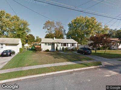
255 Amherst Ave Wenonah, NJ 08090
Deptford Township NeighborhoodEstimated Value: $222,097 - $349,000
--
Bed
--
Bath
1,084
Sq Ft
$275/Sq Ft
Est. Value
About This Home
This home is located at 255 Amherst Ave, Wenonah, NJ 08090 and is currently estimated at $298,274, approximately $275 per square foot. 255 Amherst Ave is a home located in Gloucester County with nearby schools including Deptford Township High School and St Margaret Regional School.
Ownership History
Date
Name
Owned For
Owner Type
Purchase Details
Closed on
Nov 13, 2009
Sold by
Estate Of Ralph E Shinkle Sr
Bought by
Shinkle Stephen M
Current Estimated Value
Purchase Details
Closed on
May 30, 1997
Sold by
Shinkle Ralph E
Bought by
Shinkle Ralph E and Shinkle Stephen M
Purchase Details
Closed on
Jul 29, 1996
Sold by
Shinkle Elizabeth M
Bought by
Shinkle Ralph E
Create a Home Valuation Report for This Property
The Home Valuation Report is an in-depth analysis detailing your home's value as well as a comparison with similar homes in the area
Home Values in the Area
Average Home Value in this Area
Purchase History
| Date | Buyer | Sale Price | Title Company |
|---|---|---|---|
| Shinkle Stephen M | -- | None Available | |
| Shinkle Ralph E | $94,000 | -- | |
| Shinkle Ralph E | -- | -- |
Source: Public Records
Mortgage History
| Date | Status | Borrower | Loan Amount |
|---|---|---|---|
| Closed | Shinkle Ralph E | $51,000 | |
| Closed | Shinkle Stephen M | $20,000 |
Source: Public Records
Tax History Compared to Growth
Tax History
| Year | Tax Paid | Tax Assessment Tax Assessment Total Assessment is a certain percentage of the fair market value that is determined by local assessors to be the total taxable value of land and additions on the property. | Land | Improvement |
|---|---|---|---|---|
| 2024 | $5,066 | $146,000 | $43,700 | $102,300 |
| 2023 | $5,066 | $146,000 | $43,700 | $102,300 |
| 2022 | $5,030 | $146,000 | $43,700 | $102,300 |
| 2021 | $4,638 | $146,000 | $43,700 | $102,300 |
| 2020 | $4,901 | $146,000 | $43,700 | $102,300 |
| 2019 | $4,808 | $146,000 | $43,700 | $102,300 |
| 2018 | $4,700 | $146,000 | $43,700 | $102,300 |
| 2017 | $4,574 | $146,000 | $43,700 | $102,300 |
| 2016 | $4,481 | $146,000 | $43,700 | $102,300 |
| 2015 | $4,342 | $146,000 | $43,700 | $102,300 |
| 2014 | $4,230 | $146,000 | $43,700 | $102,300 |
Source: Public Records
Map
Nearby Homes
- 257 Cornell Ave
- 640 Cornell Ave
- 666 Montclair Ave
- 505 University Blvd
- 136 Vanderbilt Ave
- 199 Ogden Station Rd
- 595 Allegheny Rd
- 483 University Blvd
- 104 Moore St
- 315 Ogden Station Rd
- 80 Moore St
- 598 Princeton Blvd
- 459 University Blvd
- 448 University Blvd
- 421 Westminster Rd
- 480 Princeton Blvd
- 127 Ashton Ct
- 727 Howard Ave
- 3 6th Ave
- 264 Barclay Ct Unit 264
- 255 Amherst Ave
- 257 Amherst Ave
- 254 Cornell Ave
- 252 Cornell Ave
- 259 Amherst Ave
- 251 Amherst Ave
- 260 Amherst Ave
- 258 Amherst Ave
- 250 Cornell Ave
- 605 Hamilton Rd
- 249 Amherst Ave
- 258 Cornell Ave
- 262 Amherst Ave
- 261 Amherst Ave
- 611 Hamilton Rd
- 256 Amherst Ave
- 601 Hamilton Rd
- 612 Franklin Rd
- 613 Hamilton Rd
- 247 Amherst Ave