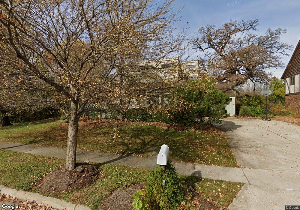
255 Brookside Dr Elgin, IL 60123
North Country Knolls NeighborhoodEstimated Value: $443,000 - $532,067
4
Beds
3
Baths
2,995
Sq Ft
$165/Sq Ft
Est. Value
About This Home
This home is located at 255 Brookside Dr, Elgin, IL 60123 and is currently estimated at $493,017, approximately $164 per square foot. 255 Brookside Dr is a home located in Kane County with nearby schools including Hillcrest Elementary School, Kimball Middle School, and Larkin High School.
Ownership History
Date
Name
Owned For
Owner Type
Purchase Details
Closed on
Aug 23, 2011
Sold by
Poulos Dorothea
Bought by
Poulos Peter Andrew
Current Estimated Value
Purchase Details
Closed on
Mar 27, 2007
Sold by
Dimitroyannis Dimitrios
Bought by
Poulos Dorothea
Purchase Details
Closed on
Oct 11, 1996
Sold by
Poulos Dorothea and Dimitroyannis Dimitrios A
Bought by
Dimitroyannis Dimitrios A and Poulos Dorothea
Home Financials for this Owner
Home Financials are based on the most recent Mortgage that was taken out on this home.
Original Mortgage
$207,000
Interest Rate
8.29%
Purchase Details
Closed on
Aug 27, 1996
Sold by
Poulos Dorothea
Bought by
Poulos Dorothea and Dimitroyannis Dimitrios
Home Financials for this Owner
Home Financials are based on the most recent Mortgage that was taken out on this home.
Original Mortgage
$207,000
Interest Rate
8.29%
Purchase Details
Closed on
Apr 12, 1996
Sold by
Rapidis Petros A
Bought by
Poulos Dorothea
Create a Home Valuation Report for This Property
The Home Valuation Report is an in-depth analysis detailing your home's value as well as a comparison with similar homes in the area
Home Values in the Area
Average Home Value in this Area
Purchase History
| Date | Buyer | Sale Price | Title Company |
|---|---|---|---|
| Poulos Peter Andrew | -- | None Available | |
| Poulos Dorothea | -- | None Available | |
| Dimitroyannis Dimitrios A | -- | -- | |
| Poulos Dorothea | -- | Chicago Title Insurance Co | |
| Poulos Dorothea | -- | Chicago Title Insurance Co |
Source: Public Records
Mortgage History
| Date | Status | Borrower | Loan Amount |
|---|---|---|---|
| Previous Owner | Poulos Dorothea | $207,000 |
Source: Public Records
Tax History
| Year | Tax Paid | Tax Assessment Tax Assessment Total Assessment is a certain percentage of the fair market value that is determined by local assessors to be the total taxable value of land and additions on the property. | Land | Improvement |
|---|---|---|---|---|
| 2024 | $11,865 | $156,258 | $38,554 | $117,704 |
| 2023 | $11,352 | $141,168 | $34,831 | $106,337 |
| 2022 | $10,641 | $128,721 | $31,760 | $96,961 |
| 2021 | $10,202 | $120,345 | $29,693 | $90,652 |
| 2020 | $9,931 | $114,888 | $28,347 | $86,541 |
| 2019 | $9,661 | $109,438 | $27,002 | $82,436 |
| 2018 | $9,236 | $99,423 | $25,438 | $73,985 |
| 2017 | $9,050 | $93,990 | $24,048 | $69,942 |
| 2016 | $8,660 | $87,197 | $22,310 | $64,887 |
| 2015 | -- | $79,924 | $20,449 | $59,475 |
| 2014 | -- | $78,938 | $20,197 | $58,741 |
| 2013 | -- | $81,020 | $20,730 | $60,290 |
Source: Public Records
Map
Nearby Homes
- 2022 Torino Dr
- 40 Acres Randall Rd
- 550 Madison Ln
- Lot 1 Highland Springs Dr
- 640 Highland Springs Dr
- 519 Shagbark Dr
- 512 Shenandoah Trail
- 2705 Colonial Dr
- 92 N Airlite St
- 660 Robin Ridge
- 2214 Colorado Ave Unit 4
- 2829 Randall Ridge Dr
- 2865 Winchester Dr
- 10N866 Hawthorne St
- 3032 Long Common Pkwy
- 10N827 Hawthorne St
- 11N060 Johnstown Rd
- 304 Nautical Way Unit D
- 1630 Maple Ln
- 207 Second St
- 251 Brookside Dr
- 249 Brookside Dr
- 223 Brookside Dr Unit 18
- 243 Brookside Dr
- 227 Brookside Dr
- 216 Brookside Dr
- 239 Brookside Dr
- 211 Brookside Dr
- 231 Brookside Dr
- 235 Brookside Dr
- 207 Brookside Dr
- 212 Brookside Dr
- 208 Brookside Dr
- 203 Brookside Dr
- 2421 Tall Oaks Dr
- 2423 Tall Oaks Dr
- 2417 Tall Oaks Dr
- 2425 Tall Oaks Dr
- 199 Brookside Dr Unit 18
- 202 Brookside Dr
Your Personal Tour Guide
Ask me questions while you tour the home.