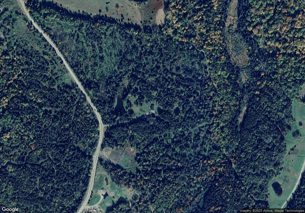
255 Gray Rd Colebrook, NH 03576
Estimated Value: $346,824 - $586,000
3
Beds
2
Baths
1,415
Sq Ft
$307/Sq Ft
Est. Value
About This Home
This home is located at 255 Gray Rd, Colebrook, NH 03576 and is currently estimated at $433,956, approximately $306 per square foot. 255 Gray Rd is a home located in Coos County with nearby schools including Colebrook Elementary School and Colebrook Academy.
Ownership History
Date
Name
Owned For
Owner Type
Purchase Details
Closed on
Mar 10, 2005
Sold by
Valkmann Wayne R and Valkmann Susan L
Bought by
Macfarlane Christina M and Macfarlane Donald J
Current Estimated Value
Home Financials for this Owner
Home Financials are based on the most recent Mortgage that was taken out on this home.
Original Mortgage
$166,500
Interest Rate
5.64%
Mortgage Type
Purchase Money Mortgage
Create a Home Valuation Report for This Property
The Home Valuation Report is an in-depth analysis detailing your home's value as well as a comparison with similar homes in the area
Home Values in the Area
Average Home Value in this Area
Purchase History
| Date | Buyer | Sale Price | Title Company |
|---|---|---|---|
| Macfarlane Christina M | $185,000 | -- |
Source: Public Records
Mortgage History
| Date | Status | Borrower | Loan Amount |
|---|---|---|---|
| Open | Macfarlane Christina M | $152,356 | |
| Closed | Macfarlane Christina M | $166,500 |
Source: Public Records
Tax History Compared to Growth
Tax History
| Year | Tax Paid | Tax Assessment Tax Assessment Total Assessment is a certain percentage of the fair market value that is determined by local assessors to be the total taxable value of land and additions on the property. | Land | Improvement |
|---|---|---|---|---|
| 2024 | $2,938 | $131,873 | $33,473 | $98,400 |
| 2023 | $2,222 | $131,944 | $33,544 | $98,400 |
| 2022 | $2,019 | $131,944 | $33,544 | $98,400 |
| 2020 | $606 | $129,912 | $33,612 | $96,300 |
| 2019 | $570 | $122,332 | $33,632 | $88,700 |
| 2018 | $2,135 | $122,258 | $33,558 | $88,700 |
| 2016 | $574 | $122,224 | $33,524 | $88,700 |
| 2015 | $2,435 | $122,224 | $33,524 | $88,700 |
| 2009 | $2,285 | $145,076 | $47,076 | $98,000 |
Source: Public Records
Map
Nearby Homes
- 295 Gray Rd
- 126 Gray Rd
- Lot 16 Oakes Rd
- 0 Fish Pond Rd Unit 46
- 464 Bungy Rd
- 475 Bungy Rd Unit MAP 420, LOT 32
- 0 Harrys Way Unit 26 5058763
- - Harrys Way
- 55 Carr Rd
- 21 Bungy Rd
- 30 Carleton Hill Rd
- 23 E Colebrook Rd
- 22 Hartlen Ave
- 400 New Hampshire 26
- 15 Forbes Hill Rd
- 193 Reed Rd
- 31 Preston Ln
- 30 Spring St
- 1 High St
- 21 Spring St
- 287 Gray Rd
- 430 Marshall Hill Rd
- 321 Gray Rd
- 189 Gray Rd
- 00 Gray Rd
- 417-35 Gray Rd
- 354 Gray Rd
- 147 Gray Rd
- 428 Marshall Hill Rd
- 379 Gray Rd
- 0 Gray Unit 4641355
- - Gray Rd
- 0 Gray Unit 4023792
- 0 Gray Unit 4083912
- 0 Gray Unit 4003100
- 0 Gray Unit 4877287
- 0 Gray Unit 4732218
- 410 Marshall Hill Rd
- 186 Gray Rd
- 417 Gray Rd
