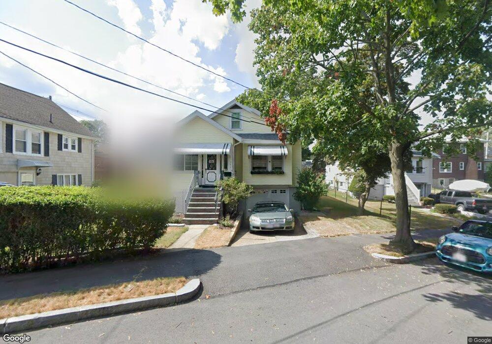
255 Hobart St Quincy, MA 02170
Montclair NeighborhoodEstimated Value: $641,000 - $661,000
3
Beds
1
Bath
1,071
Sq Ft
$611/Sq Ft
Est. Value
About This Home
This home is located at 255 Hobart St, Quincy, MA 02170 and is currently estimated at $654,297, approximately $610 per square foot. 255 Hobart St is a home located in Norfolk County with nearby schools including Montclair Elementary School, Atlantic Middle School, and North Quincy High School.
Ownership History
Date
Name
Owned For
Owner Type
Purchase Details
Closed on
Jul 24, 2020
Sold by
Briody Thomas J
Bought by
Tj Briody Lt
Current Estimated Value
Purchase Details
Closed on
Jun 30, 2011
Sold by
Flaherty Michael D and Flaherty Barbara
Bought by
Briody Thomas J
Home Financials for this Owner
Home Financials are based on the most recent Mortgage that was taken out on this home.
Original Mortgage
$200,000
Interest Rate
4.62%
Mortgage Type
Purchase Money Mortgage
Create a Home Valuation Report for This Property
The Home Valuation Report is an in-depth analysis detailing your home's value as well as a comparison with similar homes in the area
Home Values in the Area
Average Home Value in this Area
Purchase History
| Date | Buyer | Sale Price | Title Company |
|---|---|---|---|
| Tj Briody Lt | -- | None Available | |
| Briody Thomas J | $287,000 | -- |
Source: Public Records
Mortgage History
| Date | Status | Borrower | Loan Amount |
|---|---|---|---|
| Previous Owner | Briody Thomas J | $200,000 |
Source: Public Records
Tax History Compared to Growth
Tax History
| Year | Tax Paid | Tax Assessment Tax Assessment Total Assessment is a certain percentage of the fair market value that is determined by local assessors to be the total taxable value of land and additions on the property. | Land | Improvement |
|---|---|---|---|---|
| 2025 | $6,609 | $573,200 | $333,800 | $239,400 |
| 2024 | $6,486 | $575,500 | $333,800 | $241,700 |
| 2023 | $6,256 | $562,100 | $317,900 | $244,200 |
| 2022 | $6,111 | $510,100 | $276,400 | $233,700 |
| 2021 | $5,819 | $479,300 | $263,300 | $216,000 |
| 2020 | $5,633 | $453,200 | $263,300 | $189,900 |
| 2019 | $5,302 | $422,500 | $246,000 | $176,500 |
| 2018 | $5,221 | $391,400 | $227,800 | $163,600 |
| 2017 | $5,001 | $352,900 | $217,000 | $135,900 |
| 2016 | $4,554 | $317,100 | $188,700 | $128,400 |
| 2015 | $4,181 | $286,400 | $171,500 | $114,900 |
| 2014 | $3,994 | $268,800 | $163,300 | $105,500 |
Source: Public Records
Map
Nearby Homes
- 129-131 Pine St
- 65 Barham Ave
- 169 Pine St
- 171 Milton St
- 51 Denmark Ave
- 11 Rockwell Ave
- 26 Berlin Ave
- 121 Hillside Ave
- 18 Eaton St
- 143 Arlington St
- 250 Fayette St
- 115 W Squantum St Unit 907
- 115 W Squantum St Unit 810
- 60 Pond St
- 41 Wallace Rd
- 55 Christopher Dr
- 17 Holmes St Unit 2
- 17 Holmes St Unit 4
- 312 Edge Hill Rd
- 10 White St