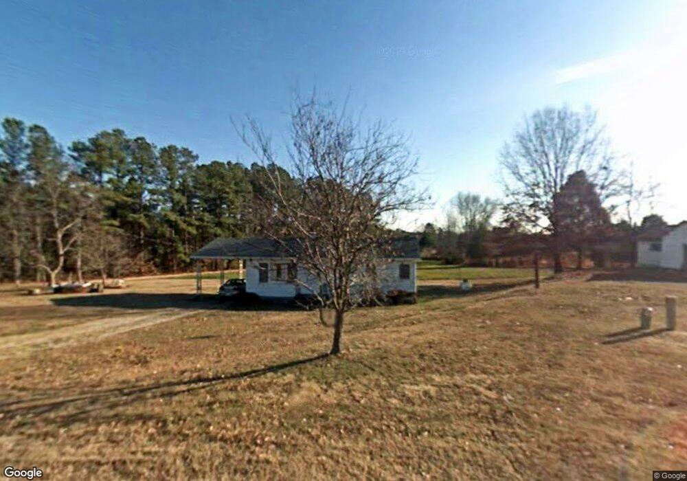
255 Mc Wilder Rd Louisburg, NC 27549
Estimated Value: $174,479 - $264,000
2
Beds
1
Bath
936
Sq Ft
$226/Sq Ft
Est. Value
About This Home
This home is located at 255 Mc Wilder Rd, Louisburg, NC 27549 and is currently estimated at $211,370, approximately $225 per square foot. 255 Mc Wilder Rd is a home located in Franklin County with nearby schools including Louisburg Elementary School, Bunn Middle School, and Bunn High School.
Ownership History
Date
Name
Owned For
Owner Type
Purchase Details
Closed on
Dec 28, 2011
Sold by
Smith Judy S and Smith Harold A
Bought by
Ww Properties & Rentals Llc
Current Estimated Value
Home Financials for this Owner
Home Financials are based on the most recent Mortgage that was taken out on this home.
Original Mortgage
$18,000
Interest Rate
4.06%
Mortgage Type
Seller Take Back
Create a Home Valuation Report for This Property
The Home Valuation Report is an in-depth analysis detailing your home's value as well as a comparison with similar homes in the area
Home Values in the Area
Average Home Value in this Area
Purchase History
| Date | Buyer | Sale Price | Title Company |
|---|---|---|---|
| Ww Properties & Rentals Llc | $20,000 | None Available |
Source: Public Records
Mortgage History
| Date | Status | Borrower | Loan Amount |
|---|---|---|---|
| Closed | Ww Properties & Rentals Llc | $18,000 |
Source: Public Records
Tax History Compared to Growth
Tax History
| Year | Tax Paid | Tax Assessment Tax Assessment Total Assessment is a certain percentage of the fair market value that is determined by local assessors to be the total taxable value of land and additions on the property. | Land | Improvement |
|---|---|---|---|---|
| 2025 | $1,032 | $161,730 | $53,630 | $108,100 |
| 2024 | $1,016 | $161,730 | $53,630 | $108,100 |
| 2023 | $807 | $81,080 | $24,670 | $56,410 |
| 2022 | $797 | $81,080 | $24,670 | $56,410 |
| 2021 | $805 | $81,080 | $24,670 | $56,410 |
| 2020 | $810 | $81,080 | $24,670 | $56,410 |
| 2019 | $766 | $77,960 | $24,670 | $53,290 |
| 2018 | $762 | $77,960 | $24,670 | $53,290 |
| 2017 | $761 | $71,130 | $21,450 | $49,680 |
| 2016 | $786 | $71,130 | $21,450 | $49,680 |
| 2015 | $786 | $71,130 | $21,450 | $49,680 |
| 2014 | $724 | $71,130 | $21,450 | $49,680 |
Source: Public Records
Map
Nearby Homes
- 10 Wilders Ln
- 35 Cotton Dr
- 60 Harley Ct
- 4009 Nc 39 Hwy S
- 70 Rough Ln
- Lot 1 Rembert Run Ct
- Lot 3 Rembert Run Ct
- Lot 5 Rembert Run Ct
- 45 Horsecreek Rd
- 7187 Pearces Rd
- 7397 Pearces Rd
- 25 Rembert Run Ct
- 7030 Pearces Rd
- 80 Shartree Farms Ln
- 444 Barnette Rd
- 6964 Pearce Rd
- 563 Arnold Rd
- 6964 Pearces Rd
- 654 Ferrells Bridge Rd
- 129 Dump Horton Rd
- 10 Wilders Crossing Dr
- 6 Wilders Crossing Dr Unit Lot 6
- 15 Wilders Crossing Dr
- 22 Wilders Crossing Dr Unit Lot22
- 30 Wilders Crossing Dr Unit 14
- 25 Wilders Crossing Dr Unit 14
- 23 Wilders Crossing Dr Unit Lot23
- 35 Wilders Crossing St
- 35 Wilders Crossing St Unit 3
- 35 Wilders Crossing Dr
- 35 Wilders Crossing Dr Unit 3
- 50 Wilders Crossing Dr
- 45 Wilders Crossing Dr
- 192 Mc Wilder Rd
- 55 Wilders Crossing Dr
- 20 Oak Hollow Ct
- 301 Mc Wilder Rd
- 70 Wilders Crossing Dr
- 65 Wilders Crossing Dr
- 187 Mc Wilder Rd