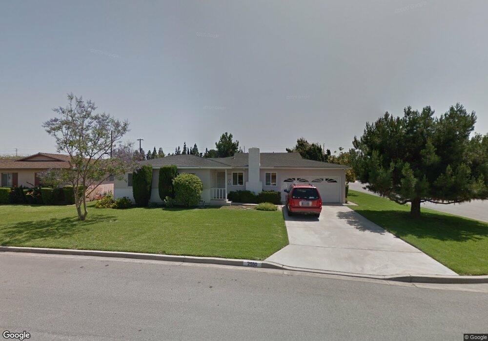
2550 W Heffron Dr Anaheim, CA 92804
West Anaheim NeighborhoodEstimated Value: $969,000 - $1,081,000
4
Beds
2
Baths
1,698
Sq Ft
$595/Sq Ft
Est. Value
About This Home
This home is located at 2550 W Heffron Dr, Anaheim, CA 92804 and is currently estimated at $1,010,709, approximately $595 per square foot. 2550 W Heffron Dr is a home located in Orange County with nearby schools including Mattie Lou Maxwell Elementary School, Dale Jr High School, and Magnolia High.
Ownership History
Date
Name
Owned For
Owner Type
Purchase Details
Closed on
Oct 14, 2020
Sold by
Hanshaw Peggy L
Bought by
Hanshaw Kristina Deann
Current Estimated Value
Purchase Details
Closed on
Sep 9, 2016
Sold by
Hanshaw Peggy L
Bought by
Hanshaw Peggy Lea and The Peggy Lea Hanshaw Trust
Purchase Details
Closed on
Apr 2, 1999
Sold by
Perardi Theresa L and Brennan Theresa Lee
Bought by
Mary L Brennan Trust
Purchase Details
Closed on
Mar 11, 1999
Sold by
Brennan Mary L
Bought by
Hanshaw Peggy L
Purchase Details
Closed on
Jan 8, 1998
Sold by
Lang Mary Kay
Bought by
Brennan Mary Louise
Purchase Details
Closed on
Dec 29, 1997
Sold by
Perardi Theresa L
Bought by
Brennan Mary L
Purchase Details
Closed on
Sep 27, 1997
Sold by
Brennan Linda M
Bought by
Brennan Mary L
Create a Home Valuation Report for This Property
The Home Valuation Report is an in-depth analysis detailing your home's value as well as a comparison with similar homes in the area
Home Values in the Area
Average Home Value in this Area
Purchase History
| Date | Buyer | Sale Price | Title Company |
|---|---|---|---|
| Hanshaw Kristina Deann | -- | None Available | |
| Hanshaw Peggy Lea | -- | None Available | |
| Mary L Brennan Trust | -- | Commonwealth Land Title | |
| Mary L Brennan Trust | -- | Commonwealth Land Title | |
| Mary L Brennan Trust | -- | Commonwealth Land Title | |
| Mary L Brennan Trust | -- | Commonwealth Land Title | |
| Hanshaw Peggy L | $192,000 | Commonwealth Land Title | |
| Hanshaw Peggy L | -- | Commonwealth Land Title | |
| Brennan Mary Louise | -- | -- | |
| Brennan Mary L | -- | -- | |
| Brennan Mary L | -- | -- | |
| Brennan Mary L | -- | -- |
Source: Public Records
Tax History Compared to Growth
Tax History
| Year | Tax Paid | Tax Assessment Tax Assessment Total Assessment is a certain percentage of the fair market value that is determined by local assessors to be the total taxable value of land and additions on the property. | Land | Improvement |
|---|---|---|---|---|
| 2025 | $3,631 | $305,692 | $221,051 | $84,641 |
| 2024 | $3,631 | $299,699 | $216,717 | $82,982 |
| 2023 | $3,536 | $293,823 | $212,468 | $81,355 |
| 2022 | $3,499 | $288,062 | $208,302 | $79,760 |
| 2021 | $3,458 | $282,414 | $204,217 | $78,197 |
| 2020 | $3,438 | $279,519 | $202,123 | $77,396 |
| 2019 | $3,356 | $274,039 | $198,160 | $75,879 |
| 2018 | $3,316 | $268,666 | $194,274 | $74,392 |
| 2017 | $3,202 | $263,399 | $190,465 | $72,934 |
| 2016 | $3,186 | $258,235 | $186,731 | $71,504 |
| 2015 | $3,158 | $254,357 | $183,927 | $70,430 |
| 2014 | $3,004 | $249,375 | $180,324 | $69,051 |
Source: Public Records
Map
Nearby Homes
- 2517 W Merle Place
- 837 S Magnolia Ave
- 927 S Webster Ave
- 8921 Kennelly Ln
- 2533 W Chanticleer Rd
- 1234 S Macduff St
- 2550 W Rowland Ave
- 10211 Macduff St
- 9531 Orange Ave
- 619 S Shields Dr
- 958 S Crossbow Ln Unit 8
- 998 S Crossbow Ln Unit 12D
- 2631 W Cerritos Ave
- 9272 Cerritos Ave
- 1223 S Dale Ave
- 507 S Shields Dr
- 2513 W Fulcrum Place
- 10301 Rhiems Rd
- 2435 W Broadway
- 917 S Sutter Creek Rd Unit 46
- 2544 W Heffron Dr
- 910 S Ira Ct
- 2558 W Heffron Dr
- 2540 W Heffron Dr
- 2549 W Heffron Dr
- 911 S Velare St
- 914 S Ira Ct
- 909 S Ira Ct
- 2555 W Heffron Dr
- 2545 W Heffron Dr
- 2564 W Heffron Dr
- 917 S Ira Ct
- 917 S Velare St
- 2561 W Heffron Dr
- 2541 W Heffron Dr
- 913 S Ira Ct
- 2548 W Eola Dr
- 921 S Velare St
- 2554 W Eola Dr
- 2544 W Eola Dr