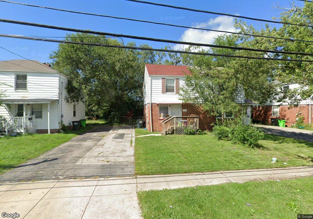
25511 Tungsten Rd Euclid, OH 44132
Estimated Value: $75,000 - $107,418
2
Beds
1
Bath
1,716
Sq Ft
$50/Sq Ft
Est. Value
About This Home
This home is located at 25511 Tungsten Rd, Euclid, OH 44132 and is currently estimated at $86,355, approximately $50 per square foot. 25511 Tungsten Rd is a home located in Cuyahoga County with nearby schools including Bluestone Elementary School, Euclid High School, and Euclid Preparatory School.
Ownership History
Date
Name
Owned For
Owner Type
Purchase Details
Closed on
Sep 21, 2015
Sold by
Cuyahoga County Land Reutilization Corpo
Bought by
Barr Dulcey
Current Estimated Value
Purchase Details
Closed on
Sep 16, 2015
Sold by
Cuyahoga County
Bought by
Cuyahoga County Land Reutilization Corpo
Purchase Details
Closed on
Dec 14, 1999
Sold by
Hedderman John P
Bought by
Greene Ila
Home Financials for this Owner
Home Financials are based on the most recent Mortgage that was taken out on this home.
Original Mortgage
$50,800
Interest Rate
7.87%
Purchase Details
Closed on
Aug 27, 1999
Sold by
Poulas Nicholes J and Clark Kathy E
Bought by
Hedderman John P
Purchase Details
Closed on
Aug 15, 1977
Sold by
Miller Richard L and Miller Stephanie
Bought by
Poulas Nicholes J
Purchase Details
Closed on
Jan 1, 1975
Bought by
Miller Richard L and Miller Stephanie
Create a Home Valuation Report for This Property
The Home Valuation Report is an in-depth analysis detailing your home's value as well as a comparison with similar homes in the area
Home Values in the Area
Average Home Value in this Area
Purchase History
| Date | Buyer | Sale Price | Title Company |
|---|---|---|---|
| Barr Dulcey | -- | Ohio Real Title | |
| Cuyahoga County Land Reutilization Corpo | -- | Attorney | |
| Greene Ila | $53,500 | -- | |
| Hedderman John P | $31,000 | Executive Title Agency Inc | |
| Poulas Nicholes J | $25,500 | -- | |
| Miller Richard L | -- | -- |
Source: Public Records
Mortgage History
| Date | Status | Borrower | Loan Amount |
|---|---|---|---|
| Previous Owner | Greene Ila | $50,800 |
Source: Public Records
Tax History Compared to Growth
Tax History
| Year | Tax Paid | Tax Assessment Tax Assessment Total Assessment is a certain percentage of the fair market value that is determined by local assessors to be the total taxable value of land and additions on the property. | Land | Improvement |
|---|---|---|---|---|
| 2024 | $2,486 | $35,175 | $3,955 | $31,220 |
| 2023 | $1,614 | $17,610 | $3,330 | $14,280 |
| 2022 | $1,579 | $17,605 | $3,325 | $14,280 |
| 2021 | $1,751 | $17,610 | $3,330 | $14,280 |
| 2020 | $1,481 | $13,340 | $2,520 | $10,820 |
| 2019 | $1,329 | $38,100 | $7,200 | $30,900 |
| 2018 | $1,341 | $13,340 | $2,520 | $10,820 |
| 2017 | $1,382 | $11,480 | $2,100 | $9,380 |
| 2016 | $1,536 | $11,480 | $2,100 | $9,380 |
| 2015 | $24,837 | $11,480 | $2,100 | $9,380 |
| 2014 | $24,837 | $13,520 | $2,490 | $11,030 |
Source: Public Records
Map
Nearby Homes
- 25550 Tungsten Rd
- 1507 E 256th St
- 1507 Babbitt Rd
- 1523 Babbitt Rd
- 1530 E 254th St
- 1552 E 254th St
- 1468 E 252nd St
- 1467 E 250th St
- 1501 E 248th St
- 1498 E 248th St
- 25151 Euclid Ave
- 24971 Euclid Ave
- 24691 Hawthorne Dr
- 24690 Hawthorne Dr
- 860 E 245th St
- 25310 Chatworth Dr
- 23050 Tracy Ave
- 1775 Braeburn Park Dr
- 164 Richmond Rd
- 1620 E 243rd St
- 25505 Tungsten Rd
- 25515 Tungsten Rd
- 25521 Tungsten Rd
- 25501 Tungsten Rd
- 25525 Tungsten Rd
- 25495 Tungsten Rd
- 25491 Tungsten Rd
- 25531 Tungsten Rd
- 25506 Tungsten Rd
- 25510 Tungsten Rd
- 25485 Tungsten Rd
- 25514 Tungsten Rd
- 25535 Tungsten Rd
- 25520 Tungsten Rd
- 25524 Tungsten Rd
- 25541 Tungsten Rd
- 25481 Tungsten Rd
- 25530 Tungsten Rd
- 1429 Sulzer Ave
- 25534 Tungsten Rd