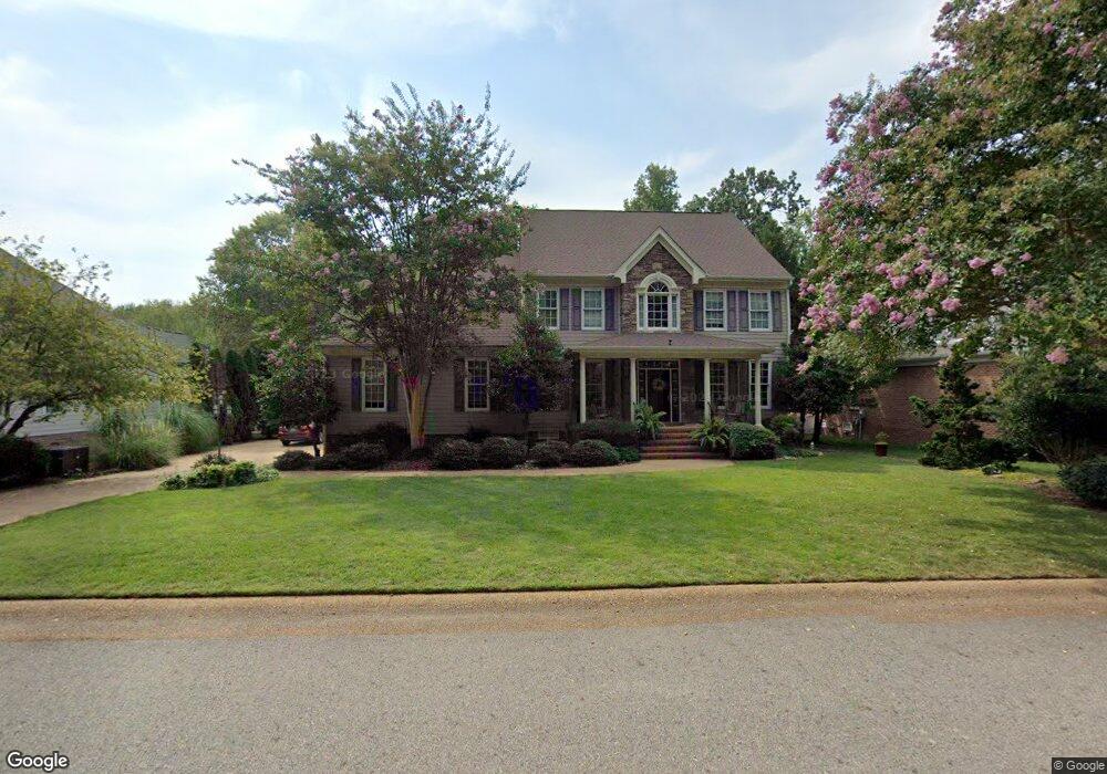
2553 Robert Fenton Rd Williamsburg, VA 23185
Jamestown NeighborhoodEstimated Value: $716,000 - $807,000
5
Beds
4
Baths
3,600
Sq Ft
$210/Sq Ft
Est. Value
About This Home
This home is located at 2553 Robert Fenton Rd, Williamsburg, VA 23185 and is currently estimated at $756,647, approximately $210 per square foot. 2553 Robert Fenton Rd is a home located in James City County with nearby schools including Laurel Lane Elementary School, Berkeley Middle School, and Jamestown High School.
Ownership History
Date
Name
Owned For
Owner Type
Purchase Details
Closed on
Sep 27, 2004
Sold by
Mccale Dev Landfall
Bought by
Yowell Stuart
Current Estimated Value
Home Financials for this Owner
Home Financials are based on the most recent Mortgage that was taken out on this home.
Original Mortgage
$280,000
Outstanding Balance
$138,348
Interest Rate
5.84%
Mortgage Type
New Conventional
Estimated Equity
$618,299
Create a Home Valuation Report for This Property
The Home Valuation Report is an in-depth analysis detailing your home's value as well as a comparison with similar homes in the area
Home Values in the Area
Average Home Value in this Area
Purchase History
| Date | Buyer | Sale Price | Title Company |
|---|---|---|---|
| Yowell Stuart | $499,000 | -- |
Source: Public Records
Mortgage History
| Date | Status | Borrower | Loan Amount |
|---|---|---|---|
| Open | Yowell Stuart | $280,000 |
Source: Public Records
Tax History
| Year | Tax Paid | Tax Assessment Tax Assessment Total Assessment is a certain percentage of the fair market value that is determined by local assessors to be the total taxable value of land and additions on the property. | Land | Improvement |
|---|---|---|---|---|
| 2025 | $5,749 | $692,600 | $108,000 | $584,600 |
| 2023 | $5,402 | $612,600 | $108,000 | $504,600 |
| 2022 | $5,085 | $612,600 | $108,000 | $504,600 |
| 2021 | $4,298 | $511,700 | $108,000 | $403,700 |
| 2020 | $4,298 | $511,700 | $108,000 | $403,700 |
| 2019 | $4,026 | $479,300 | $108,000 | $371,300 |
| 2018 | $4,026 | $479,300 | $108,000 | $371,300 |
| 2017 | $4,003 | $476,600 | $108,000 | $368,600 |
| 2016 | $4,003 | $476,600 | $108,000 | $368,600 |
| 2015 | $2,118 | $504,300 | $108,000 | $396,300 |
| 2014 | $1,942 | $504,300 | $108,000 | $396,300 |
Source: Public Records
Map
Nearby Homes
- 2504 William Tankard Dr
- 2509 Nathaniell Powell Rd
- 406 London Company Way
- 2529 Fair Chase
- 2509 Fair Chase
- 127 Constance Ave
- 120 Constance Ave
- 158 Albemarle Dr
- 339 Neck O Land Rd
- 339 Neck-O-land Rd
- 125 Albemarle Dr
- 403 Neck O Land Rd
- 2917 Richard Grove S
- 2209 Sir Hatchett Ct
- 116 Mill Stream Way
- 268 Mill Stream Way
- 1 Brandon Cir
- 125 Arena St
- 4808 Pilgrims Cir
- 3316 Reades Way
- 2549 Robert Fenton Rd
- 2557 Robert Fenton Rd
- 2459 William Tankard Dr Unit TANKARD
- 2545 Robert Fenton Rd
- 2506 Robert Fenton Rd
- 2556 Robert Fenton Rd
- 2548 Robert Fenton Rd
- 2560 Robert Fenton Rd
- 2552 Robert Fenton Rd
- 2540 Robert Fenton Rd
- 4329 Landfall Dr
- 4333 Landfall Dr
- 4337 Landfall Dr
- 2525 Robert Fenton Rd
- 4309 Landfall Dr
- 4341 Landfall Dr
- 2532 Robert Fenton Rd
- 4345 Landfall Dr
- 2536 Robert Fenton Rd
- 2528 Robert Fenton Rd
Your Personal Tour Guide
Ask me questions while you tour the home.