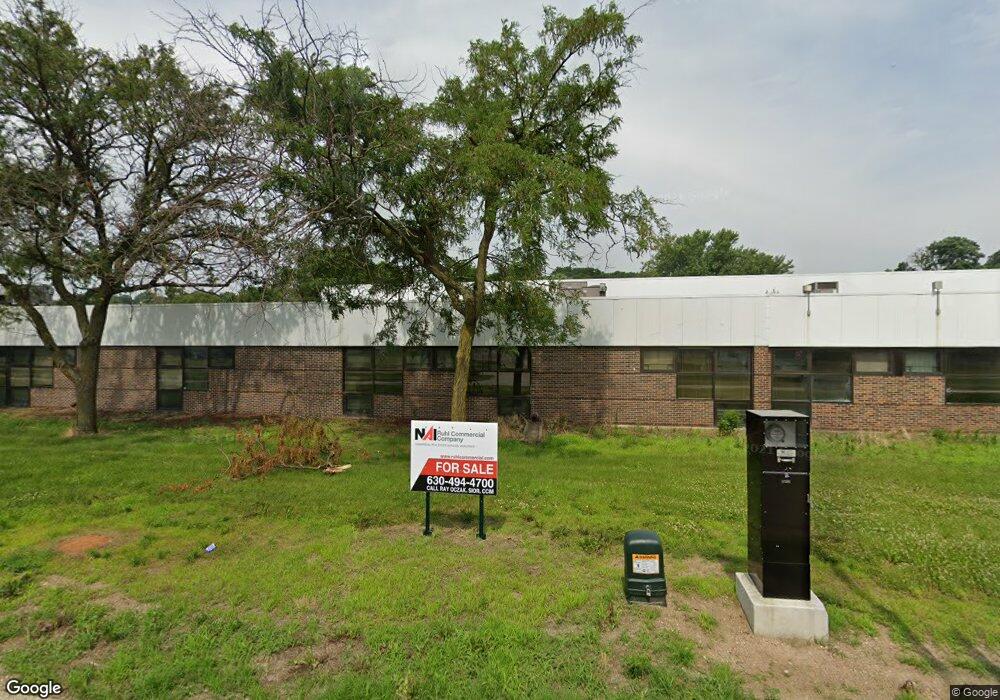
2555 Kerper Blvd Dubuque, IA 52001
Estimated Value: $2,318,976
--
Bed
--
Bath
189,000
Sq Ft
$12/Sq Ft
Est. Value
About This Home
This home is located at 2555 Kerper Blvd, Dubuque, IA 52001 and is currently estimated at $2,318,976, approximately $12 per square foot. 2555 Kerper Blvd is a home located in Dubuque County with nearby schools including Marshall Elementary School, Thomas Jefferson Middle School, and Hempstead High School.
Ownership History
Date
Name
Owned For
Owner Type
Purchase Details
Closed on
Jun 15, 2021
Sold by
Sgw Kerper Development Llc
Bought by
Jjj Hurst Properties Llc
Current Estimated Value
Home Financials for this Owner
Home Financials are based on the most recent Mortgage that was taken out on this home.
Original Mortgage
$2,875,000
Outstanding Balance
$2,602,954
Interest Rate
2.9%
Mortgage Type
Purchase Money Mortgage
Estimated Equity
-$283,978
Purchase Details
Closed on
Dec 14, 2010
Sold by
Barnstead Thermolyne Corporation
Bought by
Sgw Kerper Development Llc
Home Financials for this Owner
Home Financials are based on the most recent Mortgage that was taken out on this home.
Original Mortgage
$1,248,652
Interest Rate
4.16%
Mortgage Type
Future Advance Clause Open End Mortgage
Create a Home Valuation Report for This Property
The Home Valuation Report is an in-depth analysis detailing your home's value as well as a comparison with similar homes in the area
Home Values in the Area
Average Home Value in this Area
Purchase History
| Date | Buyer | Sale Price | Title Company |
|---|---|---|---|
| Jjj Hurst Properties Llc | $1,900,000 | None Available | |
| Sgw Kerper Development Llc | $1,550,000 | Chicago Title Insurance Co |
Source: Public Records
Mortgage History
| Date | Status | Borrower | Loan Amount |
|---|---|---|---|
| Open | Jjj Hurst Properties Llc | $2,875,000 | |
| Previous Owner | Sgw Kerper Development Llc | $1,248,652 |
Source: Public Records
Tax History Compared to Growth
Tax History
| Year | Tax Paid | Tax Assessment Tax Assessment Total Assessment is a certain percentage of the fair market value that is determined by local assessors to be the total taxable value of land and additions on the property. | Land | Improvement |
|---|---|---|---|---|
| 2025 | $73,084 | $3,113,500 | $1,011,000 | $2,102,500 |
| 2024 | $73,084 | $2,749,200 | $919,100 | $1,830,100 |
| 2023 | $72,568 | $2,749,200 | $919,100 | $1,830,100 |
| 2022 | $75,170 | $2,733,680 | $919,130 | $1,814,550 |
| 2021 | $75,170 | $2,733,680 | $919,130 | $1,814,550 |
| 2020 | $79,452 | $2,733,680 | $919,130 | $1,814,550 |
| 2019 | $72,454 | $2,733,680 | $919,130 | $1,814,550 |
Source: Public Records
Map
Nearby Homes
- 1902 Rhomberg Ave
- 1620 Justin Ln
- 1510 Garfield Ave
- 1305 Rhomberg Ave
- 1229 Rhomberg Ave
- 1223 Lincoln Ave
- 0 Thomas Place Unit 151876
- 1 Lindberg Terrace
- 932 Merz St
- 2524 Stafford St
- 809 Goethe St
- 811 Lawther St
- 2413 Stafford St
- 719 E 22nd St
- 1992 Golden Eagle Dr
- Lot 1 Cobalt Ct Ct
- 2084 Sky Blue Dr
- 2035 Cobalt Ct
- 2520 Queen St
- 2044 Sky Blue Dr
- 2555 Kerper Blvd Unit Thermolyne Property
- 2148 Garfield Ave
- 2092 Garfield Ave
- 2172 Garfield Ave
- 2086 Garfield Ave
- 2076 Garfield Ave
- 0 Shiras Ave
- 2070 Garfield Ave
- 2091 Garfield Ave
- 2081 Garfield Ave
- 2020 Garfield Ave
- 2079 Garfield Ave
- 2209 Garfield Ave
- 2100 Rhomberg Ave
- 2075 Garfield Ave
- 2010 Garfield Ave
- 2219 Garfield Ave
- 1895 Roosevelt St
- 2032 Rhomberg Ave
- 2221 Garfield Ave
