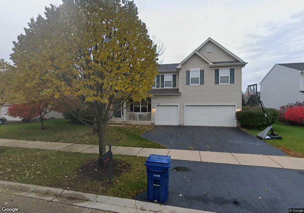
2555 Rourke Dr Unit 5 Aurora, IL 60503
Far Southeast NeighborhoodEstimated Value: $562,000 - $600,000
4
Beds
3
Baths
3,691
Sq Ft
$155/Sq Ft
Est. Value
About This Home
This home is located at 2555 Rourke Dr Unit 5, Aurora, IL 60503 and is currently estimated at $572,387, approximately $155 per square foot. 2555 Rourke Dr Unit 5 is a home located in Kendall County with nearby schools including Wolfs Crossing Elementary School, Bednarcik Jr. High School, and Oswego East High School.
Ownership History
Date
Name
Owned For
Owner Type
Purchase Details
Closed on
Jun 22, 2007
Sold by
Anderson Dale and Anderson Karen
Bought by
Deatrick John R
Current Estimated Value
Home Financials for this Owner
Home Financials are based on the most recent Mortgage that was taken out on this home.
Original Mortgage
$60,000
Interest Rate
6.23%
Mortgage Type
Credit Line Revolving
Purchase Details
Closed on
Aug 18, 2004
Sold by
The Ryland Group Inc
Bought by
Anderson Dale K and Anderson Karen E
Home Financials for this Owner
Home Financials are based on the most recent Mortgage that was taken out on this home.
Original Mortgage
$247,201
Interest Rate
5.95%
Mortgage Type
Purchase Money Mortgage
Purchase Details
Closed on
Jan 5, 2004
Sold by
Light Daniel B and Light Lea Rae
Bought by
The Ryland Group Inc
Create a Home Valuation Report for This Property
The Home Valuation Report is an in-depth analysis detailing your home's value as well as a comparison with similar homes in the area
Home Values in the Area
Average Home Value in this Area
Purchase History
| Date | Buyer | Sale Price | Title Company |
|---|---|---|---|
| Deatrick John R | -- | Chicago Title Insurance Co | |
| Anderson Dale K | $347,500 | First American Title Ins Co | |
| The Ryland Group Inc | $956,500 | -- |
Source: Public Records
Mortgage History
| Date | Status | Borrower | Loan Amount |
|---|---|---|---|
| Closed | Deatrick John R | $60,000 | |
| Open | Deatrick John R | $320,000 | |
| Previous Owner | Anderson Dale K | $247,201 |
Source: Public Records
Tax History
| Year | Tax Paid | Tax Assessment Tax Assessment Total Assessment is a certain percentage of the fair market value that is determined by local assessors to be the total taxable value of land and additions on the property. | Land | Improvement |
|---|---|---|---|---|
| 2024 | $13,619 | $159,289 | $30,348 | $128,941 |
| 2023 | $12,297 | $140,964 | $26,857 | $114,107 |
| 2022 | $12,297 | $128,149 | $24,415 | $103,734 |
| 2021 | $12,013 | $120,895 | $23,033 | $97,862 |
| 2020 | $11,664 | $116,245 | $22,147 | $94,098 |
| 2019 | $13,070 | $126,700 | $22,147 | $104,553 |
| 2018 | $12,058 | $117,445 | $20,529 | $96,916 |
| 2017 | $11,728 | $108,745 | $19,008 | $89,737 |
| 2016 | $11,424 | $104,563 | $18,277 | $86,286 |
| 2015 | $11,609 | $101,518 | $17,745 | $83,773 |
| 2014 | -- | $95,772 | $16,741 | $79,031 |
| 2013 | -- | $96,739 | $16,910 | $79,829 |
Source: Public Records
Map
Nearby Homes
- 2263 Shiloh Dr Unit 2
- 1893 Indian Hill Ln Unit 4053
- 1851 Indian Hill Ln Unit 4083
- 2413 Sunrise Cir Unit 34126
- 10140 S Eola Rd
- 2406 Sunshine Ln Unit 2386
- 1823 Indian Hill Ln Unit 4102
- 3237 Peyton Cir
- 3235 Kimblewick Cir
- 2811 Imperial Valley Trail
- 2799 Squaw Valley Trail
- 240 Devoe Dr
- 2327 Georgetown Cir Unit 18/4
- 2495 Hafenrichter Rd
- 608 Hawley Dr Unit 4342
- 2208 Grand Pointe Trail
- 1800 Diamond Creek Ln Unit 1
- 628 Lincoln Station Dr Unit 303
- 1703 Baler Ave
- 1734 Baler Ave
- 2563 Rourke Dr Unit 5
- 2531 Rourke Dr
- 2532 Lundquist Dr Unit 5
- 2518 Lundquist Dr
- 2546 Lundquist Dr
- 2504 Lundquist Dr Unit 5
- 2558 Rourke Dr Unit 5
- 2550 Rourke Dr Unit 5
- 2560 Lundquist Dr
- 2542 Rourke Dr Unit 5
- 2579 Rourke Dr Unit 5
- 2574 Rourke Dr Unit 5
- 2518 Rourke Dr
- 2252 Shiloh Dr Unit 2
- 2510 Rourke Dr Unit 5
- 2574 Lundquist Dr Unit 5
- 2582 Rourke Dr Unit 5
- 2250 Shiloh Dr
- 2254 Shiloh Dr Unit 2
- 2587 Rourke Dr Unit 5
Your Personal Tour Guide
Ask me questions while you tour the home.