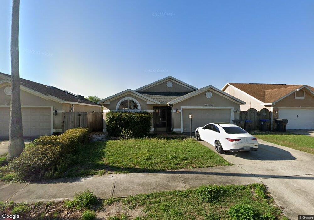
2555 St Anthony's Titusville, FL 32780
Estimated Value: $306,000 - $337,000
3
Beds
2
Baths
1,700
Sq Ft
$192/Sq Ft
Est. Value
About This Home
This home is located at 2555 St Anthony's, Titusville, FL 32780 and is currently estimated at $326,632, approximately $192 per square foot. 2555 St Anthony's is a home located in Brevard County with nearby schools including Imperial Estates Elementary School, Titusville High School, and Andrew Jackson Middle School.
Ownership History
Date
Name
Owned For
Owner Type
Purchase Details
Closed on
Oct 24, 2024
Sold by
Udo Thomas D and Udo Keri L
Bought by
Porter Matthew and Porter Macy
Current Estimated Value
Home Financials for this Owner
Home Financials are based on the most recent Mortgage that was taken out on this home.
Original Mortgage
$341,696
Outstanding Balance
$338,001
Interest Rate
6.2%
Mortgage Type
FHA
Estimated Equity
-$11,369
Purchase Details
Closed on
Oct 17, 2011
Sold by
Fleming George L and Fleming Annette R
Bought by
Udo Thomas D and Udo Keri L
Home Financials for this Owner
Home Financials are based on the most recent Mortgage that was taken out on this home.
Original Mortgage
$128,653
Interest Rate
4.25%
Mortgage Type
FHA
Create a Home Valuation Report for This Property
The Home Valuation Report is an in-depth analysis detailing your home's value as well as a comparison with similar homes in the area
Home Values in the Area
Average Home Value in this Area
Purchase History
| Date | Buyer | Sale Price | Title Company |
|---|---|---|---|
| Porter Matthew | $348,000 | Clear Choice Title | |
| Udo Thomas D | $132,000 | First Securit Title Services |
Source: Public Records
Mortgage History
| Date | Status | Borrower | Loan Amount |
|---|---|---|---|
| Open | Porter Matthew | $341,696 | |
| Previous Owner | Udo Thomas D | $128,653 |
Source: Public Records
Tax History Compared to Growth
Tax History
| Year | Tax Paid | Tax Assessment Tax Assessment Total Assessment is a certain percentage of the fair market value that is determined by local assessors to be the total taxable value of land and additions on the property. | Land | Improvement |
|---|---|---|---|---|
| 2025 | $1,424 | $267,080 | -- | -- |
| 2024 | $1,428 | $112,810 | -- | -- |
| 2023 | $1,428 | $112,130 | $0 | $0 |
| 2022 | $1,314 | $108,870 | $0 | $0 |
| 2021 | $3,130 | $105,700 | $0 | $0 |
| 2020 | $3,122 | $104,250 | $0 | $0 |
| 2019 | $3,131 | $101,910 | $0 | $0 |
| 2018 | $1,330 | $100,010 | $0 | $0 |
| 2017 | $1,314 | $97,960 | $0 | $0 |
| 2016 | $1,244 | $95,950 | $18,000 | $77,950 |
| 2015 | $1,279 | $95,290 | $18,000 | $77,290 |
| 2014 | $1,269 | $94,540 | $18,000 | $76,540 |
Source: Public Records
Map
Nearby Homes
- 2280 Saint Andrews Dr
- 2370 Saint Andrews Dr
- 2560 Saint Anthonys St
- 4875 Winchester Dr
- 2795 Saint Marks Dr
- 4980 Winchester Dr
- 2475 Cheney Hwy
- 2765 Notre Dame Dr
- 0 Unknown Hwy Unit 1059313
- 0000 Cheney Hwy
- 4850 Walton Ave
- 5085 Winchester Dr
- 4840 Volusia Ave
- 4970 Walton Ave
- 4980 Walton Ave
- 5175 Walton Ave
- 5035 Kirkwood Trail
- 0 Florida 405
- 4845 Santa Rosa Ave
- 0 Louisiana St
- 2555 Saint Anthonys St
- 2545 Saint Anthonys St
- 2545 St Anthony's
- 2565 St Anthony's
- 2565 Saint Anthonys St
- 4855 Saint Georges Ave
- 2535 Saint Anthonys St
- 2465 Saint Pauls Dr
- 4865 St George's
- 4865 Saint Georges Ave
- 2550 Saint Anthonys St
- 2455 Saint Pauls Dr
- 2455 St Paul`s
- 2455 St Paul S
- 2585 Saint Anthonys St
- 2505 Saint Pauls Dr
- 2570 St Anthony's St
- 2570 Saint Anthonys St
- 2505 St Paul's Dr
- 4860 Staint George's Ave