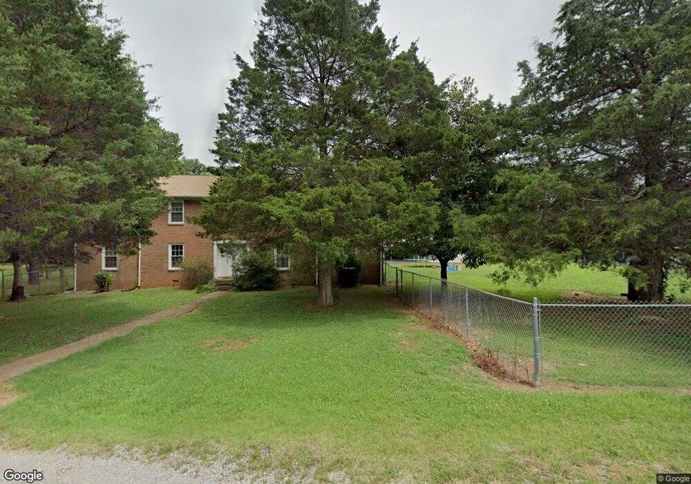
2555 Summit Ct Unit 2557 Murfreesboro, TN 37130
Estimated Value: $419,000 - $515,000
--
Bed
4
Baths
3,100
Sq Ft
$146/Sq Ft
Est. Value
About This Home
This home is located at 2555 Summit Ct Unit 2557, Murfreesboro, TN 37130 and is currently estimated at $451,265, approximately $145 per square foot. 2555 Summit Ct Unit 2557 is a home located in Rutherford County with nearby schools including John Pittard Elementary School, Oakland Middle School, and Oakland High School.
Ownership History
Date
Name
Owned For
Owner Type
Purchase Details
Closed on
May 23, 2024
Sold by
Carver Dan R
Bought by
Danny R And Linda Wynne Carver Revocable Livi and Carver
Current Estimated Value
Purchase Details
Closed on
Jul 28, 2003
Sold by
Butler Ronny L
Bought by
Carver Dan R
Home Financials for this Owner
Home Financials are based on the most recent Mortgage that was taken out on this home.
Original Mortgage
$106,400
Interest Rate
5.24%
Mortgage Type
Purchase Money Mortgage
Purchase Details
Closed on
May 22, 1997
Sold by
David Gatewood
Bought by
Bautler Ronnie L and Bautler Carol A
Create a Home Valuation Report for This Property
The Home Valuation Report is an in-depth analysis detailing your home's value as well as a comparison with similar homes in the area
Home Values in the Area
Average Home Value in this Area
Purchase History
| Date | Buyer | Sale Price | Title Company |
|---|---|---|---|
| Danny R And Linda Wynne Carver Revocable Livi | -- | None Listed On Document | |
| Danny R And Linda Wynne Carver Revocable Livi | -- | None Listed On Document | |
| Carver Dan R | $133,000 | -- | |
| Bautler Ronnie L | $118,000 | -- |
Source: Public Records
Mortgage History
| Date | Status | Borrower | Loan Amount |
|---|---|---|---|
| Previous Owner | Bautler Ronnie L | $106,400 |
Source: Public Records
Tax History Compared to Growth
Tax History
| Year | Tax Paid | Tax Assessment Tax Assessment Total Assessment is a certain percentage of the fair market value that is determined by local assessors to be the total taxable value of land and additions on the property. | Land | Improvement |
|---|---|---|---|---|
| 2025 | $3,569 | $126,160 | $20,000 | $106,160 |
| 2024 | $3,569 | $126,160 | $20,000 | $106,160 |
| 2023 | $2,367 | $126,160 | $20,000 | $106,160 |
| 2022 | $2,039 | $126,160 | $20,000 | $106,160 |
| 2021 | $2,029 | $91,400 | $14,800 | $76,600 |
| 2020 | $2,029 | $91,400 | $14,800 | $76,600 |
| 2019 | $2,029 | $91,400 | $14,800 | $76,600 |
| 2018 | $2,787 | $91,400 | $0 | $0 |
| 2017 | $3,259 | $83,840 | $0 | $0 |
| 2016 | $3,259 | $83,840 | $0 | $0 |
| 2015 | $3,259 | $83,840 | $0 | $0 |
| 2014 | $2,085 | $83,840 | $0 | $0 |
| 2013 | -- | $62,320 | $0 | $0 |
Source: Public Records
Map
Nearby Homes
- 2223 Brick Way
- 2164 White Poplar Ct
- 2111 Lovelace Ln
- 2403 English Hill Dr
- 1640 Drayton Dr
- 0 Pitts Ln
- 2510 Mission Ridge Dr
- 1512 Mirabella Way
- 1430 Avellino Cir
- 2607 Mission Ridge Dr
- 2110 Stillwell Ct
- 2428 Sandstone Cir
- 2639 Mission Ridge Dr
- 2514 Sandstone Cir
- 2326 Laurelstone Dr
- 2328 Laurelstone Dr
- 2336 Laurelstone Dr
- 2333 Laurelstone Dr
- 2406 Laurelstone Dr
- 2427 Donald Bradley Ct
- 2545 Summit Ct
- 2543 Summit Ct
- 2563 Summit Ct
- 2537 Summit Ct Unit 2539
- 2556 Summit Ct Unit 2558
- 2538 Summit Ct Unit 2540
- 748 Dejarnette Ln
- 788 Dejarnette Ln
- 2546 Summit Ct
- 2235 Brick Way
- 2231 Brick Way
- 740 Dejarnette Ln Unit 738
- 2548 Peace Place
- 2227 Brick Way
- 16 Summit Ct
- 2234 Brick Way
- 2230 Brick Way
- 2219 Brick Way
- 2550 Peace Place
- 2226 Brick Way