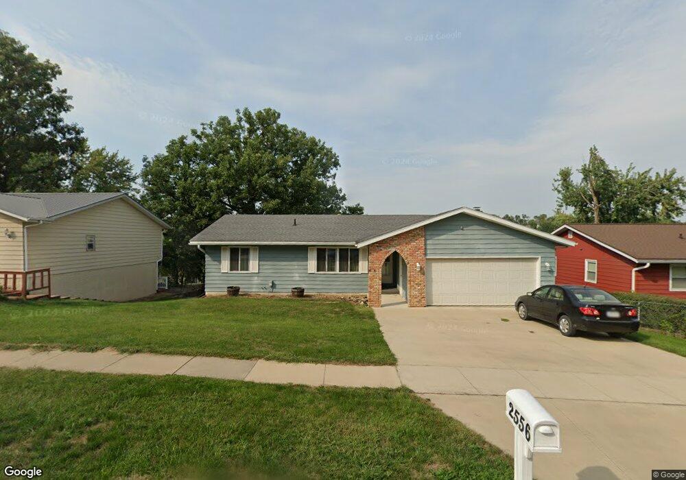
2556 M Ave NW Cedar Rapids, IA 52405
Estimated Value: $256,000 - $277,000
4
Beds
3
Baths
2,338
Sq Ft
$113/Sq Ft
Est. Value
About This Home
This home is located at 2556 M Ave NW, Cedar Rapids, IA 52405 and is currently estimated at $264,215, approximately $113 per square foot. 2556 M Ave NW is a home located in Linn County with nearby schools including Kentucky Tech - Ashland Reg Tech Center, Ponderosa Elementary School, and Madison Elementary School.
Ownership History
Date
Name
Owned For
Owner Type
Purchase Details
Closed on
Nov 29, 2010
Sold by
Thomas Brian L and Thomas Patricia V
Bought by
Middlekauff Jason T
Current Estimated Value
Home Financials for this Owner
Home Financials are based on the most recent Mortgage that was taken out on this home.
Original Mortgage
$113,000
Outstanding Balance
$74,543
Interest Rate
4.19%
Mortgage Type
New Conventional
Estimated Equity
$189,672
Purchase Details
Closed on
Feb 19, 2010
Sold by
Miller Linda J
Bought by
Thomas Brian L and Thomas Patricia V
Home Financials for this Owner
Home Financials are based on the most recent Mortgage that was taken out on this home.
Original Mortgage
$106,000
Interest Rate
5.11%
Mortgage Type
Future Advance Clause Open End Mortgage
Create a Home Valuation Report for This Property
The Home Valuation Report is an in-depth analysis detailing your home's value as well as a comparison with similar homes in the area
Home Values in the Area
Average Home Value in this Area
Purchase History
| Date | Buyer | Sale Price | Title Company |
|---|---|---|---|
| Middlekauff Jason T | $154,500 | None Available | |
| Thomas Brian L | $124,500 | None Available |
Source: Public Records
Mortgage History
| Date | Status | Borrower | Loan Amount |
|---|---|---|---|
| Open | Middlekauff Jason T | $113,000 | |
| Previous Owner | Thomas Brian L | $106,000 |
Source: Public Records
Tax History Compared to Growth
Tax History
| Year | Tax Paid | Tax Assessment Tax Assessment Total Assessment is a certain percentage of the fair market value that is determined by local assessors to be the total taxable value of land and additions on the property. | Land | Improvement |
|---|---|---|---|---|
| 2025 | $3,548 | $228,300 | $41,300 | $187,000 |
| 2024 | $3,810 | $220,100 | $41,300 | $178,800 |
| 2023 | $3,810 | $211,000 | $36,100 | $174,900 |
| 2022 | $3,538 | $189,500 | $36,100 | $153,400 |
| 2021 | $3,648 | $179,700 | $32,700 | $147,000 |
| 2020 | $3,648 | $173,900 | $32,700 | $141,200 |
| 2019 | $3,140 | $154,200 | $27,500 | $126,700 |
| 2018 | $3,050 | $154,200 | $27,500 | $126,700 |
| 2017 | $3,152 | $153,300 | $27,500 | $125,800 |
| 2016 | $3,233 | $152,100 | $27,500 | $124,600 |
| 2015 | $3,239 | $152,258 | $27,518 | $124,740 |
| 2014 | $3,054 | $152,258 | $27,518 | $124,740 |
| 2013 | $2,984 | $152,258 | $27,518 | $124,740 |
Source: Public Records
Map
Nearby Homes
- 2520 N Ave NW
- 2801 Schultz Dr NW
- 2825 Schultz Dr NW
- 2210 O Ave NW
- 1322 Woodside Dr NW
- 2623 Iris Ave NW
- 949 Westwood Dr NW
- 0 O Ave NW
- 1613 Southview Dr NW
- 1733 Hillside Dr NW
- 912 29th St NW
- 327* Edgewood Rd NW
- 3313 Crestwood Dr NW
- 1724 O Ave NW
- 1814 Shawnee Ct NW
- 623 27th St NW
- 615 27th St NW
- 3312 G Ave NW
- 451 23rd St NW
- 1424 N Ave NW