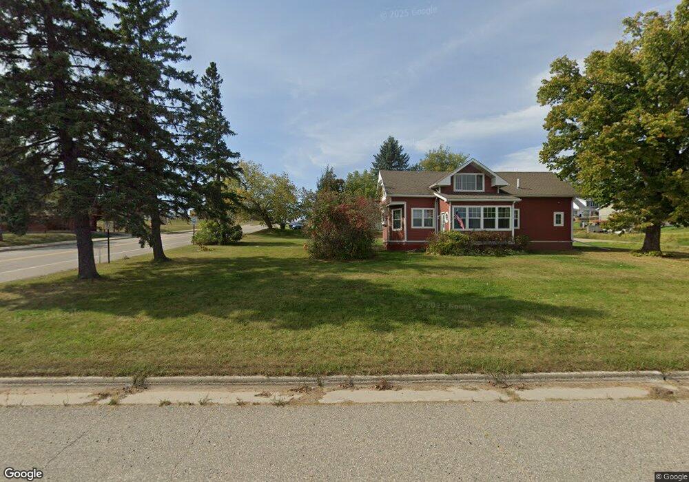
25566 Co Rd 16 Laporte, MN 56461
Estimated Value: $171,000 - $266,565
3
Beds
1
Bath
1,056
Sq Ft
$225/Sq Ft
Est. Value
About This Home
This home is located at 25566 Co Rd 16, Laporte, MN 56461 and is currently estimated at $237,891, approximately $225 per square foot. 25566 Co Rd 16 is a home located in Hubbard County with nearby schools including Horace May Elementary School, Bemidji Middle School, and Bemidji Senior High School.
Ownership History
Date
Name
Owned For
Owner Type
Purchase Details
Closed on
Apr 29, 2022
Sold by
Tomlinson Kimberly R and Tomlinson Donald
Bought by
Black Karen J
Current Estimated Value
Home Financials for this Owner
Home Financials are based on the most recent Mortgage that was taken out on this home.
Original Mortgage
$191,920
Outstanding Balance
$179,171
Interest Rate
4.16%
Mortgage Type
Balloon
Estimated Equity
$58,720
Purchase Details
Closed on
Oct 8, 2015
Sold by
Katz David David
Bought by
Hunter Kimberly Kimberly
Purchase Details
Closed on
Jun 23, 2010
Sold by
Katz David A and Katz Melissa
Bought by
Salvhus Andrew M and Salvhus Melissa A
Home Financials for this Owner
Home Financials are based on the most recent Mortgage that was taken out on this home.
Original Mortgage
$48,983
Interest Rate
4.97%
Mortgage Type
Seller Take Back
Create a Home Valuation Report for This Property
The Home Valuation Report is an in-depth analysis detailing your home's value as well as a comparison with similar homes in the area
Purchase History
| Date | Buyer | Sale Price | Title Company |
|---|---|---|---|
| Black Karen J | $239,900 | None Listed On Document | |
| Hunter Kimberly Kimberly | $35,900 | -- | |
| Salvhus Andrew M | $61,000 | None Available |
Source: Public Records
Mortgage History
| Date | Status | Borrower | Loan Amount |
|---|---|---|---|
| Open | Black Karen J | $191,920 | |
| Previous Owner | Salvhus Andrew M | $48,983 |
Source: Public Records
Tax History
| Year | Tax Paid | Tax Assessment Tax Assessment Total Assessment is a certain percentage of the fair market value that is determined by local assessors to be the total taxable value of land and additions on the property. | Land | Improvement |
|---|---|---|---|---|
| 2024 | $1,738 | $229,300 | $44,000 | $185,300 |
| 2023 | $1,818 | $236,700 | $36,300 | $200,400 |
| 2022 | $1,206 | $217,400 | $32,100 | $185,300 |
| 2021 | $1,238 | $145,600 | $28,400 | $117,200 |
| 2020 | $866 | $118,800 | $23,561 | $95,239 |
| 2019 | $788 | $73,500 | $19,822 | $53,678 |
| 2018 | $692 | $55,800 | $23,600 | $32,200 |
| 2016 | $638 | $52,800 | $20,000 | $32,800 |
| 2015 | $594 | $64,100 | $22,400 | $41,700 |
| 2014 | $530 | $61,000 | $23,400 | $37,600 |
Source: Public Records
Map
Nearby Homes
- 27462 Raven Rd
- 46962 parcel B 269th Ave
- 39669 Old Brook Rd
- 26070 County 9
- 23837 State 200
- TBD County 39 Rd
- TBD 450th St
- 31622 450th St
- TBD County 36
- 30371 Old Sunset Dr
- 170 Main St E
- 50743 Us 71
- 29866 Oxbow Ln
- 32597 Quail Ln
- 37276 Willow Rd N
- 50836 Vinewood Rd
- 37901 County 91
- TBD N Plantangenet Rd SE
- 47183 Cass Line Rd
- 50164 County 29
- 25566 County 16
- 25668 County 16
- 43875 255th Ave
- 25863 County 16
- 25227 County 16
- 25227 County 16
- 25675 County 16
- 25190 County 16
- 25986 County 16
- 25961 County 16
- 25107 County 16
- 43473 255th Ave
- 26128 County 16
- 24953 County 16
- 26199 County 16
- 26222 County 16
- 24816 County 16
- 24765 County 16
- 43899 County 36
- 26456 County 16