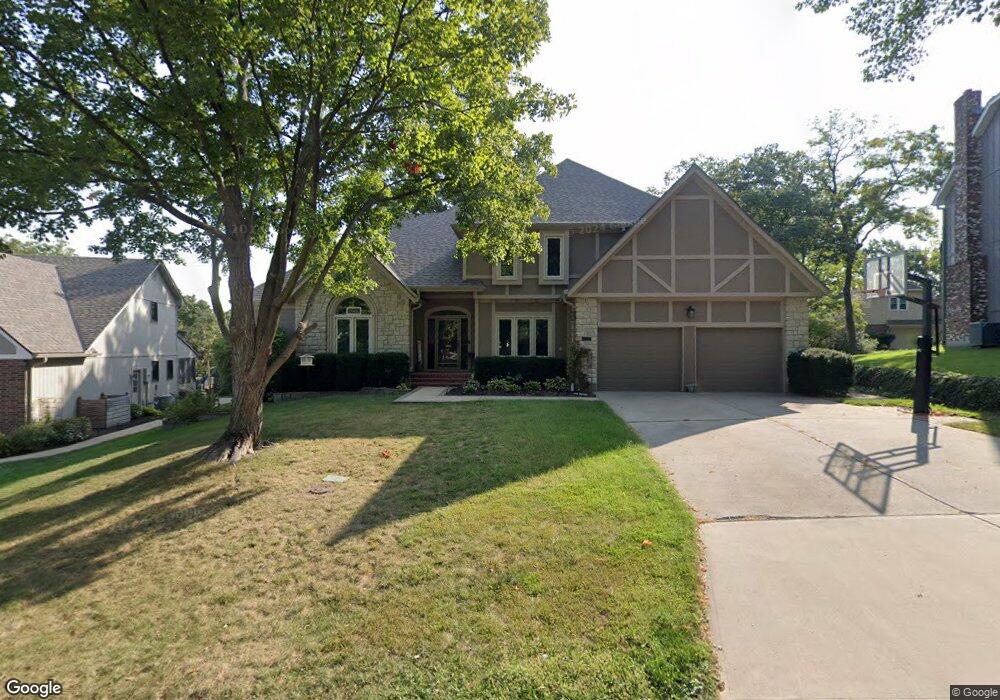
2557 NW Bent Tree Cir Lees Summit, MO 64081
Estimated Value: $520,000 - $608,000
3
Beds
5
Baths
3,437
Sq Ft
$158/Sq Ft
Est. Value
About This Home
This home is located at 2557 NW Bent Tree Cir, Lees Summit, MO 64081 and is currently estimated at $544,322, approximately $158 per square foot. 2557 NW Bent Tree Cir is a home located in Jackson County with nearby schools including Cedar Creek Elementary School, Bernard C. Campbell Middle School, and Lee's Summit North High School.
Ownership History
Date
Name
Owned For
Owner Type
Purchase Details
Closed on
Apr 1, 2019
Sold by
Franke Brian D and Franke Sheryl L
Bought by
Nurnberg Todd and Kindler Sara
Current Estimated Value
Home Financials for this Owner
Home Financials are based on the most recent Mortgage that was taken out on this home.
Original Mortgage
$308,000
Outstanding Balance
$270,787
Interest Rate
4.3%
Mortgage Type
New Conventional
Estimated Equity
$273,535
Purchase Details
Closed on
Jul 1, 2002
Sold by
Sailors Donald B and Sailors Susanne L
Bought by
Franke Brian D and Franke Sheryl L
Home Financials for this Owner
Home Financials are based on the most recent Mortgage that was taken out on this home.
Original Mortgage
$264,000
Interest Rate
6.78%
Mortgage Type
Purchase Money Mortgage
Create a Home Valuation Report for This Property
The Home Valuation Report is an in-depth analysis detailing your home's value as well as a comparison with similar homes in the area
Home Values in the Area
Average Home Value in this Area
Purchase History
| Date | Buyer | Sale Price | Title Company |
|---|---|---|---|
| Nurnberg Todd | -- | Kansas City Title Inc | |
| Franke Brian D | -- | Security Land Title Company |
Source: Public Records
Mortgage History
| Date | Status | Borrower | Loan Amount |
|---|---|---|---|
| Open | Nurnberg Todd | $308,000 | |
| Previous Owner | Franke Brian D | $264,000 | |
| Closed | Franke Brian D | $49,500 |
Source: Public Records
Tax History
| Year | Tax Paid | Tax Assessment Tax Assessment Total Assessment is a certain percentage of the fair market value that is determined by local assessors to be the total taxable value of land and additions on the property. | Land | Improvement |
|---|---|---|---|---|
| 2025 | $5,858 | $93,299 | $13,849 | $79,450 |
| 2024 | $5,816 | $81,130 | $71,077 | $10,053 |
| 2023 | $5,816 | $81,130 | $10,053 | $71,077 |
| 2022 | $5,890 | $72,960 | $8,509 | $64,451 |
| 2021 | $6,012 | $72,960 | $8,509 | $64,451 |
| 2020 | $6,382 | $76,704 | $8,509 | $68,195 |
| 2019 | $6,208 | $76,704 | $8,509 | $68,195 |
| 2018 | $983,212 | $66,757 | $7,405 | $59,352 |
| 2017 | $5,822 | $66,757 | $7,405 | $59,352 |
| 2016 | $5,438 | $61,712 | $7,353 | $54,359 |
Source: Public Records
Map
Nearby Homes
- 955 NW High Point Dr
- 2430 NW Windwood Dr
- 507 NW Ashurst Ct
- 2635 NW Ashurst Ln
- 2224 NW Summerfield Dr
- 334 NW Ambersham Dr
- 321 NW Nutall Dr
- 13004 E 99th St
- 2809 NW Audubon Ln
- 2122 NW Ashurst Dr
- 2110 NW Ashurst Dr
- 433 NW Kaylea Ct
- 209 NW Cody Dr
- 2214 NW Killarney Ln
- 2086 NW O'Brien Rd
- 2074 NW O'Brien Rd
- 2070 NW O'Brien Rd
- 317 NW Lovins
- 316 NW Lovins
- 320 NW Lovins
- 2561 NW Bent Tree Cir
- 2548 NW Bent Tree Cir
- 2544 NW Bent Tree Cir
- 2549 NW Bent Tree Cir
- 2600 NW Bent Tree Cir
- 2530 NW Overbrook Dr
- 814 NW Game Creek
- 2545 NW Bent Tree Cir
- 818 NW Game Creek
- 2605 NW Bent Tree Cir
- 2540 NW Bent Tree Cir
- 2529 NW Overbrook Dr
- 2604 NW Bent Tree Cir
- 2541 NW Bent Tree Cir
- 2609 NW Bent Tree Cir
- 811 NW Game Creek
- 2600 NW Lookout Ridge
- 2537 NW Bent Tree Cir
- 2525 NW Overbrook Dr
- 2613 NW Bent Tree Cir
Your Personal Tour Guide
Ask me questions while you tour the home.