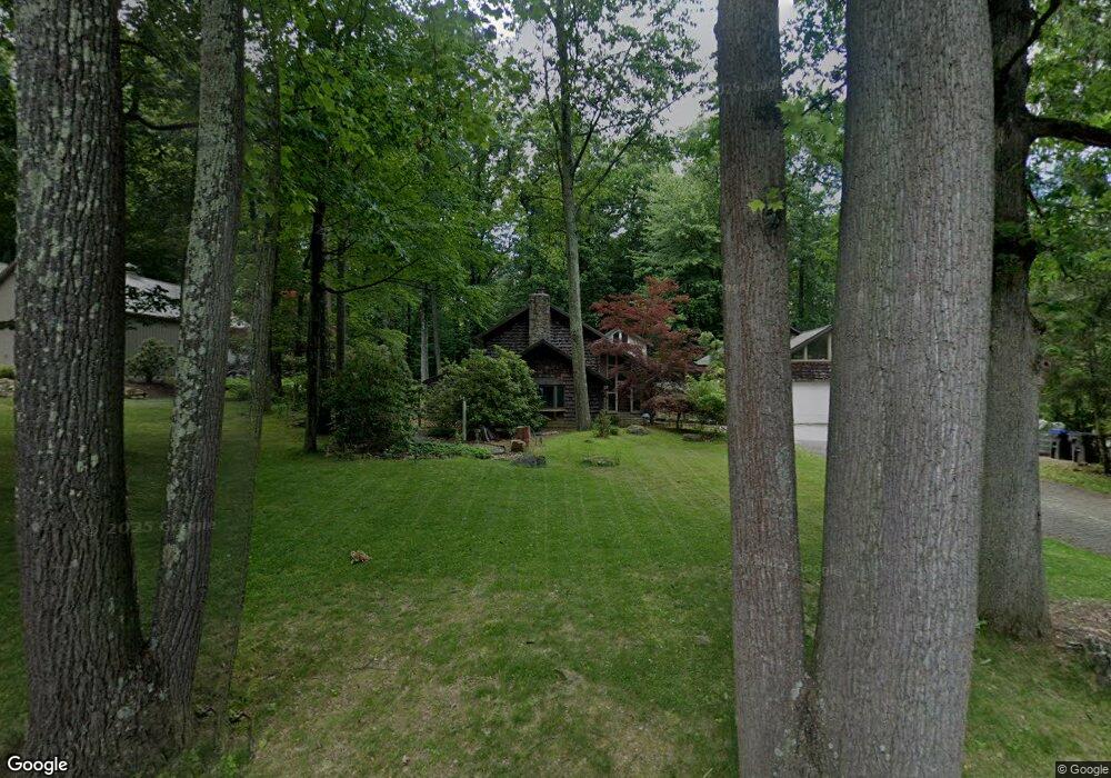
2559 W Rock Rd Allentown, PA 18103
Southside NeighborhoodEstimated Value: $466,000 - $591,000
3
Beds
3
Baths
2,475
Sq Ft
$221/Sq Ft
Est. Value
About This Home
This home is located at 2559 W Rock Rd, Allentown, PA 18103 and is currently estimated at $547,972, approximately $221 per square foot. 2559 W Rock Rd is a home located in Lehigh County with nearby schools including Salisbury Elementary School, Salisbury Middle School, and Salisbury Senior High School.
Ownership History
Date
Name
Owned For
Owner Type
Purchase Details
Closed on
Oct 13, 2006
Sold by
Anderson Raymond L
Bought by
Gawne Graham
Current Estimated Value
Home Financials for this Owner
Home Financials are based on the most recent Mortgage that was taken out on this home.
Original Mortgage
$346,000
Outstanding Balance
$206,807
Interest Rate
6.49%
Mortgage Type
Purchase Money Mortgage
Estimated Equity
$341,165
Purchase Details
Closed on
Apr 29, 2005
Sold by
Kuehner Marcia A
Bought by
Anderson Raymond L
Home Financials for this Owner
Home Financials are based on the most recent Mortgage that was taken out on this home.
Original Mortgage
$66,300
Interest Rate
6.01%
Mortgage Type
Stand Alone Second
Purchase Details
Closed on
Sep 8, 1992
Sold by
Kuehner Harry J and Kuehner Marcia A
Bought by
Kuehner Marcia A
Purchase Details
Closed on
Oct 13, 1978
Bought by
Kuehner Harry J and Kuehner Marcia A
Create a Home Valuation Report for This Property
The Home Valuation Report is an in-depth analysis detailing your home's value as well as a comparison with similar homes in the area
Home Values in the Area
Average Home Value in this Area
Purchase History
| Date | Buyer | Sale Price | Title Company |
|---|---|---|---|
| Gawne Graham | $433,000 | First American Title Ins Co | |
| Anderson Raymond L | $331,500 | -- | |
| Kuehner Marcia A | -- | -- | |
| Kuehner Harry J | $14,000 | -- |
Source: Public Records
Mortgage History
| Date | Status | Borrower | Loan Amount |
|---|---|---|---|
| Open | Gawne Graham | $346,000 | |
| Previous Owner | Anderson Raymond L | $66,300 |
Source: Public Records
Tax History Compared to Growth
Tax History
| Year | Tax Paid | Tax Assessment Tax Assessment Total Assessment is a certain percentage of the fair market value that is determined by local assessors to be the total taxable value of land and additions on the property. | Land | Improvement |
|---|---|---|---|---|
| 2025 | $8,674 | $275,400 | $59,600 | $215,800 |
| 2024 | $8,287 | $275,400 | $59,600 | $215,800 |
| 2023 | $7,861 | $275,400 | $59,600 | $215,800 |
| 2022 | $7,663 | $275,400 | $215,800 | $59,600 |
| 2021 | $7,356 | $275,400 | $59,600 | $215,800 |
| 2020 | $7,070 | $275,400 | $59,600 | $215,800 |
| 2019 | $6,812 | $275,400 | $59,600 | $215,800 |
| 2018 | $6,690 | $275,400 | $59,600 | $215,800 |
| 2017 | $6,520 | $275,400 | $59,600 | $215,800 |
| 2016 | -- | $275,400 | $59,600 | $215,800 |
| 2015 | -- | $275,400 | $59,600 | $215,800 |
| 2014 | -- | $275,400 | $59,600 | $215,800 |
Source: Public Records
Map
Nearby Homes
- 2700 Lanze Ln
- 2704 Appel St
- 2531 S Carbon St
- 2948 Klein St
- 2541-2545 27th St SW
- 2620 Arch St SW
- 2616 Arch St SW
- 5044 Vera Cruz Rd
- 3011 Ithaca St
- 2420 28th St SW
- 3043 Ithaca St
- 2413 S Church St
- 2430 S Law St
- 3020 W Fairbanks St
- 566 W Emaus Ave
- 566 588 W Emaus Ave
- 1066 Devonshire Rd Unit 1068
- 2426 S Wood St
- 2429 S Front St
- 2157 S Poplar St
- 2529 W Rock Rd
- 2609 W Rock Rd
- 2558 W Rock Rd
- 2524 W Rock Rd
- 2509 W Rock Rd
- 3110 Ironwood Ln
- 2844 Dewalt St
- 2619 W Rock Rd
- 2614 W Rock Rd
- 3130 Ironwood Ln
- 3134 Ironwood Ln
- 2643 W Rock Rd
- 2470 W Rock Rd
- 2665 W Rock Rd
- 2463 W Rock Rd
- 2460 W Rock Rd
- 2450 W Rock Rd
- 3138 Ironwood Ln Unit 3144
- 3135 Ironwood Ln
- 2423 W Rock Rd