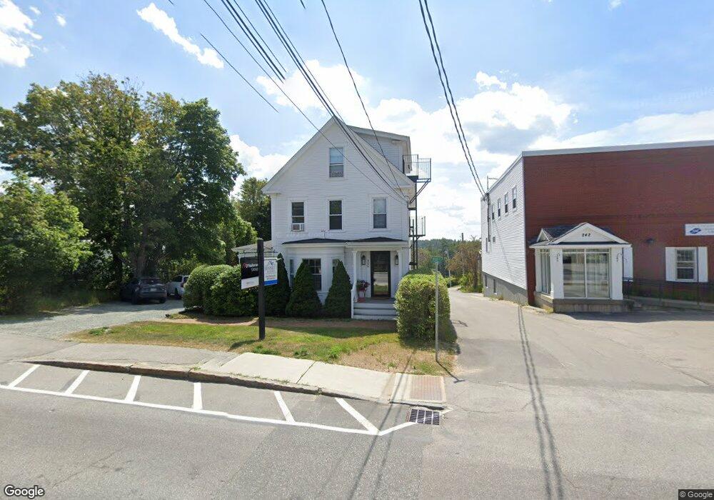
256 Main St New London, NH 03257
Estimated Value: $736,722
3
Beds
1
Bath
2,526
Sq Ft
$292/Sq Ft
Est. Value
About This Home
This home is located at 256 Main St, New London, NH 03257 and is currently estimated at $736,722, approximately $291 per square foot. 256 Main St is a home located in Merrimack County with nearby schools including Kearsarge Elementary School - New London, Kearsarge Regional Middle School, and Kearsarge Regional High School.
Ownership History
Date
Name
Owned For
Owner Type
Purchase Details
Closed on
Apr 9, 2019
Sold by
Sleeper Kevin S
Bought by
Dco Llc
Current Estimated Value
Home Financials for this Owner
Home Financials are based on the most recent Mortgage that was taken out on this home.
Original Mortgage
$360,000
Outstanding Balance
$316,504
Interest Rate
4.3%
Mortgage Type
New Conventional
Estimated Equity
$420,218
Create a Home Valuation Report for This Property
The Home Valuation Report is an in-depth analysis detailing your home's value as well as a comparison with similar homes in the area
Home Values in the Area
Average Home Value in this Area
Purchase History
| Date | Buyer | Sale Price | Title Company |
|---|---|---|---|
| Dco Llc | $385,000 | -- |
Source: Public Records
Mortgage History
| Date | Status | Borrower | Loan Amount |
|---|---|---|---|
| Open | Dco Llc | $360,000 |
Source: Public Records
Tax History Compared to Growth
Tax History
| Year | Tax Paid | Tax Assessment Tax Assessment Total Assessment is a certain percentage of the fair market value that is determined by local assessors to be the total taxable value of land and additions on the property. | Land | Improvement |
|---|---|---|---|---|
| 2024 | $5,479 | $471,900 | $220,000 | $251,900 |
| 2023 | $5,101 | $471,900 | $220,000 | $251,900 |
| 2022 | $5,744 | $362,200 | $201,700 | $160,500 |
| 2021 | $5,600 | $363,900 | $201,700 | $162,200 |
| 2020 | $5,437 | $363,900 | $201,700 | $162,200 |
| 2019 | $5,353 | $363,900 | $201,700 | $162,200 |
| 2018 | $8,389 | $336,700 | $217,500 | $119,200 |
| 2017 | $8,549 | $336,700 | $217,500 | $119,200 |
| 2016 | $8,368 | $336,700 | $217,500 | $119,200 |
| 2015 | $5,202 | $336,700 | $217,500 | $119,200 |
| 2014 | $5,155 | $336,700 | $217,500 | $119,200 |
| 2013 | $4,714 | $313,200 | $217,500 | $95,700 |
Source: Public Records
Map
Nearby Homes
- 27 Pipers Glen
- 0 Newport Rd Unit 10
- 385 Seamans Rd
- 10 Highland Ridge Rd
- 158 Quail Run
- 106-23 Fieldstone Ln
- 71 Hilltop Place
- 195 Pine Hill Rd
- 58 Kearsarge Rd
- 712 Sugarhouse Rd
- 273 Forest Acres Rd
- 295 Andover Rd
- 000 Farwell Ln Unit 17
- 000 Shaker Rd Unit 288
- 0 Summit Rd Unit 431
- 0 Fairway Ln Unit 8
- 0 Little Lake Sunapee Rd Unit 40 4989636
- 617 & 619 Route 103a Map 91 Lot 37 38
- 00 Mountainside Dr Unit 183
- 155 Wilder Ln
- 19 Pearl St
- 27 Pearl St
- 224 Main St
- 20 Lovering Ln
- 29 Hayes Rd
- 37 Pearl St
- 35 Hayes Rd
- 12 Lovering Ln
- 210 Main St
- 145 Barrett Rd
- 207 Main St
- 207 Main St Unit 4
- 207 Main St Unit 1
- 207 Main St Unit 5
- 207 Main St Unit 2
- 207 Main St Unit 2
- 207 Main St Unit 5 Upstairs
- 207 Main St Unit 3
- 207 Main - Unit #2 St
- 207 Main - Unit #3 St