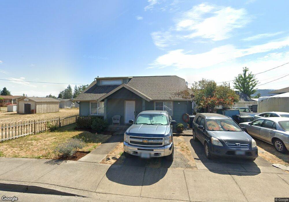
256 N 1st St Creswell, OR 97426
Estimated Value: $335,000 - $389,000
2
Beds
1
Bath
1,420
Sq Ft
$252/Sq Ft
Est. Value
About This Home
This home is located at 256 N 1st St, Creswell, OR 97426 and is currently estimated at $358,040, approximately $252 per square foot. 256 N 1st St is a home located in Lane County with nearby schools including Creslane Elementary School, Creswell Middle School, and Creswell High School.
Ownership History
Date
Name
Owned For
Owner Type
Purchase Details
Closed on
Nov 28, 2012
Sold by
Miller Christopher Val and Miller Mary Lynn
Bought by
Miller Jacob Clark and Miller Ryan Lee
Current Estimated Value
Purchase Details
Closed on
May 3, 2012
Sold by
The Secretary Of Housing & Urban Develop
Bought by
Miller Christopher Val and Miller Mary Lynn
Purchase Details
Closed on
Nov 15, 2011
Sold by
Oregon Housing & Community Services Depa
Bought by
Secretary Of Housing & Urban Development
Purchase Details
Closed on
Nov 10, 2011
Sold by
Plummer Sandy V
Bought by
Oregon Housing & Community Services Depa
Purchase Details
Closed on
Jun 12, 2007
Sold by
Koch Daniel A and Koch Angela M
Bought by
Plummer Sandy
Home Financials for this Owner
Home Financials are based on the most recent Mortgage that was taken out on this home.
Original Mortgage
$169,342
Interest Rate
6.14%
Mortgage Type
FHA
Purchase Details
Closed on
Aug 10, 2004
Sold by
Bruce Bruce D and Bruce Jenette L
Bought by
Grove Bruce D
Home Financials for this Owner
Home Financials are based on the most recent Mortgage that was taken out on this home.
Original Mortgage
$105,000
Interest Rate
7.9%
Mortgage Type
Purchase Money Mortgage
Purchase Details
Closed on
Aug 9, 2004
Sold by
Bruce Bruce D
Bought by
Koch Daniel A and Koch Angela M
Home Financials for this Owner
Home Financials are based on the most recent Mortgage that was taken out on this home.
Original Mortgage
$105,000
Interest Rate
7.9%
Mortgage Type
Purchase Money Mortgage
Purchase Details
Closed on
Feb 11, 2003
Sold by
Hud
Bought by
Bruce Ray C
Purchase Details
Closed on
Nov 8, 2002
Sold by
Wells Fargo Home Mtg Inc
Bought by
Hud
Purchase Details
Closed on
Nov 6, 2002
Sold by
Mcintosh Gregory Scott and Mcintosh Debra May
Bought by
Wells Fargo Home Mtg Inc
Create a Home Valuation Report for This Property
The Home Valuation Report is an in-depth analysis detailing your home's value as well as a comparison with similar homes in the area
Home Values in the Area
Average Home Value in this Area
Purchase History
| Date | Buyer | Sale Price | Title Company |
|---|---|---|---|
| Miller Jacob Clark | $63,000 | First American Title | |
| Miller Christopher Val | $61,820 | Fidelity Natl Title Co Of Or | |
| Secretary Of Housing & Urban Development | -- | Cascade Title Company | |
| Oregon Housing & Community Services Depa | $182,781 | Cascade Title Company | |
| Plummer Sandy | $172,000 | Cascade Title Co | |
| Grove Bruce D | -- | Western Pioneer Title Co | |
| Koch Daniel A | $105,000 | Western Pioneer Title Co | |
| Bruce Ray C | $60,200 | Western Pioneer Title Co | |
| Hud | $63,180 | Western Pioneer Title Co | |
| Wells Fargo Home Mtg Inc | $71,372 | Western Pioneer Title Co |
Source: Public Records
Mortgage History
| Date | Status | Borrower | Loan Amount |
|---|---|---|---|
| Previous Owner | Plummer Sandy | $169,342 | |
| Previous Owner | Koch Daniel A | $105,000 |
Source: Public Records
Tax History Compared to Growth
Tax History
| Year | Tax Paid | Tax Assessment Tax Assessment Total Assessment is a certain percentage of the fair market value that is determined by local assessors to be the total taxable value of land and additions on the property. | Land | Improvement |
|---|---|---|---|---|
| 2025 | $2,455 | $149,578 | -- | -- |
| 2024 | $1,836 | $145,222 | -- | -- |
| 2023 | $1,836 | $140,993 | $0 | $0 |
| 2022 | $1,978 | $136,887 | $0 | $0 |
| 2021 | $1,911 | $132,900 | $0 | $0 |
| 2020 | $1,884 | $129,030 | $0 | $0 |
| 2019 | $1,842 | $125,272 | $0 | $0 |
| 2018 | $1,817 | $118,082 | $0 | $0 |
| 2017 | $1,762 | $118,082 | $0 | $0 |
| 2016 | $1,805 | $114,643 | $0 | $0 |
| 2015 | $1,740 | $111,304 | $0 | $0 |
| 2014 | $1,553 | $97,249 | $0 | $0 |
Source: Public Records
Map
Nearby Homes
- 368 Hillegas Ave
- 156 N 1st St
- 692 N 1st St
- 689 Blue Jay Loop
- 700 N Mill St Unit 109
- 700 N Mill St
- 589 Mary Neal Ln
- 83354 N Pacific Hwy
- 521 S 7th St
- 460 Meadow Ln
- 0 Holbrook Ln Unit 339588620
- 1 Queens Ave Unit 1
- 491 Ironwood Loop
- 645 Boulder Loop
- 375 Sunday Dr
- 316 Sunday Dr
- 336 Sunday Dr
- 685 St Andrews Loop
- 33465 Irish Ln
- 370 Magnolia Dr