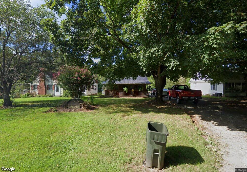
256 Old Us 52 S Mount Airy, NC 27030
Estimated Value: $132,249 - $213,000
2
Beds
1
Bath
1,008
Sq Ft
$173/Sq Ft
Est. Value
About This Home
This home is located at 256 Old Us 52 S, Mount Airy, NC 27030 and is currently estimated at $174,750, approximately $173 per square foot. 256 Old Us 52 S is a home with nearby schools including Pilot Mountain Elementary School, Pilot Mountain Middle School, and East Surry High School.
Ownership History
Date
Name
Owned For
Owner Type
Purchase Details
Closed on
Jul 7, 2022
Sold by
Noretta Hooker
Bought by
Hooker Mark Anthony and Hooker Libby T
Current Estimated Value
Purchase Details
Closed on
Feb 11, 2011
Sold by
Hooker Mark Anthony and Hooker Libby T
Bought by
Hooker Donald J and Hooker Noretta
Purchase Details
Closed on
May 4, 2010
Sold by
Hooker Donald Johnson and Hooker Noretta
Bought by
Hooker Mark Anthony and Hooker Libby T
Purchase Details
Closed on
Oct 1, 1988
Purchase Details
Closed on
Sep 1, 1988
Purchase Details
Closed on
Jul 1, 1986
Purchase Details
Closed on
Dec 1, 1985
Create a Home Valuation Report for This Property
The Home Valuation Report is an in-depth analysis detailing your home's value as well as a comparison with similar homes in the area
Home Values in the Area
Average Home Value in this Area
Purchase History
| Date | Buyer | Sale Price | Title Company |
|---|---|---|---|
| Hooker Mark Anthony | -- | Stevens & Brintle Pllc | |
| Hooker Donald J | -- | None Available | |
| Hooker Mark Anthony | -- | None Available | |
| -- | $15,000 | -- | |
| -- | -- | -- | |
| -- | $10,000 | -- | |
| -- | -- | -- | |
| -- | -- | -- |
Source: Public Records
Tax History Compared to Growth
Tax History
| Year | Tax Paid | Tax Assessment Tax Assessment Total Assessment is a certain percentage of the fair market value that is determined by local assessors to be the total taxable value of land and additions on the property. | Land | Improvement |
|---|---|---|---|---|
| 2025 | $456 | $69,170 | $6,000 | $63,170 |
| 2024 | $329 | $45,060 | $6,000 | $39,060 |
| 2023 | $324 | $45,060 | $6,000 | $39,060 |
| 2022 | $324 | $45,060 | $6,000 | $39,060 |
| 2021 | $329 | $45,060 | $6,000 | $39,060 |
| 2020 | $315 | $41,800 | $6,000 | $35,800 |
| 2019 | $312 | $41,800 | $6,000 | $35,800 |
| 2018 | $312 | $41,800 | $0 | $0 |
| 2017 | $309 | $41,800 | $0 | $0 |
| 2016 | $309 | $41,800 | $0 | $0 |
| 2013 | -- | $31,830 | $0 | $0 |
Source: Public Records
Map
Nearby Homes
- 278 Old Us Highway 52
- 208 Holly Ave
- 177 Janice Dr
- 201 Circle View Rd
- Tbd Farmbrook Rd
- 115 Stout Ln
- 00 S Andy Griffith Pkwy
- TBD S Andy Griffith Pkwy
- 181 Fox Walk Ln
- 00 Farmbrook Rd
- 02 Farmbrook Rd
- 000000 Farmbrook Rd
- 01 Farmbrook Rd
- 00000 Farmbrook Rd
- 2326 Westfield Rd
- 1610 E Wensley Dr
- 216 E Devon Dr
- 2183 Westfield Rd
- 2384 Westfield Rd
- 200 Englewood Trail
- 268 Old Us 52 S
- 112 Sheep Farm Rd
- 130 Apostle Ln
- 230 Old Us 52 S
- 136 Sheep Farm Rd
- 213 Old Us 52 S
- 304 Old Us 52 S
- 160 Sheep Farm Rd
- 305 Old Us 52 S
- 197 Old Us 52 S
- 180 Sheep Farm Rd
- 141 E Sheep Farm Rd
- 171 Old Us 52 S
- 143 Lowrider Trail
- 210 Sheep Farm Rd
- 256 Sheep Farm Rd
- 401 Old Us 52 S
- 213 McGee Rd
- 168 Samuel Trail
- 451 Old Us 52 S