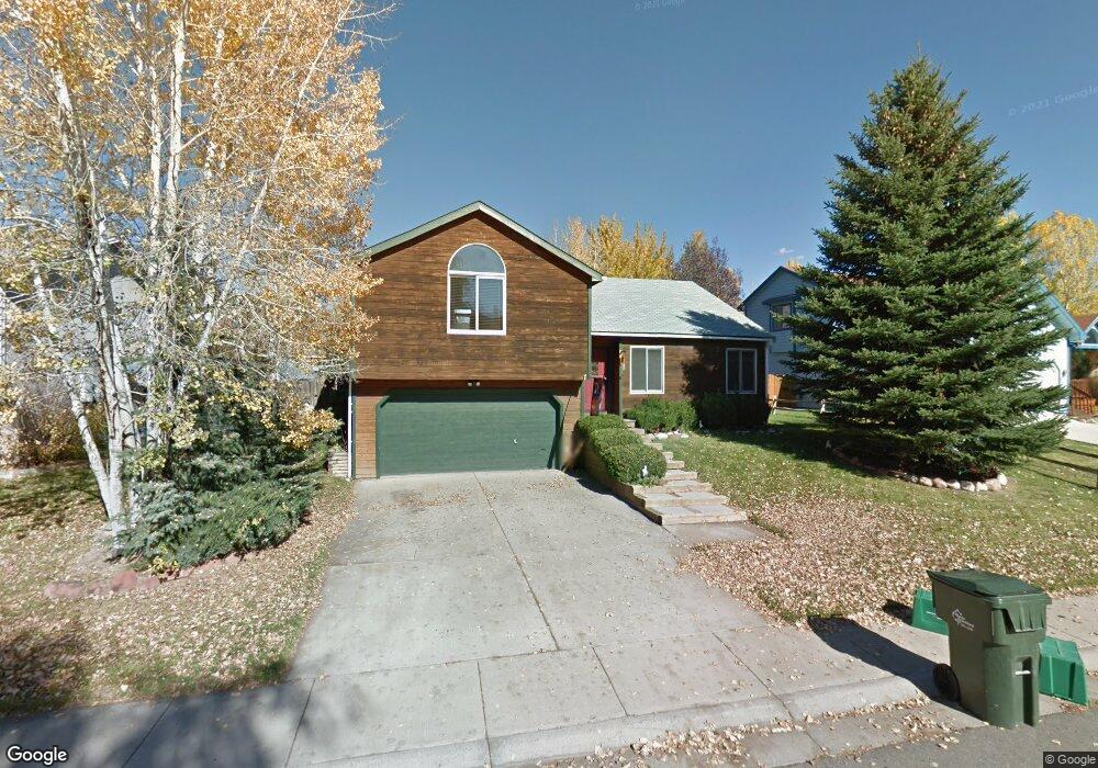
256 Rabbit Rd Carbondale, CO 81623
Estimated Value: $1,238,000 - $1,351,000
3
Beds
2
Baths
1,908
Sq Ft
$687/Sq Ft
Est. Value
About This Home
This home is located at 256 Rabbit Rd, Carbondale, CO 81623 and is currently estimated at $1,310,059, approximately $686 per square foot. 256 Rabbit Rd is a home located in Eagle County with nearby schools including Cornerstone Classical School and Waldorf School on the Roaring Fork.
Ownership History
Date
Name
Owned For
Owner Type
Purchase Details
Closed on
Jan 15, 1999
Sold by
Lee Melinda B
Bought by
Batcher Michael D and Batcher Christine R
Current Estimated Value
Home Financials for this Owner
Home Financials are based on the most recent Mortgage that was taken out on this home.
Original Mortgage
$210,000
Outstanding Balance
$48,289
Interest Rate
6.66%
Estimated Equity
$1,261,770
Purchase Details
Closed on
Jun 3, 1997
Sold by
Brisbane Gary and Brisbane Nancy
Bought by
Lee Melinda B
Home Financials for this Owner
Home Financials are based on the most recent Mortgage that was taken out on this home.
Original Mortgage
$204,750
Interest Rate
8.25%
Create a Home Valuation Report for This Property
The Home Valuation Report is an in-depth analysis detailing your home's value as well as a comparison with similar homes in the area
Home Values in the Area
Average Home Value in this Area
Purchase History
| Date | Buyer | Sale Price | Title Company |
|---|---|---|---|
| Batcher Michael D | $246,500 | Land Title | |
| Lee Melinda B | $227,500 | Stewart Title |
Source: Public Records
Mortgage History
| Date | Status | Borrower | Loan Amount |
|---|---|---|---|
| Open | Batcher Michael D | $210,000 | |
| Previous Owner | Lee Melinda B | $204,750 |
Source: Public Records
Tax History Compared to Growth
Tax History
| Year | Tax Paid | Tax Assessment Tax Assessment Total Assessment is a certain percentage of the fair market value that is determined by local assessors to be the total taxable value of land and additions on the property. | Land | Improvement |
|---|---|---|---|---|
| 2024 | $5,192 | $69,550 | $18,130 | $51,420 |
| 2023 | $5,192 | $69,550 | $18,130 | $51,420 |
| 2022 | $3,703 | $45,910 | $9,170 | $36,740 |
| 2021 | $3,805 | $47,230 | $9,440 | $37,790 |
| 2020 | $3,114 | $40,560 | $9,440 | $31,120 |
| 2019 | $3,143 | $40,560 | $9,440 | $31,120 |
| 2018 | $3,121 | $39,890 | $8,640 | $31,250 |
| 2017 | $2,955 | $39,890 | $8,640 | $31,250 |
| 2016 | $2,878 | $38,170 | $7,960 | $30,210 |
| 2015 | -- | $38,170 | $7,960 | $30,210 |
| 2014 | $2,012 | $28,070 | $5,970 | $22,100 |
Source: Public Records
Map
Nearby Homes
- 298 Black Bear Trail
- 456 Black Bear Trail
- 161 James Cir
- 196 Dakota Meadows Dr
- 14 Fender Ln
- 101 Prentice
- 539 Sunrise Ln
- 274 Overlook Ridge
- 236 Overlook Ridge
- 70 Cleve Ct
- 140 Juniper Trail Unit 140
- 145 Juniper Trail
- 191 Navajo
- 201 Tree Farm Dr Unit All Parcels
- 201 Tree Farm Dr Unit The Lakeview
- 201 Tree Farm Dr Unit The Creekside
- 577 Fox Run Dr
- 128 Hopi
- TBD Tree Farm Dr Unit The Edge at Tree Far
- TBD Tree Farm Dr Unit A2 - 301