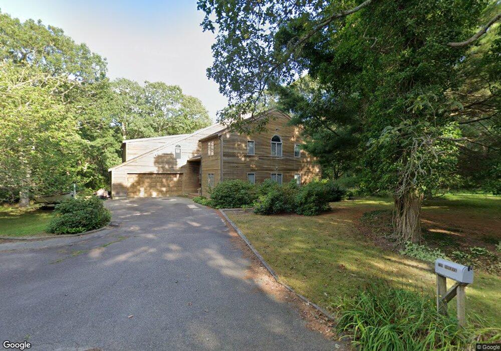
256 Red Fawn Rd Brewster, MA 02631
Estimated Value: $954,000 - $1,327,128
5
Beds
5
Baths
3,354
Sq Ft
$352/Sq Ft
Est. Value
About This Home
This home is located at 256 Red Fawn Rd, Brewster, MA 02631 and is currently estimated at $1,180,282, approximately $351 per square foot. 256 Red Fawn Rd is a home located in Barnstable County with nearby schools including Stony Brook Elementary School, Eddy Elementary School, and Nauset Regional Middle School.
Ownership History
Date
Name
Owned For
Owner Type
Purchase Details
Closed on
Nov 13, 2021
Sold by
Roderick Peter J and Zurlinden Mary L
Bought by
Stoneridge Rt
Current Estimated Value
Purchase Details
Closed on
Jan 3, 1986
Bought by
Roderick Peter J and Zurlinden Mary Lou
Create a Home Valuation Report for This Property
The Home Valuation Report is an in-depth analysis detailing your home's value as well as a comparison with similar homes in the area
Home Values in the Area
Average Home Value in this Area
Purchase History
| Date | Buyer | Sale Price | Title Company |
|---|---|---|---|
| Stoneridge Rt | -- | None Available | |
| Roderick Peter J | $52,000 | -- |
Source: Public Records
Mortgage History
| Date | Status | Borrower | Loan Amount |
|---|---|---|---|
| Previous Owner | Roderick Peter J | $338,000 | |
| Previous Owner | Roderick Peter J | $290,000 | |
| Previous Owner | Roderick Peter J | $290,000 | |
| Previous Owner | Roderick Peter J | $125,000 |
Source: Public Records
Tax History Compared to Growth
Tax History
| Year | Tax Paid | Tax Assessment Tax Assessment Total Assessment is a certain percentage of the fair market value that is determined by local assessors to be the total taxable value of land and additions on the property. | Land | Improvement |
|---|---|---|---|---|
| 2025 | $7,310 | $1,062,500 | $250,900 | $811,600 |
| 2024 | $6,901 | $1,013,300 | $236,700 | $776,600 |
| 2023 | $6,334 | $906,200 | $211,300 | $694,900 |
| 2022 | $6,493 | $827,100 | $176,000 | $651,100 |
| 2021 | $6,164 | $718,400 | $153,000 | $565,400 |
| 2020 | $6,026 | $699,100 | $153,000 | $546,100 |
| 2019 | $5,783 | $674,000 | $147,200 | $526,800 |
| 2018 | $5,461 | $661,100 | $147,200 | $513,900 |
| 2017 | $5,062 | $603,300 | $147,200 | $456,100 |
| 2016 | $4,859 | $576,400 | $144,300 | $432,100 |
| 2015 | $4,654 | $563,400 | $141,400 | $422,000 |
Source: Public Records
Map
Nearby Homes
- 153 Red Fawn Rd
- 190 Blueberry Pond Dr
- 410 Blueberry Pond Dr
- 277 Lund Farm Way
- 0 Partridge
- 100 Fletcher Ln Unit E
- 81 Fletcher Ln Unit I
- 81 Fletcher Ln Unit C
- 80 Fletcher Ln Unit E
- 60 Fletcher Ln Unit H
- 60 Fletcher Ln Unit C
- 61 Fletcher Ln Unit H
- 62 Fletcher Ln Unit N
- 82 Fletcher Ln Unit I
- 28 Middlecott Ln
- 82 Middlecott Ln
- 0 Commons Way Unit 22504099
- 16 Commons Way
- 253 Red Fawn Rd
- 273 Red Fawn Rd
- 206 Red Fawn Rd
- 229 Red Fawn Rd
- 299 Red Fawn Rd
- 48 Somerset Rd
- 60 Somerset Rd
- 30 Somerset Rd
- 40 Somerset Rd
- 78 Somerset Rd
- 20 Somerset Rd
- 197 Red Fawn Rd
- 88 Somerset Rd
- 180 Red Fawn Rd
- 29 Somerset Rd
- 177 Red Fawn Rd
- 302 Red Fawn Rd
- 51 Somerset Rd
- 63 Somerset Rd
- 10 Somerset Rd