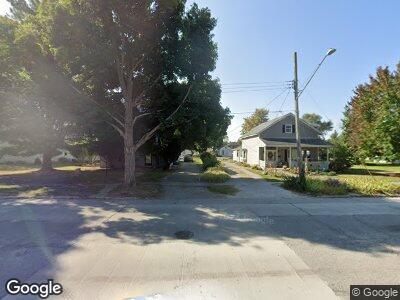
256 Rr 2 Carrollton, IL 62016
Estimated Value: $219,000 - $316,356
--
Bed
--
Bath
--
Sq Ft
2.92
Acres
About This Home
This home is located at 256 Rr 2, Carrollton, IL 62016 and is currently estimated at $276,589. 256 Rr 2 is a home located in Greene County with nearby schools including Carrollton Grade School, Carrollton High School, and St. John the Evangelist School.
Ownership History
Date
Name
Owned For
Owner Type
Purchase Details
Closed on
Apr 12, 2013
Sold by
Daum Ricky G and Daum Judith A
Bought by
Griswold Thomas and Griswold Kristen
Current Estimated Value
Home Financials for this Owner
Home Financials are based on the most recent Mortgage that was taken out on this home.
Original Mortgage
$195,750
Outstanding Balance
$144,550
Interest Rate
3.6%
Mortgage Type
New Conventional
Estimated Equity
$125,054
Create a Home Valuation Report for This Property
The Home Valuation Report is an in-depth analysis detailing your home's value as well as a comparison with similar homes in the area
Home Values in the Area
Average Home Value in this Area
Purchase History
| Date | Buyer | Sale Price | Title Company |
|---|---|---|---|
| Griswold Thomas | -- | -- |
Source: Public Records
Mortgage History
| Date | Status | Borrower | Loan Amount |
|---|---|---|---|
| Open | Griswold Thomas | $195,750 | |
| Previous Owner | Daum Ricky G | $72,100 | |
| Previous Owner | Daum Rick G | $117,889 | |
| Previous Owner | Daum Aka Ricky G Daum Rick G | $40,000 |
Source: Public Records
Tax History Compared to Growth
Tax History
| Year | Tax Paid | Tax Assessment Tax Assessment Total Assessment is a certain percentage of the fair market value that is determined by local assessors to be the total taxable value of land and additions on the property. | Land | Improvement |
|---|---|---|---|---|
| 2023 | $5,842 | $90,119 | $13,529 | $76,590 |
| 2022 | $5,616 | $83,652 | $9,307 | $74,345 |
| 2021 | $5,581 | $82,149 | $9,140 | $73,009 |
| 2020 | $5,514 | $76,803 | $8,545 | $68,258 |
| 2019 | $5,455 | $72,812 | $8,545 | $64,267 |
| 2018 | $5,338 | $72,812 | $8,545 | $64,267 |
| 2017 | $5,395 | $72,812 | $8,545 | $64,267 |
| 2015 | $5,382 | $74,104 | $8,545 | $65,559 |
| 2012 | $5,100 | $67,102 | $0 | $0 |
Source: Public Records
Map
Nearby Homes
- 633 4th St
- 609 3rd St
- 533 Locust St
- 419 5th St
- 326 S Main St
- 209 N Main St
- 202 4th St
- 149 SE 450 Ave
- 121 5th St
- 234 SE 350 St
- 601 Promenade St
- 407 Madison St
- 350 Locust St
- 28432 MacOupin Creek Rd
- 0 State Highway 267 Unit MAR24053256
- 1002 Brianna Ct
- 1000 Brianna Ct
- 0 Waggoner Ave
- 2 W Fairground Ave
- 239 Olive St