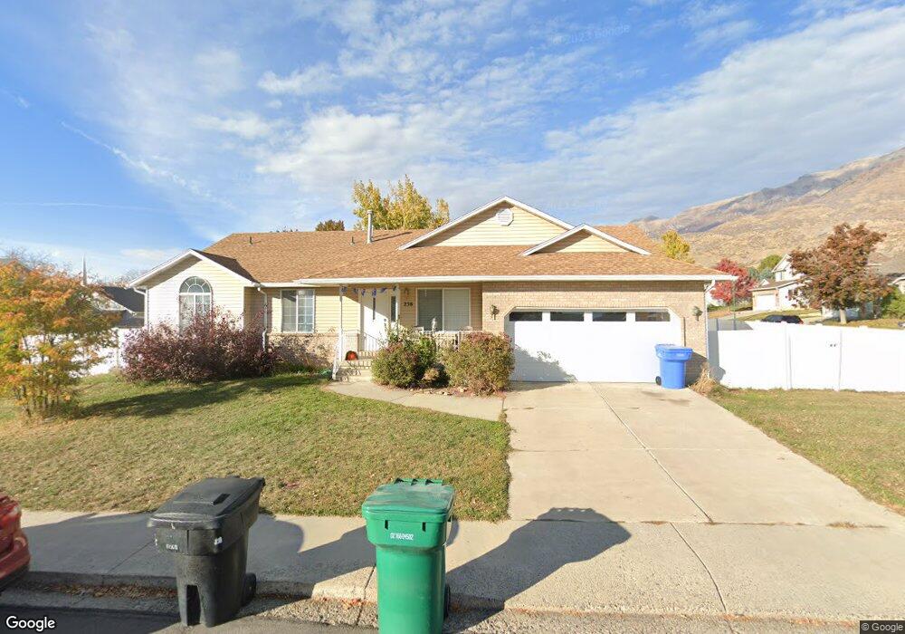
256 W 1820 N Orem, UT 84057
Northridge NeighborhoodEstimated Value: $578,000 - $635,774
4
Beds
3
Baths
3,408
Sq Ft
$182/Sq Ft
Est. Value
About This Home
This home is located at 256 W 1820 N, Orem, UT 84057 and is currently estimated at $619,694, approximately $181 per square foot. 256 W 1820 N is a home located in Utah County with nearby schools including Northridge Elementary School, Oak Canyon Junior High School, and Timpanogos High School.
Ownership History
Date
Name
Owned For
Owner Type
Purchase Details
Closed on
Jan 9, 2015
Sold by
Woolston Thomas L and The Woolston Family Trust
Bought by
Jenson Jeremy Alton and Jenson Plonnie Xantippe
Current Estimated Value
Home Financials for this Owner
Home Financials are based on the most recent Mortgage that was taken out on this home.
Original Mortgage
$251,363
Outstanding Balance
$192,115
Interest Rate
3.86%
Mortgage Type
FHA
Estimated Equity
$427,579
Purchase Details
Closed on
Mar 1, 2007
Sold by
Tdl Enterprises Lc
Bought by
Woolston Lynn T and Woolston Nona S
Create a Home Valuation Report for This Property
The Home Valuation Report is an in-depth analysis detailing your home's value as well as a comparison with similar homes in the area
Home Values in the Area
Average Home Value in this Area
Purchase History
| Date | Buyer | Sale Price | Title Company |
|---|---|---|---|
| Jenson Jeremy Alton | -- | Sutherland Title Co | |
| Woolston Lynn T | -- | Accommodation |
Source: Public Records
Mortgage History
| Date | Status | Borrower | Loan Amount |
|---|---|---|---|
| Open | Jenson Jeremy Alton | $251,363 |
Source: Public Records
Tax History
| Year | Tax Paid | Tax Assessment Tax Assessment Total Assessment is a certain percentage of the fair market value that is determined by local assessors to be the total taxable value of land and additions on the property. | Land | Improvement |
|---|---|---|---|---|
| 2025 | $2,566 | $322,300 | -- | -- |
| 2024 | $2,566 | $313,775 | $0 | $0 |
| 2023 | $2,413 | $317,185 | $0 | $0 |
| 2022 | $2,430 | $309,430 | $0 | $0 |
| 2021 | $2,190 | $422,300 | $154,500 | $267,800 |
| 2020 | $2,037 | $386,100 | $123,600 | $262,500 |
| 2019 | $1,804 | $355,500 | $123,600 | $231,900 |
| 2018 | $1,809 | $340,600 | $116,500 | $224,100 |
| 2017 | $1,665 | $167,915 | $0 | $0 |
| 2016 | $1,582 | $147,180 | $0 | $0 |
| 2015 | $1,549 | $136,290 | $0 | $0 |
| 2014 | $1,543 | $135,135 | $0 | $0 |
Source: Public Records
Map
Nearby Homes
- 1744 N 280 W
- 49 W 1880 N
- 1916 N 430 W
- 127 S 400 E
- 1547 N 275 West St Unit 5
- 1566 N 275 West St Unit 1
- 1948 N 520 W
- 92 W 1565 N
- 1548 N 275 West St Unit 2
- 1461 N Amiron Way Unit B
- 332 W Amiron Way Unit D
- 1545 N State St Unit 1
- 1638 N 160 E
- 1636 N 160 E
- 287 W 1380 N
- 14 N 850 E
- 240 E Center St
- 90 S 200 E
- 98 S 1025 E
- 512 W 1450 N
Your Personal Tour Guide
Ask me questions while you tour the home.