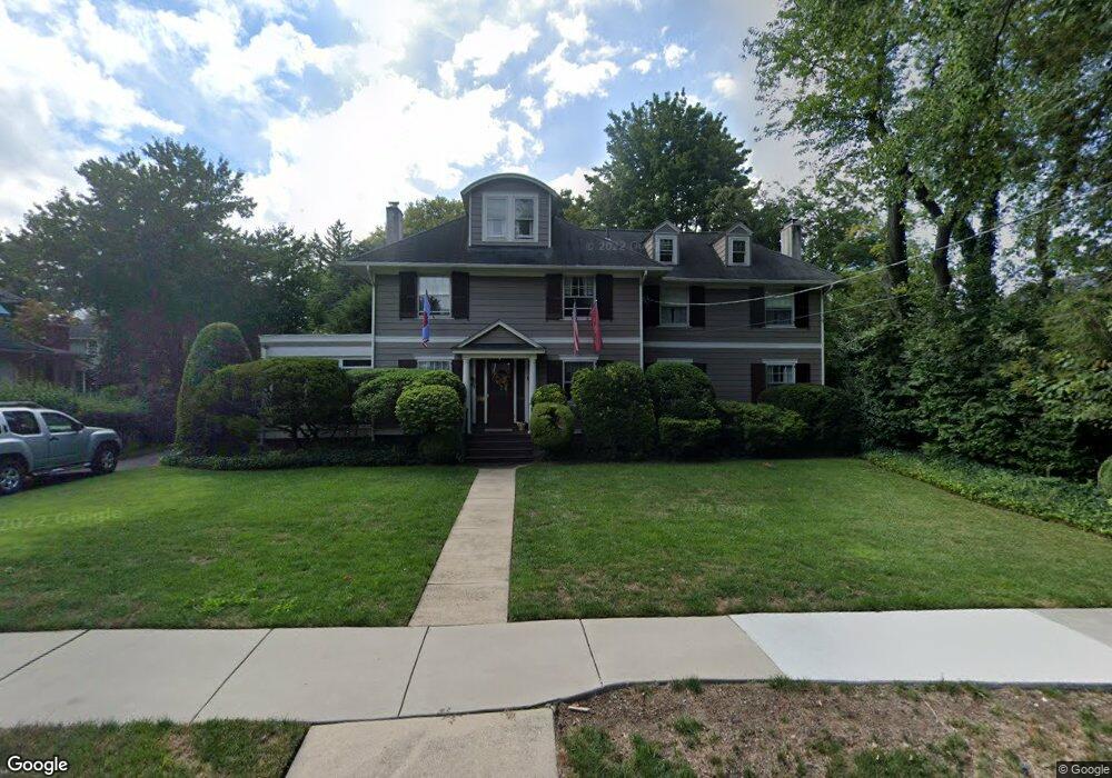
256 W Summit Ave Haddonfield, NJ 08033
Estimated Value: $1,259,000 - $1,550,000
Studio
--
Bath
3,016
Sq Ft
$452/Sq Ft
Est. Value
About This Home
This home is located at 256 W Summit Ave, Haddonfield, NJ 08033 and is currently estimated at $1,361,886, approximately $451 per square foot. 256 W Summit Ave is a home located in Camden County with nearby schools including Haddonfield Memorial High School, Haddonfield Friends School, and Christ the King Regional School.
Ownership History
Date
Name
Owned For
Owner Type
Purchase Details
Closed on
Sep 10, 2010
Sold by
Lane Susan P and Lane Malcolm V
Bought by
Lane Susan P and Lane Malcolm V
Current Estimated Value
Home Financials for this Owner
Home Financials are based on the most recent Mortgage that was taken out on this home.
Original Mortgage
$125,000
Interest Rate
4.35%
Mortgage Type
Purchase Money Mortgage
Create a Home Valuation Report for This Property
The Home Valuation Report is an in-depth analysis detailing your home's value as well as a comparison with similar homes in the area
Home Values in the Area
Average Home Value in this Area
Purchase History
| Date | Buyer | Sale Price | Title Company |
|---|---|---|---|
| Lane Susan P | -- | -- |
Source: Public Records
Mortgage History
| Date | Status | Borrower | Loan Amount |
|---|---|---|---|
| Previous Owner | Lane Susan P | $125,000 |
Source: Public Records
Tax History
| Year | Tax Paid | Tax Assessment Tax Assessment Total Assessment is a certain percentage of the fair market value that is determined by local assessors to be the total taxable value of land and additions on the property. | Land | Improvement |
|---|---|---|---|---|
| 2025 | $22,423 | $694,000 | $348,700 | $345,300 |
| 2024 | $22,125 | $694,000 | $348,700 | $345,300 |
| 2023 | $22,125 | $694,000 | $348,700 | $345,300 |
| 2022 | $21,951 | $694,000 | $348,700 | $345,300 |
| 2021 | $21,590 | $694,000 | $348,700 | $345,300 |
| 2020 | $21,688 | $694,000 | $348,700 | $345,300 |
| 2019 | $215 | $694,000 | $348,700 | $345,300 |
| 2018 | $21,257 | $694,000 | $348,700 | $345,300 |
| 2017 | $20,751 | $694,000 | $348,700 | $345,300 |
| 2016 | $20,286 | $694,000 | $348,700 | $345,300 |
| 2015 | $19,473 | $694,000 | $348,700 | $345,300 |
| 2014 | $19,036 | $694,000 | $348,700 | $345,300 |
Source: Public Records
Map
Nearby Homes
- 344 Knolltop Ln
- 370 Station Ave
- 125 W Cottage Ave
- 33 Estaugh Ave
- 35 Estaugh Ave
- 109 W Euclid Ave
- 109 S Atlantic Ave
- 25 W Euclid Ave
- 75 Birchall Dr
- 38 Birchall Dr
- 121 Reillywood Ave
- 13 Wilkins Ave
- 107 Centre St
- 313 Woodland Ave
- 233 E Kings Hwy
- 166 Ellis St
- 32 Potter St
- 209 Haddonfield Commons
- 30 Potter St
- 60 Potter St
- 252 W Summit Ave
- 310 Evans Ave
- 105 Chews Landing Rd
- 101 Chews Landing Rd
- 300 Evans Ave
- 314 Evans Ave
- 111 Chews Landing Rd
- 255 W Summit Ave
- 261 W Summit Ave
- 81 Chews Landing Rd
- 115 Chews Landing Rd
- 255 Mountwell Ave
- 77 Chews Landing Rd
- 253 Mountwell Ave
- 253 W Summit Ave
- 251 W Summit Ave
- 249 Mountwell Ave
- 311 Evans Ave
- 311 Evans Ave
- 301 Evans Ave
Your Personal Tour Guide
Ask me questions while you tour the home.