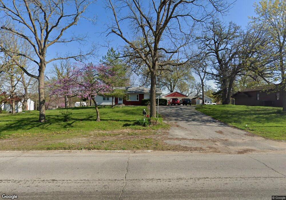
2560 1st Ave W Newton, IA 50208
Estimated Value: $216,000 - $241,000
3
Beds
3
Baths
1,536
Sq Ft
$149/Sq Ft
Est. Value
About This Home
This home is located at 2560 1st Ave W, Newton, IA 50208 and is currently estimated at $229,445, approximately $149 per square foot. 2560 1st Ave W is a home with nearby schools including Thomas Jefferson Elementary School, Woodrow Wilson Elementary School, and Berg Middle School.
Ownership History
Date
Name
Owned For
Owner Type
Purchase Details
Closed on
Sep 20, 2010
Sold by
Bonham Stephanie L and Jacobson Scott E
Bought by
Bac Home Loans Servicing Lp and Countrywide Home Loans Servicing Lp
Current Estimated Value
Create a Home Valuation Report for This Property
The Home Valuation Report is an in-depth analysis detailing your home's value as well as a comparison with similar homes in the area
Home Values in the Area
Average Home Value in this Area
Purchase History
| Date | Buyer | Sale Price | Title Company |
|---|---|---|---|
| Bac Home Loans Servicing Lp | $135,614 | None Available |
Source: Public Records
Tax History Compared to Growth
Tax History
| Year | Tax Paid | Tax Assessment Tax Assessment Total Assessment is a certain percentage of the fair market value that is determined by local assessors to be the total taxable value of land and additions on the property. | Land | Improvement |
|---|---|---|---|---|
| 2025 | -- | $199,320 | $30,890 | $168,430 |
| 2024 | -- | $179,210 | $30,890 | $148,320 |
| 2023 | -- | $179,210 | $30,890 | $148,320 |
| 2022 | $2,600 | $148,330 | $30,890 | $117,440 |
| 2021 | $2,396 | $137,390 | $30,890 | $106,500 |
| 2020 | $2,396 | $120,850 | $23,830 | $97,020 |
| 2019 | $2,238 | $105,750 | $0 | $0 |
| 2018 | $2,238 | $105,750 | $0 | $0 |
| 2017 | $2,194 | $105,750 | $0 | $0 |
| 2016 | $2,240 | $105,750 | $0 | $0 |
| 2015 | $2,198 | $105,750 | $0 | $0 |
| 2014 | $2,154 | $105,750 | $0 | $0 |
Source: Public Records
Map
Nearby Homes
- 124 Emerson Hough Dr
- 6911-10 Highway F 48 W
- 299 Hickory St
- 913 W 18th St S
- 2214 Highway F48 W
- 1431 Cardinal Ridge Dr
- 1221 Monroe Dr
- 210 W 13th St S
- 1149 W 28th St S
- 237 W 12th St S
- 860 W 28th St S
- TBD W 28th St S
- 8 Chancery Ct
- 1100 1st Ave W
- 304 W 11th St N
- 1000 1st Ave W
- 1401 W 16th St S Unit 2
- 549 W 10th St N
- 1506 W 17th St S
- 308 W 8th St S
- 2500 1st Ave W
- 100 Walnut Dr
- 2522 1st Ave W
- 2522 Highway F 48 W
- 101 Walnut Dr
- 2560 Highway F 48 Hwy W
- 2560 Highway F48 W
- 2467 Highway F48 W
- 0 Walnut Dr
- 103 Walnut Dr
- 108 Walnut Dr
- 107 Walnut Dr
- 109 Walnut Dr
- 2485 Highway F 48 W
- 2602 Highway F 48 W
- 2364 1st Ave W
- 114 Walnut Dr
- 2612 Highway F 48 W
- 111 Walnut Dr
- 2638 Highway F48 W