Estimated Value: $200,000 - $233,000
4
Beds
2
Baths
1,576
Sq Ft
$138/Sq Ft
Est. Value
About This Home
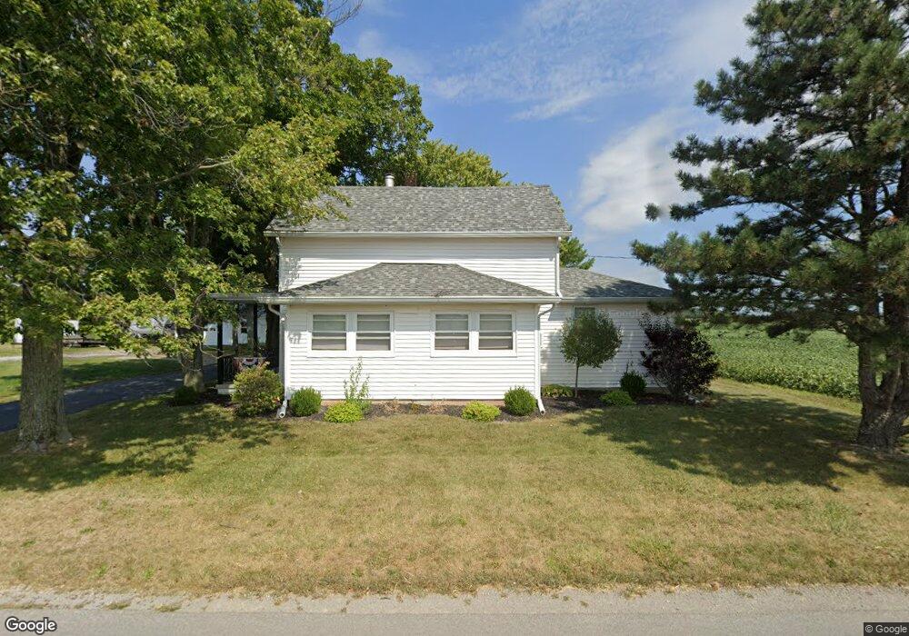
This home is located at 2560 Beery Rd, Lima, OH 45807 and is currently estimated at $217,764, approximately $138 per square foot. 2560 Beery Rd is a home located in Allen County with nearby schools including Elida Elementary School, Elida Middle School, and Elida High School.
Ownership History
Date
Name
Owned For
Owner Type
Purchase Details
Closed on
Dec 3, 2021
Sold by
Peters Andrew
Bought by
Meihls Mark A and Meihls Tammy L
Current Estimated Value
Home Financials for this Owner
Home Financials are based on the most recent Mortgage that was taken out on this home.
Original Mortgage
$120,000
Outstanding Balance
$110,339
Interest Rate
3.09%
Mortgage Type
New Conventional
Estimated Equity
$107,425
Purchase Details
Closed on
Feb 18, 2015
Sold by
Peters David W and Peters Joseph H
Bought by
Peters Andrew
Home Financials for this Owner
Home Financials are based on the most recent Mortgage that was taken out on this home.
Original Mortgage
$95,850
Interest Rate
3.6%
Mortgage Type
New Conventional
Purchase Details
Closed on
Sep 1, 1976
Bought by
Peters Lloyd W
Create a Home Valuation Report for This Property
The Home Valuation Report is an in-depth analysis detailing your home's value as well as a comparison with similar homes in the area
Purchase History
| Date | Buyer | Sale Price | Title Company |
|---|---|---|---|
| Meihls Mark A | $150,000 | Tenure Title Agency | |
| Peters Andrew | $106,500 | Tenure Title Agency | |
| Peters Lloyd W | $20,000 | -- |
Source: Public Records
Mortgage History
| Date | Status | Borrower | Loan Amount |
|---|---|---|---|
| Open | Meihls Mark A | $120,000 | |
| Previous Owner | Peters Andrew | $95,850 |
Source: Public Records
Tax History Compared to Growth
Tax History
| Year | Tax Paid | Tax Assessment Tax Assessment Total Assessment is a certain percentage of the fair market value that is determined by local assessors to be the total taxable value of land and additions on the property. | Land | Improvement |
|---|---|---|---|---|
| 2024 | $2,327 | $53,380 | $15,020 | $38,360 |
| 2023 | $1,898 | $38,680 | $10,890 | $27,790 |
| 2022 | $1,931 | $38,680 | $10,890 | $27,790 |
| 2021 | $1,941 | $38,680 | $10,890 | $27,790 |
| 2020 | $1,813 | $33,500 | $10,330 | $23,170 |
| 2019 | $1,813 | $33,500 | $10,330 | $23,170 |
| 2018 | $1,724 | $33,500 | $10,330 | $23,170 |
| 2017 | $1,607 | $30,490 | $10,330 | $20,160 |
| 2016 | $1,610 | $30,490 | $10,330 | $20,160 |
| 2015 | $1,711 | $30,490 | $10,330 | $20,160 |
| 2014 | $1,711 | $30,700 | $12,570 | $18,130 |
| 2013 | $1,545 | $30,700 | $12,570 | $18,130 |
Source: Public Records
Map
Nearby Homes
- 2511 Debbie Dr
- 1743 Sherry Lee Dr
- 2718 Carolyn Dr
- 2275 N Cable Rd Unit 178
- 2275 N Cable Rd Unit 130
- 2275 N Cable Rd Unit 43 Unit Package
- 2275 N Cable Rd Unit 42
- 2275 N Cable Rd Unit 12
- 2275 N Cable Rd Unit 24
- 2275 N Cable Rd Unit 1
- 2275 N Cable Rd
- 2275 N Cable Rd Unit 93
- 2275 N Cable Rd Unit 97
- 2275 N Cable Rd Unit 98
- 2275 N Cable Rd Unit 137
- 2275 N Cable Rd Unit 193
- 2630 Carolyn Dr
- 0 Fraunfelter Unit 307817
- 0 N Eastown Rd Unit 1034495
- 2225 N Cable Rd