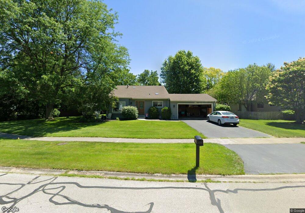
2560 Springdale Cir Naperville, IL 60564
Brook Crossing NeighborhoodEstimated Value: $401,509 - $476,000
Studio
--
Bath
1,271
Sq Ft
$357/Sq Ft
Est. Value
About This Home
This home is located at 2560 Springdale Cir, Naperville, IL 60564 and is currently estimated at $454,377, approximately $357 per square foot. 2560 Springdale Cir is a home located in Will County with nearby schools including Robert Clow Elementary School, Gordon Gregory Middle School, and Neuqua Valley High School.
Ownership History
Date
Name
Owned For
Owner Type
Purchase Details
Closed on
Aug 16, 2005
Sold by
Fornek Frank
Bought by
Fornek Diane M
Current Estimated Value
Purchase Details
Closed on
Apr 1, 1994
Sold by
Craig Dean W and Craig Deborah L
Bought by
Fornek Frank and Fornek Diane M
Home Financials for this Owner
Home Financials are based on the most recent Mortgage that was taken out on this home.
Original Mortgage
$124,300
Interest Rate
8.34%
Create a Home Valuation Report for This Property
The Home Valuation Report is an in-depth analysis detailing your home's value as well as a comparison with similar homes in the area
Home Values in the Area
Average Home Value in this Area
Purchase History
| Date | Buyer | Sale Price | Title Company |
|---|---|---|---|
| Fornek Diane M | -- | -- | |
| Fornek Frank | $155,500 | -- |
Source: Public Records
Mortgage History
| Date | Status | Borrower | Loan Amount |
|---|---|---|---|
| Previous Owner | Fornek Frank | $124,300 |
Source: Public Records
Tax History
| Year | Tax Paid | Tax Assessment Tax Assessment Total Assessment is a certain percentage of the fair market value that is determined by local assessors to be the total taxable value of land and additions on the property. | Land | Improvement |
|---|---|---|---|---|
| 2024 | $7,666 | $125,037 | $40,333 | $84,704 |
| 2023 | $7,666 | $110,457 | $35,630 | $74,827 |
| 2022 | $6,953 | $101,964 | $33,706 | $68,258 |
| 2021 | $6,636 | $97,109 | $32,101 | $65,008 |
| 2020 | $6,507 | $95,570 | $31,592 | $63,978 |
| 2019 | $6,391 | $92,877 | $30,702 | $62,175 |
| 2018 | $5,818 | $83,670 | $30,026 | $53,644 |
| 2017 | $5,724 | $81,510 | $29,251 | $52,259 |
| 2016 | $5,708 | $79,755 | $28,621 | $51,134 |
| 2015 | $5,337 | $76,687 | $27,520 | $49,167 |
| 2014 | $5,337 | $69,816 | $27,520 | $42,296 |
| 2013 | $5,337 | $69,816 | $27,520 | $42,296 |
Source: Public Records
Map
Nearby Homes
- 2725 Springdale Cir
- 28W555 Leverenz Rd
- 2413 Flambeau Dr
- 28W587 Leverenz Rd
- 2627 Homestead Dr
- 1329 Neskola Ct
- 1137 Crimson Ct
- 2240 Mecan Dr
- 3111 Landore Dr
- 2939 Brossman St
- 1860 Tamahawk Ln
- 3027 Brossman St
- 911 Rock Spring Rd
- 3212 Bennett Dr
- 2715 Wendy Dr
- 1211 Conan Doyle Rd
- 2711 Wendy Dr
- 1367 Saxon Ln
- 3412 Falkner Dr
- 1364 Saxon Ln
- 1320 Springdale Cir
- 1325 Morningstar Ct
- 1321 Morningstar Ct
- 1316 Springdale Cir
- 2565 Springdale Cir
- 2561 Springdale Cir
- 1317 Morningstar Ct Unit 1A
- 2569 Springdale Cir
- 2555 Misty Ct
- 1324 Morningstar Ct
- 1312 Springdale Cir
- 2601 Springdale Cir
- 2553 Dewhurst St
- 1313 Morningstar Ct
- 1320 Morningstar Ct
- 2605 Springdale Cir
- 2546 Misty Ct
- 2551 Misty Ct
- 2604 Springdale Cir
Your Personal Tour Guide
Ask me questions while you tour the home.