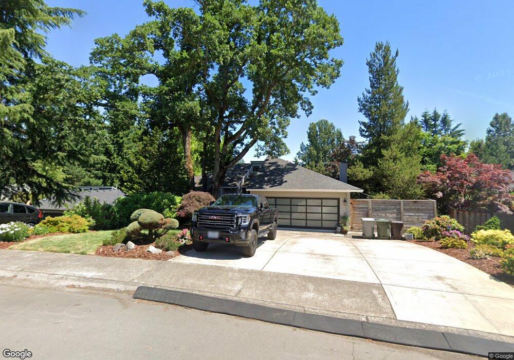
2561 Bronco Ct West Linn, OR 97068
Hidden Springs NeighborhoodEstimated Value: $1,239,000 - $1,342,000
5
Beds
8
Baths
5,372
Sq Ft
$242/Sq Ft
Est. Value
About This Home
This home is located at 2561 Bronco Ct, West Linn, OR 97068 and is currently estimated at $1,297,816, approximately $241 per square foot. 2561 Bronco Ct is a home located in Clackamas County with nearby schools including Cedaroak Park Primary School, West Linn High School, and Harmony Academy.
Ownership History
Date
Name
Owned For
Owner Type
Purchase Details
Closed on
May 16, 2014
Sold by
Green Steven and Green Emily
Bought by
Green Steven and Green Joseph R
Current Estimated Value
Purchase Details
Closed on
Jul 6, 2005
Sold by
Willamette Falls Institute Llc
Bought by
Green Steven and Green Emily
Home Financials for this Owner
Home Financials are based on the most recent Mortgage that was taken out on this home.
Original Mortgage
$104,220
Outstanding Balance
$53,777
Interest Rate
5.58%
Mortgage Type
Credit Line Revolving
Estimated Equity
$1,244,039
Create a Home Valuation Report for This Property
The Home Valuation Report is an in-depth analysis detailing your home's value as well as a comparison with similar homes in the area
Home Values in the Area
Average Home Value in this Area
Purchase History
| Date | Buyer | Sale Price | Title Company |
|---|---|---|---|
| Green Steven | -- | Servicelink | |
| Green Steven | $579,000 | Ticor Title Insurance Compan |
Source: Public Records
Mortgage History
| Date | Status | Borrower | Loan Amount |
|---|---|---|---|
| Open | Green Steven | $104,220 | |
| Open | Green Steven | $416,880 |
Source: Public Records
Tax History Compared to Growth
Tax History
| Year | Tax Paid | Tax Assessment Tax Assessment Total Assessment is a certain percentage of the fair market value that is determined by local assessors to be the total taxable value of land and additions on the property. | Land | Improvement |
|---|---|---|---|---|
| 2025 | $12,789 | $663,626 | -- | -- |
| 2024 | $12,310 | $644,298 | -- | -- |
| 2023 | $12,310 | $625,533 | $0 | $0 |
| 2022 | $11,620 | $607,314 | $0 | $0 |
| 2021 | $11,030 | $589,626 | $0 | $0 |
| 2020 | $11,105 | $572,453 | $0 | $0 |
| 2019 | $10,590 | $555,780 | $0 | $0 |
| 2018 | $10,117 | $539,592 | $0 | $0 |
| 2017 | $9,491 | $523,876 | $0 | $0 |
| 2016 | $9,105 | $508,617 | $0 | $0 |
| 2015 | $8,669 | $493,803 | $0 | $0 |
| 2014 | $8,180 | $479,420 | $0 | $0 |
Source: Public Records
Map
Nearby Homes
- 20080 Larkspur Ln Unit 50
- 20070 Larkspur Ln Unit 61
- 2583 Pimlico Dr
- 20120 Larkspur Ln Unit 85
- 19623 White Cloud Cir
- 3088 Club House Ct
- 2343 Appaloosa Way
- 3029 Club House Ct
- 19788 Wildwood Dr
- 6275 Clubhouse Cir
- 19885 Willamette Dr
- 6233 Meridian Cir
- 6296 Belmont Way
- 19775 Wildwood Dr
- 19770 Wildwood Dr
- 2024 Conestoga Ln
- 2700 Underhill Ln Unit 1
- 4050 Serango Ct
- 2488 Tulane St
- 6135 Cheyenne Terrace
- 2571 Bronco Ct
- 2555 Bronco Ct
- 2577 Bronco Ct
- 2547 Bronco Ct
- 2512 Pimlico Dr
- 2522 Pimlico Dr
- 2544 Bronco Ct
- 2554 Bronco Ct
- 2506 Pimlico Dr
- 2587 Bronco Ct
- 2531 Bronco Ct
- 2534 Bronco Ct
- 2564 Bronco Ct
- 2585 Palomino Ct
- 2557 Palomino Ct
- 2524 Bronco Ct
- 2591 Bronco Ct
- 6492 Sorrel Way
- 6478 Sorrel Way
- 6691 Palomino Cir