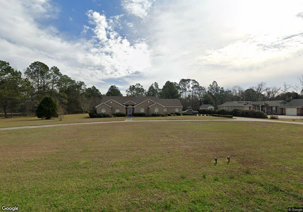
2564 James Rd Valdosta, GA 31601
Estimated Value: $403,000 - $564,000
--
Bed
2
Baths
4,123
Sq Ft
$120/Sq Ft
Est. Value
About This Home
This home is located at 2564 James Rd, Valdosta, GA 31601 and is currently estimated at $494,915, approximately $120 per square foot. 2564 James Rd is a home located in Lowndes County with nearby schools including Westside Elementary School, Hahira Middle School, and Lowndes High School.
Ownership History
Date
Name
Owned For
Owner Type
Purchase Details
Closed on
May 6, 2020
Sold by
Davis Fred
Bought by
Davis Susie Bell
Current Estimated Value
Purchase Details
Closed on
Oct 12, 2012
Sold by
Davis Fred
Bought by
Davis Fred and Davis Susie B
Home Financials for this Owner
Home Financials are based on the most recent Mortgage that was taken out on this home.
Original Mortgage
$140,000
Interest Rate
2.89%
Mortgage Type
New Conventional
Purchase Details
Closed on
Apr 1, 1997
Bought by
Davis Fred
Purchase Details
Closed on
Jun 20, 1980
Bought by
Davis Owen H
Purchase Details
Closed on
Jun 15, 1980
Bought by
Davis Owen H Sr And
Create a Home Valuation Report for This Property
The Home Valuation Report is an in-depth analysis detailing your home's value as well as a comparison with similar homes in the area
Home Values in the Area
Average Home Value in this Area
Purchase History
| Date | Buyer | Sale Price | Title Company |
|---|---|---|---|
| Davis Susie Bell | -- | -- | |
| Davis Fred | -- | -- | |
| Davis Fred | -- | -- | |
| Davis Owen H | $7,000 | -- | |
| Davis Owen H Sr And | -- | -- |
Source: Public Records
Mortgage History
| Date | Status | Borrower | Loan Amount |
|---|---|---|---|
| Previous Owner | Davis Fred | $140,000 |
Source: Public Records
Tax History Compared to Growth
Tax History
| Year | Tax Paid | Tax Assessment Tax Assessment Total Assessment is a certain percentage of the fair market value that is determined by local assessors to be the total taxable value of land and additions on the property. | Land | Improvement |
|---|---|---|---|---|
| 2024 | $1,591 | $183,721 | $15,318 | $168,403 |
| 2023 | $1,591 | $169,912 | $14,315 | $155,597 |
| 2022 | $884 | $133,470 | $14,315 | $119,155 |
| 2021 | $948 | $133,470 | $14,315 | $119,155 |
| 2020 | $1,163 | $133,365 | $14,210 | $119,155 |
| 2019 | $1,304 | $133,365 | $14,210 | $119,155 |
| 2018 | $1,443 | $133,365 | $14,210 | $119,155 |
| 2017 | $1,537 | $132,073 | $12,918 | $119,155 |
| 2016 | $1,029 | $110,332 | $12,918 | $97,414 |
| 2015 | $1,073 | $110,332 | $12,918 | $97,414 |
| 2014 | $2,550 | $103,014 | $5,600 | $97,414 |
Source: Public Records
Map
Nearby Homes
- 0 James Rd
- 2097 Lynnhaven Rd
- 2048 Dean St
- 2419 Treeview Dr
- 201 Norman Dr
- 211 Stella St
- 0 Saint Augustine Rd
- 1817 W Hill Ave
- 2.54 Ac N St Augustine Rd
- 303 Nan St
- 605 N Saint Augustine Rd
- 230 Saint Augustine Rd
- 2337 W Savannah Ave
- 1501 Harmon Dr
- TBD Moss Oak Dr
- 219 N St Augustine Rd
- 107 Jordan St
- 2008 Baytree Rd
- 2005 Baytree Rd
- 203 N Saint Augustine Rd
- 2550 James Rd
- 2578 James Rd
- 2567 James Rd
- 2570 James Rd
- 2604 James Rd
- 2547 Gays Ln
- 2146 Westside Rd
- 2152 Westside Rd
- 2128 Westside Rd
- 2544-B Gays Ln
- 2622 James Rd
- 2100 Westside Rd
- 2538 Gays Ln
- 2501 James Rd
- 2628 James Rd
- 2117 Westside Rd
- 2117 Westside Dr
- 2068 Westside Rd
- 2406 Edgar Cir
- 2410 Edgar Cir