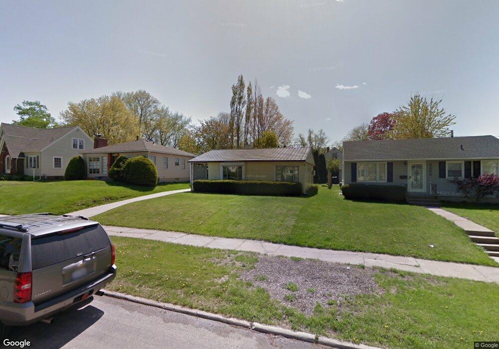
2567 Meadowbrook Dr SE Cedar Rapids, IA 52403
Vernon Heights NeighborhoodEstimated Value: $149,245 - $172,000
2
Beds
1
Bath
1,021
Sq Ft
$158/Sq Ft
Est. Value
About This Home
This home is located at 2567 Meadowbrook Dr SE, Cedar Rapids, IA 52403 and is currently estimated at $160,811, approximately $157 per square foot. 2567 Meadowbrook Dr SE is a home located in Linn County with nearby schools including Grant Wood Elementary School, Summit Elementary School, and McKinley STEAM Academy.
Ownership History
Date
Name
Owned For
Owner Type
Purchase Details
Closed on
Dec 23, 2021
Sold by
B & G Enterprises Lc
Bought by
Schouten Glenda S and Jones William K
Current Estimated Value
Purchase Details
Closed on
Sep 20, 1999
Sold by
Luvaas Clarence B and Luvaas Margaret M
Bought by
B & G Enterprises Lc
Create a Home Valuation Report for This Property
The Home Valuation Report is an in-depth analysis detailing your home's value as well as a comparison with similar homes in the area
Home Values in the Area
Average Home Value in this Area
Purchase History
| Date | Buyer | Sale Price | Title Company |
|---|---|---|---|
| Schouten Glenda S | -- | None Listed On Document | |
| B & G Enterprises Lc | $64,500 | -- |
Source: Public Records
Tax History Compared to Growth
Tax History
| Year | Tax Paid | Tax Assessment Tax Assessment Total Assessment is a certain percentage of the fair market value that is determined by local assessors to be the total taxable value of land and additions on the property. | Land | Improvement |
|---|---|---|---|---|
| 2025 | $2,240 | $141,700 | $41,500 | $100,200 |
| 2024 | $2,320 | $135,500 | $39,100 | $96,400 |
| 2023 | $2,320 | $126,600 | $36,700 | $89,900 |
| 2022 | $2,218 | $110,000 | $31,800 | $78,200 |
| 2021 | $2,098 | $107,100 | $31,800 | $75,300 |
| 2020 | $2,098 | $95,100 | $24,400 | $70,700 |
| 2019 | $1,936 | $89,800 | $24,400 | $65,400 |
| 2018 | $1,882 | $89,800 | $24,400 | $65,400 |
| 2017 | $1,916 | $88,000 | $24,400 | $63,600 |
| 2016 | $1,832 | $86,200 | $24,400 | $61,800 |
| 2015 | $1,820 | $85,572 | $24,440 | $61,132 |
| 2014 | $1,820 | $85,572 | $24,440 | $61,132 |
| 2013 | $1,782 | $85,572 | $24,440 | $61,132 |
Source: Public Records
Map
Nearby Homes
- 505 Forest Dr SE
- 435 Forest Dr SE
- 654 26th St SE
- 637 Grant Wood Dr SE
- 2323 Upland Dr SE
- 705 Grant Wood Dr SE
- 520 22nd St SE
- 2251 Bever Ave SE
- 2600 Mount Vernon Rd SE
- 700 Memorial Dr SE
- 510 Knollwood Dr SE
- 914 25th St SE
- 1929 Ridgeway Dr SE
- 2420 11th Ave SE
- 549 Vernon Dr SE
- 431 30th St SE
- 18 Blake Terrace SE
- 2700 Mount Vernon Rd SE
- 1911 Ridgeway Dr SE
- 1117 Crestview Dr SE
- 2563 Meadowbrook Dr SE
- 2571 Meadowbrook Dr SE
- 612 26th St SE
- 2601 Meadowbrook Dr SE
- 2550 Meadowbrook Dr SE
- 616 26th St SE
- 2607 Meadowbrook Dr SE
- 2546 Meadowbrook Dr SE
- 2547 Meadowbrook Dr SE
- 2542 Meadowbrook Dr SE
- 2600 Meadowbrook Dr SE
- 624 26th St SE
- 2613 Meadowbrook Dr SE
- 611 Grant Wood Dr SE
- 2534 Meadowbrook Dr SE
- 2606 Meadowbrook Dr SE
- 515 26th St SE
- 630 26th St SE
- 2612 Meadowbrook Dr SE
- 2543 Vernon Ct SE