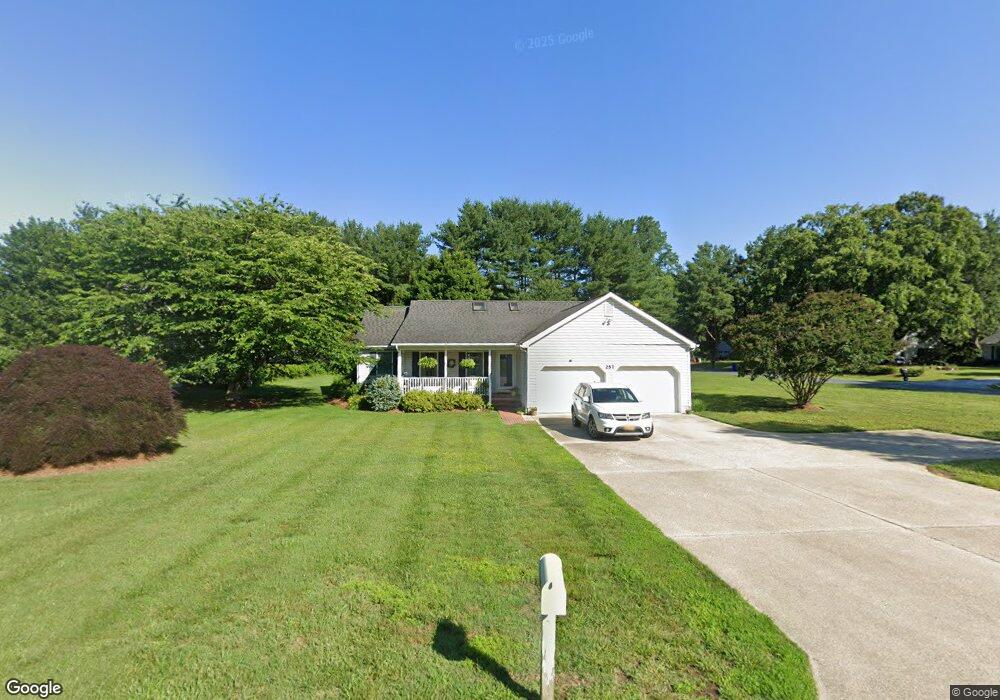
257 Duke of Kent St Chestertown, MD 21620
Kingstown NeighborhoodEstimated Value: $382,000 - $445,000
3
Beds
2
Baths
1,848
Sq Ft
$220/Sq Ft
Est. Value
About This Home
This home is located at 257 Duke of Kent St, Chestertown, MD 21620 and is currently estimated at $406,099, approximately $219 per square foot. 257 Duke of Kent St is a home located in Queen Anne's County with nearby schools including Church Hill Elementary School, Sudlersville Middle School, and Queen Anne's County High School.
Ownership History
Date
Name
Owned For
Owner Type
Purchase Details
Closed on
Sep 30, 2009
Sold by
Schauber Margaret L
Bought by
Quillen Mitchell G
Current Estimated Value
Purchase Details
Closed on
Aug 27, 1991
Sold by
Skipp Philip J and Skipp Harriett R
Bought by
Yowell John M and Yowell Barbara S
Home Financials for this Owner
Home Financials are based on the most recent Mortgage that was taken out on this home.
Original Mortgage
$200,000
Interest Rate
9.17%
Create a Home Valuation Report for This Property
The Home Valuation Report is an in-depth analysis detailing your home's value as well as a comparison with similar homes in the area
Home Values in the Area
Average Home Value in this Area
Purchase History
| Date | Buyer | Sale Price | Title Company |
|---|---|---|---|
| Quillen Mitchell G | $235,000 | -- | |
| Yowell John M | $400,000 | -- |
Source: Public Records
Mortgage History
| Date | Status | Borrower | Loan Amount |
|---|---|---|---|
| Previous Owner | Yowell John M | $200,000 | |
| Closed | Quillen Mitchell G | -- |
Source: Public Records
Tax History Compared to Growth
Tax History
| Year | Tax Paid | Tax Assessment Tax Assessment Total Assessment is a certain percentage of the fair market value that is determined by local assessors to be the total taxable value of land and additions on the property. | Land | Improvement |
|---|---|---|---|---|
| 2025 | $2,960 | $307,900 | $80,700 | $227,200 |
| 2024 | $2,797 | $290,500 | $0 | $0 |
| 2023 | $2,633 | $273,100 | $0 | $0 |
| 2022 | $2,469 | $255,700 | $74,400 | $181,300 |
| 2021 | $2,236 | $241,300 | $0 | $0 |
| 2020 | $2,236 | $226,900 | $0 | $0 |
| 2019 | $2,098 | $212,500 | $61,700 | $150,800 |
| 2018 | $2,066 | $209,133 | $0 | $0 |
| 2017 | $2,034 | $205,767 | $0 | $0 |
| 2016 | -- | $202,400 | $0 | $0 |
| 2015 | $1,010 | $202,400 | $0 | $0 |
| 2014 | $1,010 | $202,400 | $0 | $0 |
Source: Public Records
Map
Nearby Homes
- 0 East St
- 213 Central Dr
- 105 High St
- 228 S Water St
- 206 S Water St
- 303 E Campus Ave
- 206 Cannon St
- 200 Washington Ave
- 349 & 351 High St
- 349 High St
- 204 Rolling Rd
- 206 Valley Rd
- 222 Dutchess Rd
- 222 Mount Vernon Ave
- 411 Greenwood Ave
- 517 High St
- 108 Little Harbor Way
- 104 Little Harbor Way
- 0 Elm St Unit MDKE2003590
- 0 Little Harbor Way Unit 1
- 253 Duke of Kent St
- 224 Fey Rd
- 220 Fey Rd
- 308 Princess Anne Dr
- 304 Princess Anne Dr
- 416 Duke of Kent St
- 240 Duke of Kent St
- 300 Princess Anne Dr
- 216 Fey Rd
- 316 Princess Anne Dr
- 236 Duke of Kent St
- 245 Duke of Kent St
- 212 Fey Rd
- 233 Princess Anne Dr
- 232 Duke of Kent St
- 241 Duke of Kent St
- 252 Princess Anne Dr
- 229 Princess Anne Dr
- 211 Fey Rd
- 208 Fey Rd