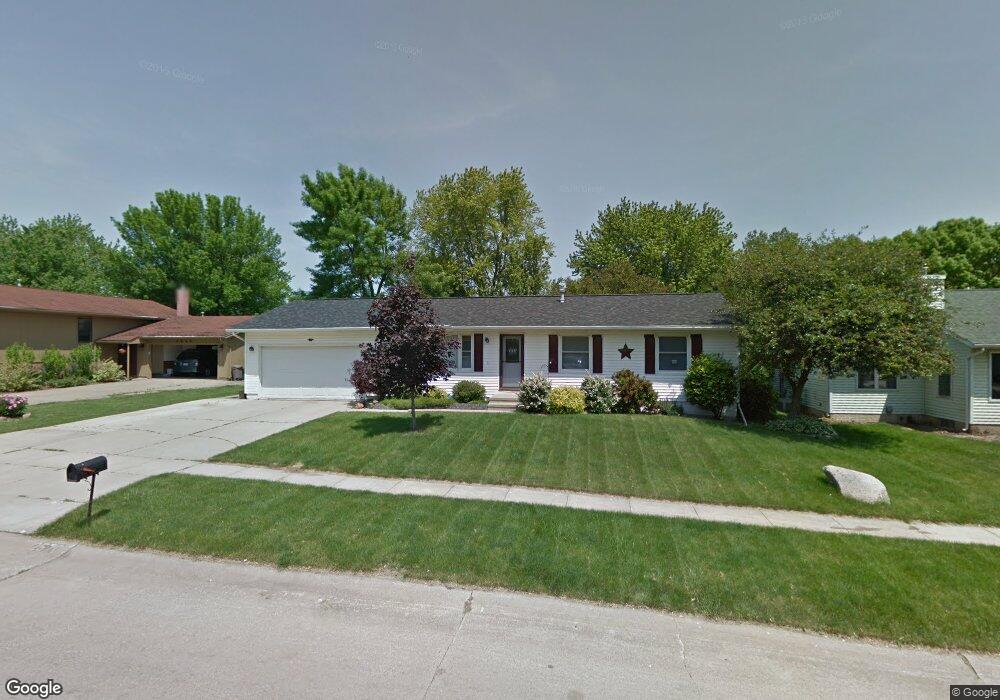
2570 A Ave Marion, IA 52302
Estimated Value: $216,761 - $262,000
3
Beds
2
Baths
2,044
Sq Ft
$116/Sq Ft
Est. Value
About This Home
This home is located at 2570 A Ave, Marion, IA 52302 and is currently estimated at $237,440, approximately $116 per square foot. 2570 A Ave is a home located in Linn County with nearby schools including Francis Marion Intermediate School, Starry Elementary School, and Vernon Middle School.
Ownership History
Date
Name
Owned For
Owner Type
Purchase Details
Closed on
Oct 24, 2011
Sold by
Ritchart Michael Charles
Bought by
United States Of America and United States Department Of Agriculture
Current Estimated Value
Purchase Details
Closed on
Feb 24, 2001
Sold by
Merritt Patricia J and Merritt Robert J
Bought by
Recker Phil J and Recker Mary Kay
Home Financials for this Owner
Home Financials are based on the most recent Mortgage that was taken out on this home.
Original Mortgage
$88,760
Interest Rate
7.06%
Purchase Details
Closed on
Jun 24, 1999
Sold by
Mcmann Francis C and Mcmann Carolyn J Jepsen
Bought by
Blazek Patricia J and Blazek Pat J
Home Financials for this Owner
Home Financials are based on the most recent Mortgage that was taken out on this home.
Original Mortgage
$80,800
Interest Rate
7.15%
Create a Home Valuation Report for This Property
The Home Valuation Report is an in-depth analysis detailing your home's value as well as a comparison with similar homes in the area
Home Values in the Area
Average Home Value in this Area
Purchase History
| Date | Buyer | Sale Price | Title Company |
|---|---|---|---|
| United States Of America | $54,400 | None Available | |
| Recker Phil J | $110,500 | -- | |
| Blazek Patricia J | $100,500 | -- |
Source: Public Records
Mortgage History
| Date | Status | Borrower | Loan Amount |
|---|---|---|---|
| Previous Owner | Recker Phil J | $88,760 | |
| Previous Owner | Blazek Patricia J | $80,800 |
Source: Public Records
Tax History Compared to Growth
Tax History
| Year | Tax Paid | Tax Assessment Tax Assessment Total Assessment is a certain percentage of the fair market value that is determined by local assessors to be the total taxable value of land and additions on the property. | Land | Improvement |
|---|---|---|---|---|
| 2025 | $3,262 | $269,900 | $27,700 | $242,200 |
| 2024 | $3,704 | $217,100 | $27,700 | $189,400 |
| 2023 | $3,704 | $184,300 | $27,700 | $156,600 |
| 2022 | $3,576 | $175,300 | $27,700 | $147,600 |
| 2021 | $3,532 | $175,300 | $27,700 | $147,600 |
| 2020 | $3,532 | $164,800 | $27,700 | $137,100 |
| 2019 | $3,240 | $152,300 | $27,700 | $124,600 |
| 2018 | $3,164 | $152,300 | $27,700 | $124,600 |
| 2017 | $3,148 | $141,500 | $27,700 | $113,800 |
| 2016 | $3,148 | $141,500 | $27,700 | $113,800 |
| 2015 | $3,135 | $141,500 | $27,700 | $113,800 |
| 2014 | $2,942 | $141,500 | $27,700 | $113,800 |
| 2013 | $2,824 | $141,500 | $27,700 | $113,800 |
Source: Public Records
Map
Nearby Homes
- 2850 Pennington Dr
- 385 Rosslare St
- 369 Raleigh Ln
- 2825 2nd Ave
- 2810 Bullis Dr
- 235 S 21st Street Ct
- 295 S 19th St
- 2605 5th Ave
- 649 Raleigh Ln
- 440 31st St
- 415 16th St
- 2700 7th Ave
- 336 Aircom Dr
- 388 Aircom Dr
- 492 Aircom Dr
- 443 Aircom Dr
- 1621 6th Ave
- 26.35 Acres M L Quass Rd
- 1600 Highview Dr
- 840 30th St