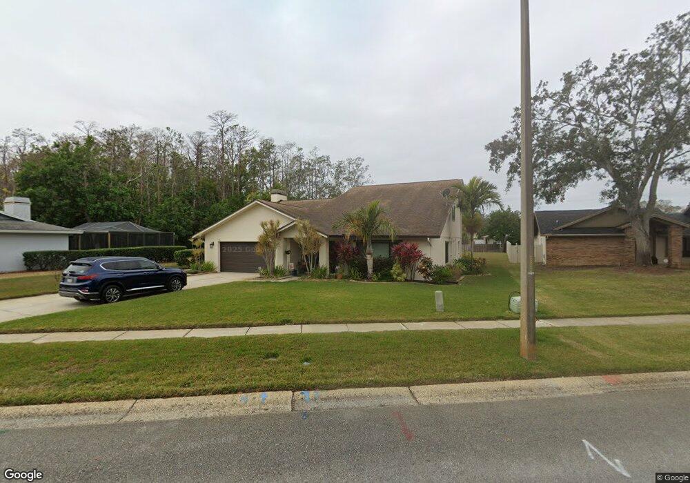
2570 Anderson Dr W Clearwater, FL 33761
Northwood NeighborhoodEstimated Value: $713,436 - $1,063,000
4
Beds
3
Baths
3,554
Sq Ft
$232/Sq Ft
Est. Value
About This Home
This home is located at 2570 Anderson Dr W, Clearwater, FL 33761 and is currently estimated at $826,109, approximately $232 per square foot. 2570 Anderson Dr W is a home located in Pinellas County with nearby schools including Leila Davis Elementary School, Countryside High School, and Safety Harbor Middle School.
Ownership History
Date
Name
Owned For
Owner Type
Purchase Details
Closed on
Sep 20, 2012
Sold by
Commons Richard
Bought by
Clabaugh Daniel B and Clabaugh Jo Anne
Current Estimated Value
Home Financials for this Owner
Home Financials are based on the most recent Mortgage that was taken out on this home.
Original Mortgage
$331,593
Outstanding Balance
$230,958
Interest Rate
3.71%
Mortgage Type
VA
Estimated Equity
$595,151
Purchase Details
Closed on
Aug 24, 2009
Sold by
Dibiasi Philip R and Dibiasi Judith C
Bought by
Commons Richard
Home Financials for this Owner
Home Financials are based on the most recent Mortgage that was taken out on this home.
Original Mortgage
$240,000
Interest Rate
5.19%
Mortgage Type
New Conventional
Create a Home Valuation Report for This Property
The Home Valuation Report is an in-depth analysis detailing your home's value as well as a comparison with similar homes in the area
Home Values in the Area
Average Home Value in this Area
Purchase History
| Date | Buyer | Sale Price | Title Company |
|---|---|---|---|
| Clabaugh Daniel B | $321,000 | Sunbelt Title Agency | |
| Commons Richard | $300,000 | Star Title Partners Of Palm |
Source: Public Records
Mortgage History
| Date | Status | Borrower | Loan Amount |
|---|---|---|---|
| Open | Clabaugh Daniel B | $331,593 | |
| Previous Owner | Commons Richard | $240,000 |
Source: Public Records
Tax History Compared to Growth
Tax History
| Year | Tax Paid | Tax Assessment Tax Assessment Total Assessment is a certain percentage of the fair market value that is determined by local assessors to be the total taxable value of land and additions on the property. | Land | Improvement |
|---|---|---|---|---|
| 2024 | $4,682 | $293,722 | -- | -- |
| 2023 | $4,682 | $285,167 | $0 | $0 |
| 2022 | $4,548 | $276,861 | $0 | $0 |
| 2021 | $4,604 | $268,797 | $0 | $0 |
| 2020 | $4,589 | $265,086 | $0 | $0 |
| 2019 | $4,505 | $259,126 | $0 | $0 |
| 2018 | $4,441 | $254,294 | $0 | $0 |
| 2017 | $4,239 | $249,064 | $0 | $0 |
| 2016 | $4,202 | $243,941 | $0 | $0 |
| 2015 | $4,264 | $242,245 | $0 | $0 |
| 2014 | $4,242 | $240,322 | $0 | $0 |
Source: Public Records
Map
Nearby Homes
- 2661 Winding Wood Dr
- 2840 Pheasant Run
- 2568 Redwood Way
- 2580 Redwood Way
- 2721 Haverhill Ct
- 2587 Forest Run Ct Unit 141B
- 2459 Parkstream Ave
- 2737 Enterprise Rd E Unit 152
- 2562 Forest Run Ct Unit 130B
- 2700 Woodmere Ct
- 2745 Enterprise Rd E Unit 24
- 2959 Deer Run S
- 2721 Countryside Blvd Unit E105
- 2670 Barksdale Ct
- 2640 Enterprise Rd E Unit B25
- 2628 Barksdale Ct Unit B
- 2583 Burntfork Dr
- 2650 Countryside Blvd Unit A210
- 2650 Countryside Blvd Unit F110
- 2650 Countryside Blvd Unit C106
- 2576 Anderson Dr W
- 2564 Anderson Dr W
- 2799 Cottonwood Ct
- 2582 Anderson Dr W
- 2798 Cottonwood Ct
- 2558 Anderson Dr W
- 2822 Anderson Ct
- 2588 Anderson Dr W
- 2829 Anderson Ct
- 2552 Anderson Dr W
- 2793 Cottonwood Ct
- 2815 Anderson Dr N
- 2792 Cottonwood Ct
- 2828 Anderson Ct
- 2797 Heatherwood Ct
- 2594 Anderson Dr W
- 2821 Anderson Dr N
- 2791 Heatherwood Ct
- 2546 Anderson Dr W
- 2557 Anderson Dr W