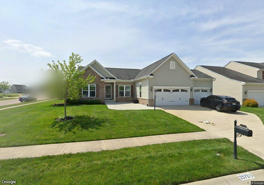
2570 Blueflag St Tipp City, OH 45371
Estimated Value: $373,000 - $457,000
3
Beds
3
Baths
1,833
Sq Ft
$229/Sq Ft
Est. Value
About This Home
This home is located at 2570 Blueflag St, Tipp City, OH 45371 and is currently estimated at $419,771, approximately $229 per square foot. 2570 Blueflag St is a home located in Miami County with nearby schools including Bethel Elementary School, Bethel Middle School, and Bethel High School.
Ownership History
Date
Name
Owned For
Owner Type
Purchase Details
Closed on
Sep 11, 2019
Sold by
Parisien Ann L and Alvarado Rosa Linda
Bought by
Carlisle Mary M
Current Estimated Value
Home Financials for this Owner
Home Financials are based on the most recent Mortgage that was taken out on this home.
Original Mortgage
$294,500
Interest Rate
3.7%
Mortgage Type
New Conventional
Purchase Details
Closed on
Nov 8, 2018
Sold by
Parisien Ann L and Alvarado Rosa Linda
Bought by
Parisien Ann L and Alvarado Rosa Linda
Purchase Details
Closed on
Apr 3, 2017
Sold by
Gregory Ronald K and Gregory Tali L
Bought by
Parisien Ann L and Alvarado Rosa Linda
Home Financials for this Owner
Home Financials are based on the most recent Mortgage that was taken out on this home.
Original Mortgage
$271,418
Interest Rate
4.21%
Mortgage Type
New Conventional
Purchase Details
Closed on
Jun 26, 2014
Sold by
Dec Land Co I Llc
Bought by
Nvr Inc
Create a Home Valuation Report for This Property
The Home Valuation Report is an in-depth analysis detailing your home's value as well as a comparison with similar homes in the area
Home Values in the Area
Average Home Value in this Area
Purchase History
| Date | Buyer | Sale Price | Title Company |
|---|---|---|---|
| Carlisle Mary M | $310,000 | Chicago Title Company Llc | |
| Parisien Ann L | -- | None Available | |
| Parisien Ann L | $297,500 | Vantage Land Title | |
| Nvr Inc | $41,000 | First Title |
Source: Public Records
Mortgage History
| Date | Status | Borrower | Loan Amount |
|---|---|---|---|
| Previous Owner | Carlisle Mary M | $294,500 | |
| Previous Owner | Parisien Ann L | $271,418 |
Source: Public Records
Tax History Compared to Growth
Tax History
| Year | Tax Paid | Tax Assessment Tax Assessment Total Assessment is a certain percentage of the fair market value that is determined by local assessors to be the total taxable value of land and additions on the property. | Land | Improvement |
|---|---|---|---|---|
| 2024 | $5,061 | $107,320 | $22,160 | $85,160 |
| 2023 | $5,061 | $107,320 | $22,160 | $85,160 |
| 2022 | $5,255 | $107,320 | $22,160 | $85,160 |
| 2021 | $4,869 | $93,310 | $19,250 | $74,060 |
| 2020 | $4,878 | $93,310 | $19,250 | $74,060 |
| 2019 | $4,972 | $93,310 | $19,250 | $74,060 |
| 2018 | $4,494 | $78,120 | $15,120 | $63,000 |
| 2017 | $4,499 | $78,120 | $15,120 | $63,000 |
| 2016 | $4,351 | $78,120 | $15,120 | $63,000 |
| 2015 | $1,303 | $11,200 | $11,200 | $0 |
| 2014 | $1,303 | $11,200 | $11,200 | $0 |
| 2013 | $978 | $11,200 | $11,200 | $0 |
Source: Public Records
Map
Nearby Homes
- 3005 Vervain Way
- 5068 Meadowview St
- 2003 Trillium Way
- 1349 Senna St
- 5195 Buttercup Dr
- 9091 Jasmine Dr
- 4400 U S Highway 40
- 5362 Windbrooke Dr
- 4676 Cobblestone Dr Unit 4676
- 4641 Cobblestone Dr Unit 4641
- 8041 Bushclover Dr
- 4957 Country Park Dr
- 7131 Bluestream Dr
- 8133 Bushclover Dr
- 3109 Coneflower Dr
- 5420 U S 40
- 3078 White Ash Dr
- 9310 Lakeside St
- 4010 Redbud Way
- 8671 Pinegate Way
- 2576 Blueflag St
- 3008 Cattail Dr
- 3333 Blueflag St
- 3005 Blueflag St
- 3005 Cattail Dr
- 868 Blueflag
- 876 Blueflag
- 871 Blueflag
- 2567 Blueflag St
- 2582 Blueflag St
- 2579 Blueflag St
- 3011 Cattail Dr
- 2561 Blueflag St
- 3014 Cattail Dr
- 2681 Blueflag St
- 2555 Blueflag St
- 2573 Blueflag St
- 2588 Blueflag St
- 3029 Cattail Dr
- 2585 Blueflag St