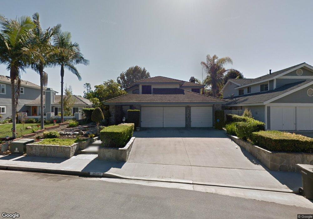
25702 Rusty Anchor St Dana Point, CA 92629
Del Obispo NeighborhoodEstimated Value: $1,732,904 - $2,184,000
4
Beds
3
Baths
2,453
Sq Ft
$779/Sq Ft
Est. Value
About This Home
This home is located at 25702 Rusty Anchor St, Dana Point, CA 92629 and is currently estimated at $1,911,976, approximately $779 per square foot. 25702 Rusty Anchor St is a home located in Orange County with nearby schools including Del Obispo Elementary School, Marco Forster Middle School, and Dana Hills High School.
Ownership History
Date
Name
Owned For
Owner Type
Purchase Details
Closed on
Mar 5, 2013
Sold by
Schaeffer George J
Bought by
Schaeffer George Jack and The George Jack Schaeffer Separate Prope
Current Estimated Value
Purchase Details
Closed on
Jun 25, 2009
Sold by
Grogg Mildred
Bought by
Schaeffer George J
Purchase Details
Closed on
Mar 29, 2000
Sold by
Mildred Grogg
Bought by
Grogg Mildred and Mildred Grogg Separate Property Trust
Create a Home Valuation Report for This Property
The Home Valuation Report is an in-depth analysis detailing your home's value as well as a comparison with similar homes in the area
Home Values in the Area
Average Home Value in this Area
Purchase History
| Date | Buyer | Sale Price | Title Company |
|---|---|---|---|
| Schaeffer George Jack | -- | None Available | |
| Schaeffer George J | -- | None Available | |
| Grogg Mildred | -- | -- |
Source: Public Records
Tax History Compared to Growth
Tax History
| Year | Tax Paid | Tax Assessment Tax Assessment Total Assessment is a certain percentage of the fair market value that is determined by local assessors to be the total taxable value of land and additions on the property. | Land | Improvement |
|---|---|---|---|---|
| 2025 | $5,612 | $390,303 | $135,557 | $254,746 |
| 2024 | $5,612 | $382,650 | $132,899 | $249,751 |
| 2023 | $5,220 | $375,148 | $130,294 | $244,854 |
| 2022 | $4,947 | $367,793 | $127,740 | $240,053 |
| 2021 | $4,438 | $360,582 | $125,235 | $235,347 |
| 2020 | $4,425 | $356,885 | $123,951 | $232,934 |
| 2019 | $4,162 | $349,888 | $121,521 | $228,367 |
| 2018 | $4,113 | $343,028 | $119,138 | $223,890 |
| 2017 | $3,947 | $336,302 | $116,802 | $219,500 |
| 2016 | $3,887 | $329,708 | $114,511 | $215,197 |
| 2015 | $3,757 | $324,756 | $112,791 | $211,965 |
| 2014 | $3,720 | $318,395 | $110,582 | $207,813 |
Source: Public Records
Map
Nearby Homes
- 33651 Surfside Dr Unit 41
- 33582 Bremerton St
- 33852 Del Obispo St Unit 80
- 33852 Del Obispo St Unit 2
- 33852 Del Obispo St Unit 117
- 33852 Del Obispo St Unit 112
- 33095 Southwind Ct
- 33095 Regatta Ct
- 26000 Avenida Aeropuerto Unit 55
- 18 Indigo Way
- 33831 Camino Capistrano Unit 50
- 33026 Lighthouse Ct
- 25382 Sea Bluffs Dr Unit 8205
- 25611 Quail Run Unit 131
- 25611 Quail Run Unit 88
- 26000 Avenida Aeropuerto Unit 155
- 26000 Avenida Aeropuerto Unit 148
- 26000 Avenida Aeropuerto Unit 38
- 33491 Sea Bright Dr
- 25422 Sea Bluffs Dr Unit 207
- 25692 Rusty Anchor St
- 25712 Rusty Anchor St
- 33501 Nancy Jane Ct
- 25682 Rusty Anchor St
- 25722 Rusty Anchor St
- 33511 Nancy Jane Ct
- 33461 Cape Bay Place
- 33502 Nancy Jane Ct
- 24645 Goldenspring Dr
- 33452 Surf Shoal Place
- 33502 Sunridge Dr
- 25672 Rusty Anchor St
- 33521 Nancy Jane Ct
- 25732 Rusty Anchor St
- 33451 Cape Bay Place
- 33472 Cape Bay Place
- 33512 Nancy Jane Ct
- 25641 Goldenspring Dr
- 33512 Sunridge Dr
- 33531 Nancy Jane Ct