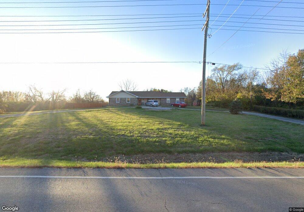
25727 147th St Leavenworth, KS 66048
Estimated Value: $373,000 - $472,164
4
Beds
3
Baths
2,098
Sq Ft
$204/Sq Ft
Est. Value
About This Home
This home is located at 25727 147th St, Leavenworth, KS 66048 and is currently estimated at $427,291, approximately $203 per square foot. 25727 147th St is a home located in Leavenworth County with nearby schools including Lansing Elementary School, Lansing Middle 6-8, and Lansing High 9-12.
Ownership History
Date
Name
Owned For
Owner Type
Purchase Details
Closed on
Aug 1, 2001
Bought by
Dvorak Peter A and Dvorak Peggy D
Current Estimated Value
Home Financials for this Owner
Home Financials are based on the most recent Mortgage that was taken out on this home.
Original Mortgage
$156,000
Outstanding Balance
$108,792
Interest Rate
7.03%
Mortgage Type
New Conventional
Estimated Equity
$318,499
Create a Home Valuation Report for This Property
The Home Valuation Report is an in-depth analysis detailing your home's value as well as a comparison with similar homes in the area
Home Values in the Area
Average Home Value in this Area
Purchase History
| Date | Buyer | Sale Price | Title Company |
|---|---|---|---|
| Dvorak Peter A | $175,000 | -- |
Source: Public Records
Mortgage History
| Date | Status | Borrower | Loan Amount |
|---|---|---|---|
| Open | Dvorak Peter A | $156,000 |
Source: Public Records
Tax History Compared to Growth
Tax History
| Year | Tax Paid | Tax Assessment Tax Assessment Total Assessment is a certain percentage of the fair market value that is determined by local assessors to be the total taxable value of land and additions on the property. | Land | Improvement |
|---|---|---|---|---|
| 2025 | $4,940 | $45,402 | $12,031 | $33,371 |
| 2024 | $4,523 | $43,673 | $10,610 | $33,063 |
| 2023 | $4,523 | $41,814 | $10,610 | $31,204 |
| 2022 | $4,325 | $38,525 | $8,919 | $29,606 |
| 2021 | $4,270 | $37,501 | $8,158 | $29,343 |
| 2020 | $3,958 | $34,201 | $7,813 | $26,388 |
| 2019 | $3,718 | $32,096 | $7,468 | $24,628 |
| 2018 | $3,435 | $29,699 | $6,548 | $23,151 |
| 2017 | $3,418 | $29,699 | $6,433 | $23,266 |
| 2016 | $3,413 | $29,699 | $6,324 | $23,375 |
| 2015 | $3,257 | $28,474 | $6,324 | $22,150 |
| 2014 | $3,136 | $27,919 | $6,324 | $21,595 |
Source: Public Records
Map
Nearby Homes
- 000 4-H Rd
- 811 4-H Rd
- 624 S Bittersweet Ln
- 722 Bittersweet Rd
- 922 Southfork St
- 527 S Valley Dr
- 73 Continental Dr
- 77 Continental Dr
- 1221 S Desoto Rd
- 610 Meadowlark Rd
- 115 W Gilman Rd
- 875 Clearview Dr
- 833 Rock Creek Dr
- 104 Olive St
- 901 S Main St
- 506 1st Terrace
- 202 S Main St
- 705 Rock Creek Dr
- 124 S Main St
- 542 Creekside Ct