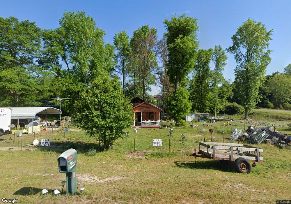
2573 Rockfish Rd Raeford, NC 28376
Estimated Value: $106,066
--
Bed
1
Bath
780
Sq Ft
$136/Sq Ft
Est. Value
About This Home
This home is located at 2573 Rockfish Rd, Raeford, NC 28376 and is currently priced at $106,066, approximately $135 per square foot. 2573 Rockfish Rd is a home located in Hoke County with nearby schools including Scurlock Elementary School, East Hoke Middle, and Hoke County High.
Ownership History
Date
Name
Owned For
Owner Type
Purchase Details
Closed on
Oct 22, 2021
Sold by
Davis Ras Edward and Davis Tommalee
Bought by
Locklear Eugene L
Current Estimated Value
Purchase Details
Closed on
Oct 24, 2016
Sold by
David Rass Edward and Davis Tommalce
Bought by
Locklear Eugene L
Home Financials for this Owner
Home Financials are based on the most recent Mortgage that was taken out on this home.
Original Mortgage
$28,500
Interest Rate
3.42%
Mortgage Type
Unknown
Create a Home Valuation Report for This Property
The Home Valuation Report is an in-depth analysis detailing your home's value as well as a comparison with similar homes in the area
Home Values in the Area
Average Home Value in this Area
Purchase History
| Date | Buyer | Sale Price | Title Company |
|---|---|---|---|
| Locklear Eugene L | -- | None Available | |
| Locklear Eugene L | $40,000 | None Available |
Source: Public Records
Mortgage History
| Date | Status | Borrower | Loan Amount |
|---|---|---|---|
| Closed | Locklear Eugene L | $28,500 |
Source: Public Records
Tax History Compared to Growth
Tax History
| Year | Tax Paid | Tax Assessment Tax Assessment Total Assessment is a certain percentage of the fair market value that is determined by local assessors to be the total taxable value of land and additions on the property. | Land | Improvement |
|---|---|---|---|---|
| 2023 | $624 | $60,940 | $48,200 | $12,740 |
| 2022 | $624 | $60,940 | $48,200 | $12,740 |
| 2021 | $0 | $31,310 | $16,430 | $14,880 |
| 2020 | $388 | $31,310 | $16,430 | $14,880 |
| 2019 | $388 | $31,310 | $16,430 | $14,880 |
| 2018 | $388 | $31,310 | $16,430 | $14,880 |
| 2017 | $388 | $31,310 | $16,430 | $14,880 |
| 2016 | $383 | $31,310 | $16,430 | $14,880 |
| 2015 | $383 | $31,310 | $16,430 | $14,880 |
| 2014 | $364 | $31,310 | $16,430 | $14,880 |
| 2013 | -- | $28,060 | $13,150 | $14,910 |
Source: Public Records
Map
Nearby Homes
- 499 Southerland Peak Dr
- 176 Grove Walk Rd
- 531 Southerland Peak
- 2911 Rockfish Rd
- 739 Southerland Peak Rd
- 731 Southerland Peak (Lot 45) Dr
- 512 Townsend Rd
- 192 Grove Walk Rd
- 723 Southerland Peak Dr
- 731 Southerland Peak Dr
- 711 Southerland Peak Rd
- 739 Southerland Peak (Lot 46) Dr
- 711 Southerland Peak (Lot 43) Dr
- 499 Dr
- Bellwood Plan at Wood Lake II
- Southport II Plan at Wood Lake II
- Kent Plan at Wood Lake II
- Topsail Plan at Wood Lake II
- 147 Smokey Mountain Dr
- 281 Leland Ln
- 208 Tranquility Dr
- 2619 Rockfish Rd
- 2619 Rockfish Rd
- 2521 Rockfish Rd
- 2663 Rockfish Rd
- 212 Tranquility Dr
- 291 Townsend Rd
- 2651 Rockfish Rd
- 2501 Rockfish Rd
- 2545 Rockfish Rd
- 2556 Rockfish Rd
- 2651 Rockfish (Lot 1) Rd
- 117 Ridgeview Dr
- 197 Tranquility Dr
- 190 Tranquility Dr
- 2673 Rockfish (Lot 2) Rd
- 139 Ridgeview Dr
- 2673 Rockfish Rd
- 2479 Rockfish Rd
- 211 Wolfbridge Dr