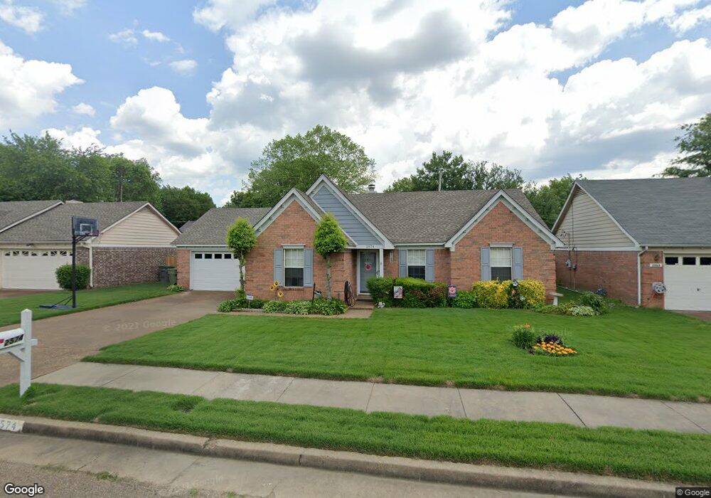
2574 Appling Crest Dr Memphis, TN 38133
Estimated Value: $228,197 - $242,000
3
Beds
3
Baths
1,357
Sq Ft
$172/Sq Ft
Est. Value
About This Home
This home is located at 2574 Appling Crest Dr, Memphis, TN 38133 and is currently estimated at $233,299, approximately $171 per square foot. 2574 Appling Crest Dr is a home located in Shelby County with nearby schools including Kate Bond Elementary School, Kate Bond Middle School, and Cordova High School.
Ownership History
Date
Name
Owned For
Owner Type
Purchase Details
Closed on
Jul 24, 2020
Sold by
Russell Regina A and Russell Jimmy D
Bought by
Reeves Savannah Leigh
Current Estimated Value
Home Financials for this Owner
Home Financials are based on the most recent Mortgage that was taken out on this home.
Original Mortgage
$151,210
Outstanding Balance
$134,083
Interest Rate
3.1%
Mortgage Type
FHA
Estimated Equity
$99,216
Create a Home Valuation Report for This Property
The Home Valuation Report is an in-depth analysis detailing your home's value as well as a comparison with similar homes in the area
Home Values in the Area
Average Home Value in this Area
Purchase History
| Date | Buyer | Sale Price | Title Company |
|---|---|---|---|
| Reeves Savannah Leigh | $154,000 | None Available |
Source: Public Records
Mortgage History
| Date | Status | Borrower | Loan Amount |
|---|---|---|---|
| Open | Reeves Savannah Leigh | $151,210 |
Source: Public Records
Tax History
| Year | Tax Paid | Tax Assessment Tax Assessment Total Assessment is a certain percentage of the fair market value that is determined by local assessors to be the total taxable value of land and additions on the property. | Land | Improvement |
|---|---|---|---|---|
| 2025 | $1,320 | $62,325 | $8,750 | $53,575 |
| 2024 | $1,320 | $38,950 | $6,125 | $32,825 |
| 2023 | $2,373 | $38,950 | $6,125 | $32,825 |
| 2022 | $2,373 | $38,950 | $6,125 | $32,825 |
| 2021 | $2,401 | $38,950 | $6,125 | $32,825 |
| 2020 | $1,877 | $25,900 | $6,125 | $19,775 |
| 2019 | $828 | $25,900 | $6,125 | $19,775 |
| 2018 | $828 | $25,900 | $6,125 | $19,775 |
| 2017 | $847 | $25,900 | $6,125 | $19,775 |
| 2016 | $1,117 | $25,550 | $0 | $0 |
| 2014 | $1,117 | $25,550 | $0 | $0 |
Source: Public Records
Map
Nearby Homes
- 2596 Appling Glen Dr
- 7503 Appling Estate Dr
- 7551 Meadowland Dr
- 7533 Meadowland Dr
- 2442 Green Glen Dr
- 7513 Meadowland Dr
- 2593 Kate Bond Rd
- 7360 Vondel Cove
- 2718 Kate Bond Rd
- 2695 van Hersh Dr
- 2412 Kate Bond Rd
- 0 Appling Rd Unit 10214193
- 0 Appling Rd Unit 10214089
- 2776 Deer Glade Ln
- 7250 Hillshire Dr
- 7251 Hillshire Dr
- 7065 Petten Dr
- 2547 Reese Lake Cir
- 6913 Johnstown Ln
- 6874 Johnstown Ln
- 2568 Appling Crest Dr
- 2580 Appling Crest Dr
- 2579 Laurelcrest Dr
- 2562 Appling Crest Dr
- 2573 Laurelcrest Dr
- 2586 Appling Crest Dr
- 2587 Laurelcrest Dr
- 2575 Appling Crest Dr
- 2569 Appling Crest Dr
- 2581 Appling Crest Dr
- 2565 Laurelcrest Dr
- 2563 Appling Crest Dr
- 2593 Laurelcrest Dr
- 2556 Appling Crest Dr
- 2592 Appling Crest Dr
- 2587 Appling Crest Dr
- 2557 Appling Crest Dr
- 2559 Laurelcrest Dr
- 2601 Laurelcrest Dr
- 2576 Arborgreen Cove
Your Personal Tour Guide
Ask me questions while you tour the home.