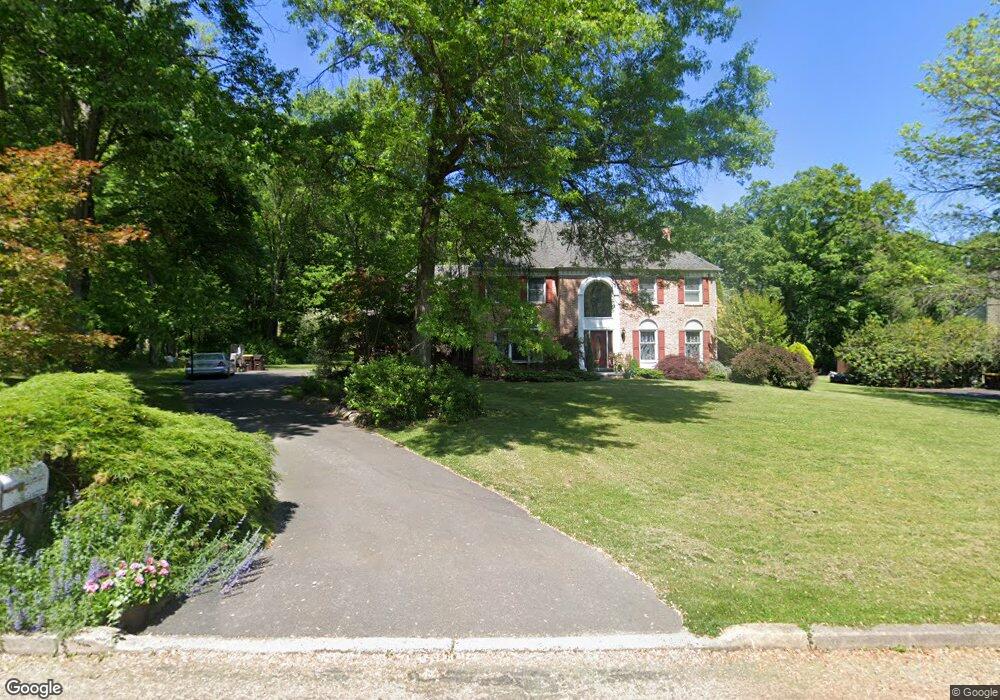
2575 Red Gate Dr Doylestown, PA 18902
Estimated Value: $745,000 - $813,000
4
Beds
3
Baths
3,148
Sq Ft
$250/Sq Ft
Est. Value
About This Home
This home is located at 2575 Red Gate Dr, Doylestown, PA 18902 and is currently estimated at $786,482, approximately $249 per square foot. 2575 Red Gate Dr is a home located in Bucks County with nearby schools including Buckingham Elementary School, Holicong Middle School, and Central Bucks High School - East.
Ownership History
Date
Name
Owned For
Owner Type
Purchase Details
Closed on
May 8, 2009
Sold by
Bruce Jamie L
Bought by
Lipski Boris and Lipskaya Olga
Current Estimated Value
Home Financials for this Owner
Home Financials are based on the most recent Mortgage that was taken out on this home.
Original Mortgage
$124,000
Outstanding Balance
$78,557
Interest Rate
4.9%
Mortgage Type
Purchase Money Mortgage
Estimated Equity
$707,925
Purchase Details
Closed on
Jun 16, 2004
Sold by
Bruce Albert M and Bruce Jamie L
Bought by
Bruce Jamie L
Purchase Details
Closed on
Oct 11, 1996
Sold by
Pearce David W and Pearce Susan M
Bought by
Dempsey Scott
Home Financials for this Owner
Home Financials are based on the most recent Mortgage that was taken out on this home.
Original Mortgage
$254,000
Interest Rate
4.25%
Purchase Details
Closed on
Apr 28, 1994
Sold by
Curtin Robert and Curtin Melanie
Bought by
Pearce David W and Pearce Susan M
Home Financials for this Owner
Home Financials are based on the most recent Mortgage that was taken out on this home.
Original Mortgage
$225,000
Interest Rate
3.87%
Create a Home Valuation Report for This Property
The Home Valuation Report is an in-depth analysis detailing your home's value as well as a comparison with similar homes in the area
Home Values in the Area
Average Home Value in this Area
Purchase History
| Date | Buyer | Sale Price | Title Company |
|---|---|---|---|
| Lipski Boris | $410,000 | None Available | |
| Bruce Jamie L | -- | -- | |
| Dempsey Scott | $289,000 | -- | |
| Pearce David W | $305,000 | T A Title Insurance Company |
Source: Public Records
Mortgage History
| Date | Status | Borrower | Loan Amount |
|---|---|---|---|
| Open | Lipski Boris | $124,000 | |
| Previous Owner | Dempsey Scott | $254,000 | |
| Previous Owner | Pearce David W | $225,000 |
Source: Public Records
Tax History
| Year | Tax Paid | Tax Assessment Tax Assessment Total Assessment is a certain percentage of the fair market value that is determined by local assessors to be the total taxable value of land and additions on the property. | Land | Improvement |
|---|---|---|---|---|
| 2025 | $7,328 | $45,010 | $7,840 | $37,170 |
| 2024 | $7,328 | $45,010 | $7,840 | $37,170 |
| 2023 | $7,080 | $45,010 | $7,840 | $37,170 |
| 2022 | $6,995 | $45,010 | $7,840 | $37,170 |
| 2021 | $6,911 | $45,010 | $7,840 | $37,170 |
| 2020 | $6,911 | $45,010 | $7,840 | $37,170 |
| 2019 | $6,866 | $45,010 | $7,840 | $37,170 |
| 2018 | $6,866 | $45,010 | $7,840 | $37,170 |
| 2017 | $6,810 | $45,010 | $7,840 | $37,170 |
| 2016 | $6,878 | $45,010 | $7,840 | $37,170 |
| 2015 | -- | $45,010 | $7,840 | $37,170 |
| 2014 | -- | $45,010 | $7,840 | $37,170 |
Source: Public Records
Map
Nearby Homes
- 4602 Sands Way
- 2918 Snake Hill Rd
- 2798 Forge Place
- 3455 & 3479 Durham Rd
- 4203 Greenspire Ln
- 5025 Anderson Rd
- 3889 Robin Rd
- 3039 Durham Rd
- 1908 Durham Rd
- 2980 Yorkshire Rd
- 4448 Lower Mountain Rd
- 3775 Buckingham Dr
- 3795 Route 202
- 4549 Lower Mountain Rd
- 5358 York Rd
- 2209 Swamp Rd
- 117 Windover Ln
- 600 Mulberry Ct
- 377 Spring Meadow Cir
- 5087 Lower Mountain Rd
- 2559 Red Gate Dr
- 2593 Red Gate Dr
- 4389 Angus Cir
- 2607 Red Gate Dr
- 2543 Red Gate Dr
- 4464 York Rd
- 4464 Old York Rd
- 4371 Angus Cir
- 2538 Red Gate Dr
- 2610 Red Gate Dr
- 2623 Red Gate Dr
- 4376 Old York Rd
- 4365 Angus Cir
- 4356 Angus Cir
- 4482 York Rd
- 4484 York Rd
- 4482 York Rd
- 2641 Red Gate Dr
- 4484 York Rd
- 2636 Red Gate Dr
Your Personal Tour Guide
Ask me questions while you tour the home.