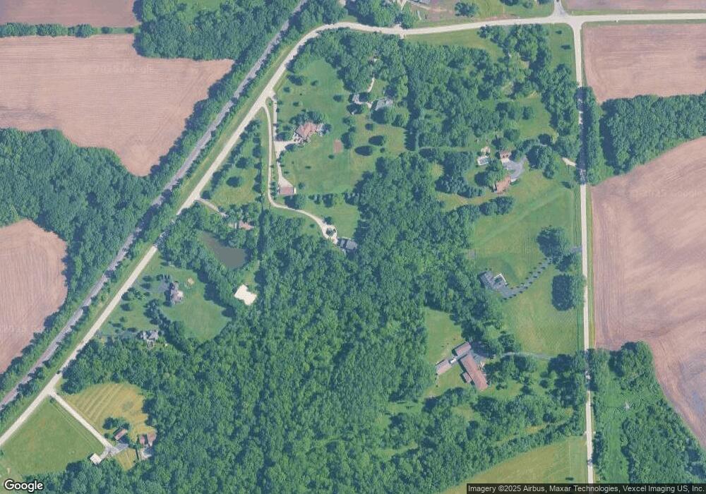
25757 Canal Rd N Minooka, IL 60447
South DuPage River NeighborhoodEstimated Value: $417,000 - $778,000
--
Bed
--
Bath
2,520
Sq Ft
$242/Sq Ft
Est. Value
About This Home
This home is located at 25757 Canal Rd N, Minooka, IL 60447 and is currently estimated at $609,965, approximately $242 per square foot. 25757 Canal Rd N is a home located in Will County with nearby schools including N B Galloway Elementary School, Three Rivers School, and Pioneer Path School.
Ownership History
Date
Name
Owned For
Owner Type
Purchase Details
Closed on
Oct 8, 2020
Sold by
Brozovich Mark J and Brozovich Kelly
Bought by
Lubke Thomas A and Lubke Dawn M
Current Estimated Value
Home Financials for this Owner
Home Financials are based on the most recent Mortgage that was taken out on this home.
Original Mortgage
$345,000
Interest Rate
2.62%
Mortgage Type
New Conventional
Purchase Details
Closed on
Dec 8, 2015
Sold by
Brozovich Mark J
Bought by
Brozovich Mark J and Brozovich Kelly A
Create a Home Valuation Report for This Property
The Home Valuation Report is an in-depth analysis detailing your home's value as well as a comparison with similar homes in the area
Home Values in the Area
Average Home Value in this Area
Purchase History
| Date | Buyer | Sale Price | Title Company |
|---|---|---|---|
| Lubke Thomas A | $495,000 | Chicago Title | |
| Brozovich Mark J | -- | Attorney |
Source: Public Records
Mortgage History
| Date | Status | Borrower | Loan Amount |
|---|---|---|---|
| Previous Owner | Lubke Thomas A | $345,000 |
Source: Public Records
Tax History Compared to Growth
Tax History
| Year | Tax Paid | Tax Assessment Tax Assessment Total Assessment is a certain percentage of the fair market value that is determined by local assessors to be the total taxable value of land and additions on the property. | Land | Improvement |
|---|---|---|---|---|
| 2024 | $8,671 | $163,925 | $43,973 | $119,952 |
| 2023 | $8,671 | $144,746 | $38,828 | $105,918 |
| 2022 | $9,153 | $135,746 | $36,414 | $99,332 |
| 2021 | $9,454 | $128,305 | $34,418 | $93,887 |
| 2020 | $9,189 | $125,543 | $33,677 | $91,866 |
| 2019 | $8,821 | $119,850 | $32,150 | $87,700 |
| 2018 | $8,578 | $117,022 | $31,246 | $85,776 |
| 2017 | $8,349 | $112,198 | $29,958 | $82,240 |
| 2016 | $8,117 | $107,675 | $28,750 | $78,925 |
| 2015 | $7,019 | $97,750 | $27,750 | $70,000 |
| 2014 | $7,019 | $93,950 | $26,950 | $67,000 |
| 2013 | $7,019 | $93,950 | $26,950 | $67,000 |
Source: Public Records
Map
Nearby Homes
- 105 Northfield Dr
- 103 Northfield Dr
- 25734 Hickory Ct
- 107 Sibley Dr
- 101 Fieldcrest Ct
- 23836 S Willow Ln
- 303 Grande Dr Unit A
- 24025 Timberwood Dr
- 9015 E Mcevilly Rd
- 308 Wabasso Place
- 25200 W Pawnee Ln
- 103 E Coady Dr
- 201 W Church St
- 405 W Mondamin St
- 24350 Marble Rd
- 23959 S Green Heron Dr
- 22416 S Kings Ct
- 24123 S Sandpiper Dr
- LOT 1 Bob Blair Rd
- 25225 W Saint Elizabeth Dr Unit B32
- 25763 Canal Rd N
- 25821 Canal Rd N
- 25741 Canal Rd N
- 25711 Canal Rd N
- 23230 S Ford Rd
- 23200 S Ford Rd
- 23200 S Ford Rd
- 23420 S Ford Rd
- 23420 S Ford Rd
- 25851 Canal Rd N
- 25905 Canal Rd N
- 25708 Canal Rd N
- 25917 Canal Rd N
- 25957 Canal Rd N
- 0 Canal Rd Unit 7826904
- 23046 Ingolsby Rd
- 157 Northfield Dr
- 153 Northfield Dr
- 26031 Canal Rd N
- 149 Northfield Dr
