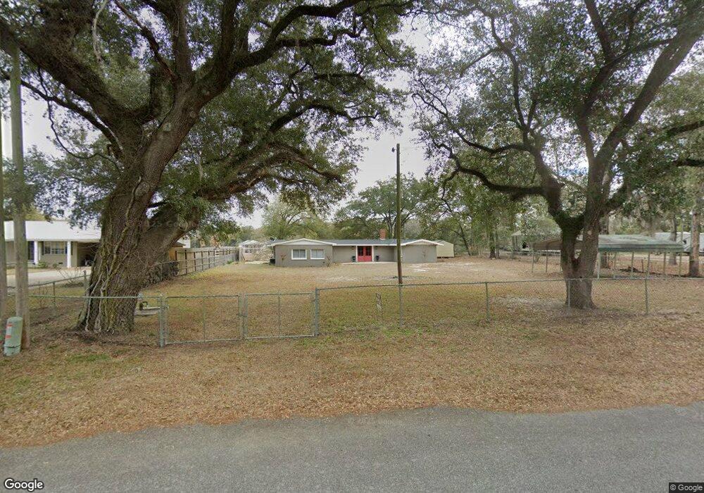
258 Flint River Heights Rd Bainbridge, GA 39817
Estimated Value: $207,810 - $307,000
--
Bed
1
Bath
1,976
Sq Ft
$139/Sq Ft
Est. Value
About This Home
This home is located at 258 Flint River Heights Rd, Bainbridge, GA 39817 and is currently estimated at $275,203, approximately $139 per square foot. 258 Flint River Heights Rd is a home located in Decatur County with nearby schools including Bainbridge High School.
Ownership History
Date
Name
Owned For
Owner Type
Purchase Details
Closed on
Nov 30, 2015
Sold by
Hanson Dawn M
Bought by
Bush Craig and Bush Roberta
Current Estimated Value
Purchase Details
Closed on
Jun 15, 2005
Sold by
Bostwick Barry Blake
Bought by
Hanson Dawn M and Hanson William B
Home Financials for this Owner
Home Financials are based on the most recent Mortgage that was taken out on this home.
Original Mortgage
$104,500
Interest Rate
5.66%
Mortgage Type
New Conventional
Create a Home Valuation Report for This Property
The Home Valuation Report is an in-depth analysis detailing your home's value as well as a comparison with similar homes in the area
Home Values in the Area
Average Home Value in this Area
Purchase History
| Date | Buyer | Sale Price | Title Company |
|---|---|---|---|
| Bush Craig | $155,000 | -- | |
| Hanson Dawn M | $110,000 | -- |
Source: Public Records
Mortgage History
| Date | Status | Borrower | Loan Amount |
|---|---|---|---|
| Previous Owner | Hanson Dawn M | $104,500 |
Source: Public Records
Tax History Compared to Growth
Tax History
| Year | Tax Paid | Tax Assessment Tax Assessment Total Assessment is a certain percentage of the fair market value that is determined by local assessors to be the total taxable value of land and additions on the property. | Land | Improvement |
|---|---|---|---|---|
| 2024 | $1,840 | $61,098 | $6,784 | $54,314 |
| 2023 | $1,840 | $61,098 | $6,784 | $54,314 |
| 2022 | $1,806 | $62,074 | $6,784 | $55,290 |
| 2021 | $1,636 | $55,198 | $6,784 | $48,414 |
| 2020 | $1,522 | $48,724 | $6,784 | $41,940 |
| 2019 | $1,676 | $51,663 | $8,652 | $43,011 |
| 2018 | $1,655 | $51,663 | $8,652 | $43,011 |
| 2017 | $1,621 | $51,663 | $8,652 | $43,011 |
| 2016 | $1,621 | $51,664 | $8,652 | $43,011 |
| 2015 | $1,524 | $51,664 | $8,652 | $43,011 |
| 2014 | $1,329 | $47,908 | $8,652 | $39,255 |
| 2013 | -- | $47,907 | $8,652 | $39,255 |
Source: Public Records
Map
Nearby Homes
- 116 Flint River Heights Rd
- 186 Aryola Dr
- 104 Brock St
- 757 Manhole Rd
- 533 Flint River Heights Rd
- Tract 1 Rivervale Dr
- 150 Rivervale Dr
- 00 Manhole Rd
- 116 Rivervale Dr
- 2137 Pondtown Rd
- 0 Pine St Unit 10993
- 287 Cloverleaf Cir
- 2036 Lexington Ave
- 2032 Lexington Ave
- 000 E River Rd
- 160 Manhole Rd
- 1302 Majestic Ave
- 1606 Hemlock St
- 1702 Vada Rd
- 467 745 Lot St N
- 262 Flint River Heights Rd
- 252 Flint River Heights Rd
- 268 Flint River Heights Rd
- 244 Flint River Heights Rd
- 278 Flint River Heights Rd
- 238 Flint River Heights Rd
- 177 Riverview Dr
- 187 Riverview Dr
- 230 Flint River Heights Rd
- 157 Riverview Dr
- 167 Riverview Dr
- 181 Riverview Dr
- 226 Flint River Heights Rd
- 153 Riverview Dr
- 191 Riverview Dr
- 294 Flint River Heights Rd
- 149 Riverview Dr
- 201 Riverview Dr
- 218 Flint River Heights Rd
- 141 Riverview Dr