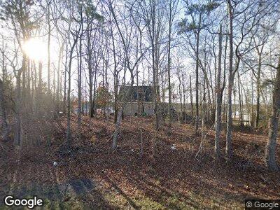
2580 Bullock Mill Rd Colbert, GA 30628
Estimated Value: $358,000 - $402,248
--
Bed
3
Baths
2,100
Sq Ft
$183/Sq Ft
Est. Value
About This Home
This home is located at 2580 Bullock Mill Rd, Colbert, GA 30628 and is currently estimated at $383,562, approximately $182 per square foot. 2580 Bullock Mill Rd is a home located in Madison County with nearby schools including Madison County High School.
Ownership History
Date
Name
Owned For
Owner Type
Purchase Details
Closed on
Sep 21, 2001
Sold by
May Jeffrey L and May Lind
Bought by
May Jeffrey L and May Linda R
Current Estimated Value
Purchase Details
Closed on
Sep 14, 2001
Sold by
Livesay Tommy A
Bought by
May Jeffrey L and May Lind
Purchase Details
Closed on
Jan 12, 1996
Bought by
Livesay Tommy A
Create a Home Valuation Report for This Property
The Home Valuation Report is an in-depth analysis detailing your home's value as well as a comparison with similar homes in the area
Home Values in the Area
Average Home Value in this Area
Purchase History
| Date | Buyer | Sale Price | Title Company |
|---|---|---|---|
| May Jeffrey L | -- | -- | |
| May Jeffrey L | $217,800 | -- | |
| Livesay Tommy A | $124,000 | -- |
Source: Public Records
Mortgage History
| Date | Status | Borrower | Loan Amount |
|---|---|---|---|
| Open | May Jeffrey L | $205,300 | |
| Closed | May Jeffrey L | $172,000 | |
| Closed | May Jeffrey L | $267,023 | |
| Closed | May Jeffrey L | $274,511 |
Source: Public Records
Tax History Compared to Growth
Tax History
| Year | Tax Paid | Tax Assessment Tax Assessment Total Assessment is a certain percentage of the fair market value that is determined by local assessors to be the total taxable value of land and additions on the property. | Land | Improvement |
|---|---|---|---|---|
| 2024 | $3,518 | $137,156 | $29,722 | $107,434 |
| 2023 | $2,867 | $93,922 | $24,768 | $69,154 |
| 2022 | $2,959 | $109,295 | $17,029 | $92,266 |
| 2021 | $2,598 | $87,119 | $17,029 | $70,090 |
| 2020 | $2,540 | $84,642 | $14,552 | $70,090 |
| 2019 | $2,524 | $83,173 | $14,552 | $68,621 |
| 2018 | $2,425 | $79,740 | $13,314 | $66,426 |
| 2017 | $2,349 | $81,586 | $12,384 | $69,202 |
| 2016 | $2,015 | $72,194 | $12,384 | $59,810 |
| 2015 | $2,016 | $72,194 | $12,384 | $59,810 |
| 2014 | $2,028 | $72,194 | $12,385 | $59,810 |
| 2013 | -- | $72,194 | $12,385 | $59,810 |
Source: Public Records
Map
Nearby Homes
- 84 Sourwood Trail Unit 55
- 68 Sourwood Trail Unit 54
- 2128 Highway 172
- 14 Sourwood Trail Unit 53
- 185 Redbud Trail Unit 56
- 220 Highway 172
- 0 Old Kincaid Rd Unit 10438229
- 0 Old Kincaid Rd Unit 1023057
- 230 Hannah Dr
- 599 Double Branch Rd
- 814 Brush Creek Rd
- 0 Bluff Rd Unit 10426339
- 3956 Highway 98 E
- 75 Gunnell Rd
- 50 Scout Hut Rd
- 2545 Highway 98 E
- 2638 Arnold Bottoms Rd
- 370 Scout Hut Rd
- 2580 Bullock Mill Rd
- 2732 Bullock Mill Rd
- 2752 Bullock Mill Rd
- 0 Bullock Mill Rd Unit 7285409
- 0 Bullock Mill Rd
- 2285 Bullock Mill Rd
- 0 Bullock Mill Rd
- 0 Bullock Mill Rd Unit 946270
- 0 Bullock Mill Rd Unit 949268
- 0 Bullock Mill Rd Unit 954904
- 0 Bullock Mill Rd Unit 7461378
- 0 Bullock Mill Rd Unit 7297210
- 0 Bullock Mill Rd Unit 7236351
- 0 Bullock Mill Rd Unit 7610670
- 0 Bullock Mill Rd Unit 8026494
- 3233 Colbert Danielsville Rd
- 3391 Colbert Danielsville Rd
- 2185 Bullock Mill Rd
- 3287 Colbert Danielsville Rd
- 3371 Colbert Danielsville Rd
