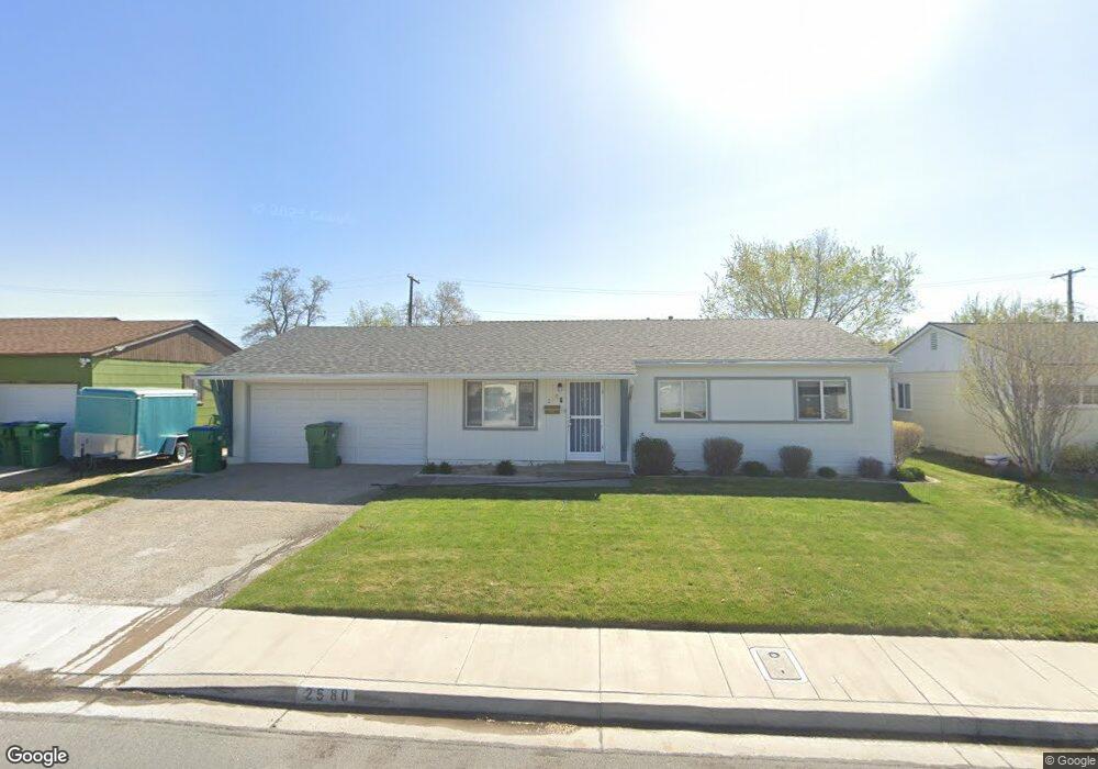
2580 Stine Way Sparks, NV 89431
McCarran Boulevard-Probasco NeighborhoodEstimated Value: $382,061 - $444,000
3
Beds
2
Baths
1,444
Sq Ft
$290/Sq Ft
Est. Value
About This Home
This home is located at 2580 Stine Way, Sparks, NV 89431 and is currently estimated at $418,765, approximately $290 per square foot. 2580 Stine Way is a home located in Washoe County with nearby schools including Florence Drake Elementary School, George L Dilworth Middle School, and Sparks High School.
Ownership History
Date
Name
Owned For
Owner Type
Purchase Details
Closed on
Mar 3, 2015
Sold by
Rossi Nicholas D E and Rossi Debra A
Bought by
Urban Sanctuaries Llc
Current Estimated Value
Purchase Details
Closed on
Oct 20, 2008
Sold by
Rossi Nicholas and Rossi Debra L
Bought by
Rossi Nicholas D E and Rossi Debra A
Purchase Details
Closed on
Oct 16, 2008
Sold by
Mix Susan L
Bought by
Rossi Nicholas D E and Rossi Debra A
Create a Home Valuation Report for This Property
The Home Valuation Report is an in-depth analysis detailing your home's value as well as a comparison with similar homes in the area
Home Values in the Area
Average Home Value in this Area
Purchase History
| Date | Buyer | Sale Price | Title Company |
|---|---|---|---|
| Urban Sanctuaries Llc | -- | None Available | |
| Rossi Nicholas D E | -- | None Available | |
| Rossi Nicholas D E | $160,000 | Western Title Inc Ridge |
Source: Public Records
Tax History Compared to Growth
Tax History
| Year | Tax Paid | Tax Assessment Tax Assessment Total Assessment is a certain percentage of the fair market value that is determined by local assessors to be the total taxable value of land and additions on the property. | Land | Improvement |
|---|---|---|---|---|
| 2025 | $822 | $54,069 | $33,565 | $20,504 |
| 2024 | $822 | $50,249 | $30,065 | $20,184 |
| 2023 | $762 | $50,002 | $31,325 | $18,677 |
| 2022 | $740 | $41,412 | $26,180 | $15,232 |
| 2021 | $721 | $32,786 | $17,955 | $14,831 |
| 2020 | $697 | $31,481 | $16,940 | $14,541 |
| 2019 | $678 | $29,665 | $15,890 | $13,775 |
| 2018 | $662 | $24,929 | $11,725 | $13,204 |
| 2017 | $642 | $23,361 | $10,395 | $12,966 |
| 2016 | $626 | $22,328 | $9,345 | $12,983 |
| 2015 | $629 | $20,407 | $7,700 | $12,707 |
| 2014 | $608 | $18,417 | $6,440 | $11,977 |
| 2013 | -- | $15,913 | $4,270 | $11,643 |
Source: Public Records
Map
Nearby Homes
- 465 Lenwood Dr
- 780 Emerson Way
- 119 Devere Way
- 1945 4th St Unit 32
- 1945 4th St Unit 33
- 1945 4th St Unit 10
- 1940 4th St Unit 20
- 1940 4th St Unit 51
- 1023 Tyler Way
- 1125 Dodson Way
- 1110 Xman Way
- 1160 York Way
- 3252 Holman Way
- 1705 9th St
- 1003 Sbragia Way
- 1345 Plymouth Way
- 3269 Valley Forge Way
- 10 Sheridan Way
- 1124 Sbragia Way
- 1703 1st St