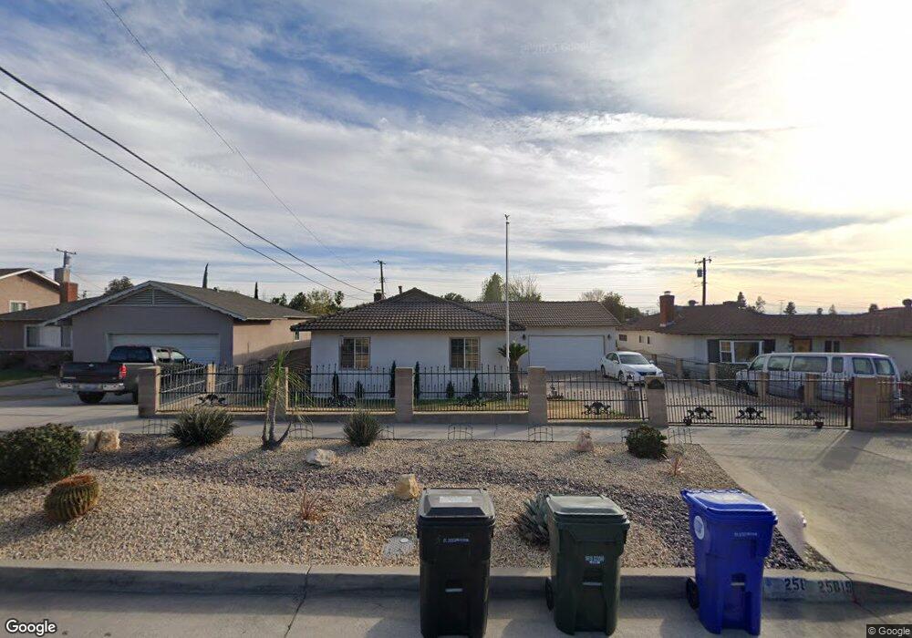
25819 Date St San Bernardino, CA 92404
Barton NeighborhoodEstimated Value: $491,996 - $563,000
3
Beds
2
Baths
1,401
Sq Ft
$374/Sq Ft
Est. Value
About This Home
This home is located at 25819 Date St, San Bernardino, CA 92404 and is currently estimated at $524,249, approximately $374 per square foot. 25819 Date St is a home located in San Bernardino County with nearby schools including Barton Elementary School, Del Vallejo Middle School, and San Gorgonio High School.
Ownership History
Date
Name
Owned For
Owner Type
Purchase Details
Closed on
Sep 18, 2004
Sold by
Coats Ronald Leroy and Coats Jean Kathleen
Bought by
Coats Ronald Leroy and Coats Jean Kathleen
Current Estimated Value
Home Financials for this Owner
Home Financials are based on the most recent Mortgage that was taken out on this home.
Original Mortgage
$200,000
Interest Rate
5.8%
Mortgage Type
Credit Line Revolving
Purchase Details
Closed on
Apr 8, 2002
Sold by
Coats Ronald Leroy and Coats Jean Kathleen
Bought by
Coats Ronald Leroy and Coats Jean Kathleen
Create a Home Valuation Report for This Property
The Home Valuation Report is an in-depth analysis detailing your home's value as well as a comparison with similar homes in the area
Home Values in the Area
Average Home Value in this Area
Purchase History
| Date | Buyer | Sale Price | Title Company |
|---|---|---|---|
| Coats Ronald Leroy | -- | Old Republic Title Company | |
| Coats Ronald Leroy | -- | Old Republic Title Company | |
| Coats Ronald Leroy | -- | -- |
Source: Public Records
Mortgage History
| Date | Status | Borrower | Loan Amount |
|---|---|---|---|
| Closed | Coats Ronald Leroy | $200,000 |
Source: Public Records
Tax History Compared to Growth
Tax History
| Year | Tax Paid | Tax Assessment Tax Assessment Total Assessment is a certain percentage of the fair market value that is determined by local assessors to be the total taxable value of land and additions on the property. | Land | Improvement |
|---|---|---|---|---|
| 2025 | $1,991 | $155,393 | $31,080 | $124,313 |
| 2024 | $1,991 | $152,346 | $30,471 | $121,875 |
| 2023 | $1,939 | $149,359 | $29,874 | $119,485 |
| 2022 | $1,938 | $146,430 | $29,288 | $117,142 |
| 2021 | $1,938 | $143,559 | $28,714 | $114,845 |
| 2020 | $1,939 | $142,087 | $28,420 | $113,667 |
| 2019 | $1,883 | $139,301 | $27,863 | $111,438 |
| 2018 | $1,722 | $136,570 | $27,317 | $109,253 |
| 2017 | $1,668 | $133,892 | $26,781 | $107,111 |
| 2016 | $1,617 | $131,267 | $26,256 | $105,011 |
| 2015 | $1,646 | $129,296 | $25,862 | $103,434 |
| 2014 | $1,594 | $126,763 | $25,355 | $101,408 |
Source: Public Records
Map
Nearby Homes
- 25842 26th St
- 6140 Mckinley Ave
- 5991 Rogers Ln
- 5974 Buchanan Ave
- 5950 Rogers Ln
- 5954 Newcomb St
- 6083 Merito Ave
- 2350 Osbun Rd Unit 78
- 2117 Jacaranda Ct
- 1974 E Lynwood Dr Unit 11F
- 1974 E Lynwood Dr Unit 1D
- 1974 E Lynwood Dr Unit 2B
- 26287 29th St
- 2194 Sunrise Ln E
- 5792 Merito Ave
- 5979 Elmwood Rd
- 26037 E Edgemont Dr
- 5793 Osbun Rd
- 2345 Del Rosa Ave
- 5749 Osbun Rd