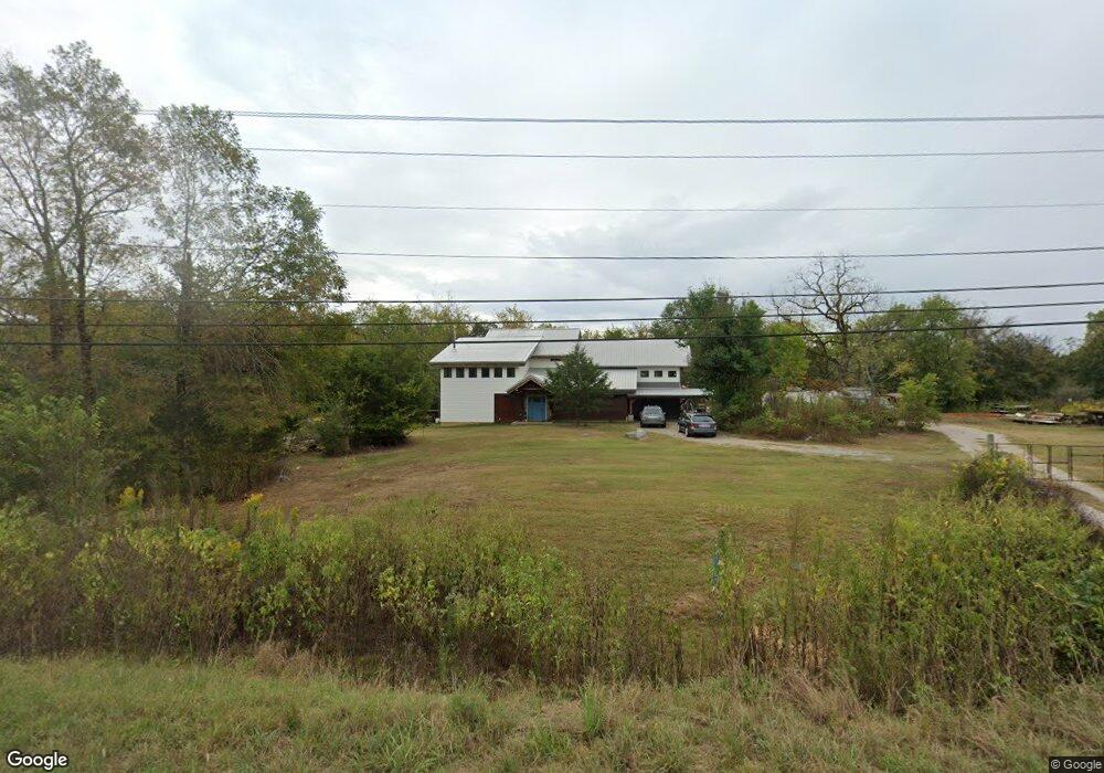
2584 Highway 119 Montevallo, AL 35115
Estimated Value: $209,000 - $264,000
--
Bed
1
Bath
1,740
Sq Ft
$137/Sq Ft
Est. Value
About This Home
This home is located at 2584 Highway 119, Montevallo, AL 35115 and is currently estimated at $239,000, approximately $137 per square foot. 2584 Highway 119 is a home located in Shelby County with nearby schools including Montevallo Elementary School, Montevallo Middle School, and Montevallo High School.
Ownership History
Date
Name
Owned For
Owner Type
Purchase Details
Closed on
Dec 20, 2013
Sold by
Gallups Gail and Vinson Gail
Bought by
Cole Tyson Andrew Earl Porter
Current Estimated Value
Home Financials for this Owner
Home Financials are based on the most recent Mortgage that was taken out on this home.
Original Mortgage
$15,200
Interest Rate
4.29%
Mortgage Type
New Conventional
Purchase Details
Closed on
Jun 9, 2008
Sold by
Gallups Kenneth
Bought by
Gallups Gail
Purchase Details
Closed on
Aug 12, 1999
Sold by
Eliason Marjorie E and Echols Marjorie E
Bought by
Gallups Kenneth and Gallups Gail
Create a Home Valuation Report for This Property
The Home Valuation Report is an in-depth analysis detailing your home's value as well as a comparison with similar homes in the area
Home Values in the Area
Average Home Value in this Area
Purchase History
| Date | Buyer | Sale Price | Title Company |
|---|---|---|---|
| Cole Tyson Andrew Earl Porter | $19,000 | None Available | |
| Gallups Gail | -- | None Available | |
| Gallups Kenneth | $50,000 | -- |
Source: Public Records
Mortgage History
| Date | Status | Borrower | Loan Amount |
|---|---|---|---|
| Closed | Cole Tyson Andrew Earl Porter | $15,200 |
Source: Public Records
Tax History Compared to Growth
Tax History
| Year | Tax Paid | Tax Assessment Tax Assessment Total Assessment is a certain percentage of the fair market value that is determined by local assessors to be the total taxable value of land and additions on the property. | Land | Improvement |
|---|---|---|---|---|
| 2024 | $777 | $15,240 | $0 | $0 |
| 2023 | $678 | $14,100 | $0 | $0 |
| 2022 | $606 | $12,680 | $0 | $0 |
| 2021 | $571 | $12,000 | $0 | $0 |
| 2020 | $569 | $11,160 | $0 | $0 |
| 2019 | $521 | $10,220 | $0 | $0 |
| 2017 | $242 | $4,740 | $0 | $0 |
| 2015 | $208 | $4,080 | $0 | $0 |
| 2014 | $416 | $8,160 | $0 | $0 |
Source: Public Records
Map
Nearby Homes
- 415 Tecumseh St
- 340 Comanche St
- 185 Sequoia St
- 164 Davila Dr
- 1620 Ashville Rd
- 2450 Spring Creek Rd Unit 1
- 1900 Spring Creek Rd
- 1059 Spring Creek Rd Unit 27-5-22-0-001-034.01
- 1059 Spring Creek Rd
- 2464 Spring Creek Rd
- 2286 Spring Creek Rd
- 1030 Moody St
- 1251 Hedgerow Dr
- 1130 Nabors St Unit 2A
- 125 Meadow Rd
- 355 Parkway Cir
- 664 Jamestown Cir
- 676 Jamestown Cir
- 672 Jamestown Cir
- 668 Jamestown Cir
- 2584 Highway 119 Unit 1.4 AC
- 2532 Highway 119
- 2300 Highway 119
- 2500 Highway 119
- 105 Grandview Farm Dr
- 2069 Highway 119
- 140 Grandview Farm Dr
- 2090 Highway 119
- 2888 Highway 119
- 801 Cobblestone Ln Unit 1c
- 811 Cobblestone Ln Unit 1B
- 821 Cobblestone Ln Unit 1A
- 1634 Cobblestone Ln
- 400 Kiowa St
- 2025 Highway 119
- 125 Coeur Dalene
- 0 Creek St
- 0 Creek St Unit 445288
- 0 Creek St Unit 472310
- 300 Kiowa St