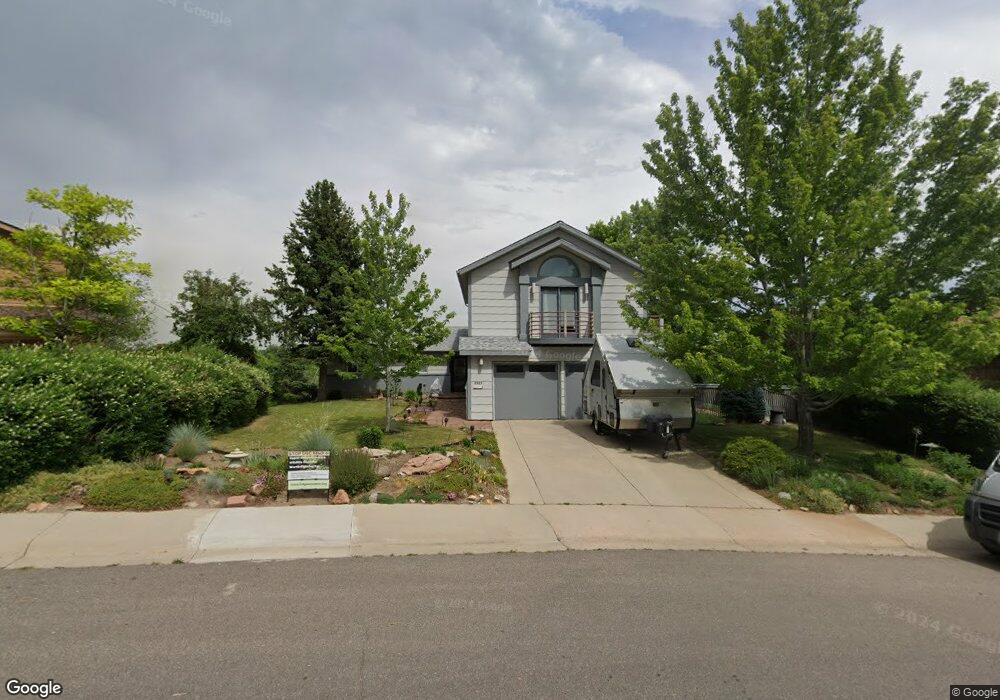
2585 Balsam Dr Boulder, CO 80304
Central Boulder NeighborhoodEstimated Value: $1,389,159 - $3,282,000
3
Beds
3
Baths
2,166
Sq Ft
$945/Sq Ft
Est. Value
About This Home
This home is located at 2585 Balsam Dr, Boulder, CO 80304 and is currently estimated at $2,047,790, approximately $945 per square foot. 2585 Balsam Dr is a home located in Boulder County with nearby schools including Whittier Elementary School, Casey Middle School, and Boulder High School.
Ownership History
Date
Name
Owned For
Owner Type
Purchase Details
Closed on
Jun 14, 2024
Sold by
Lowry Robin
Bought by
Mchugh Robert Stuart and Lowry Robin
Current Estimated Value
Purchase Details
Closed on
Sep 29, 1992
Bought by
Lowry Robin
Purchase Details
Closed on
Apr 8, 1991
Bought by
Lowry Robin
Purchase Details
Closed on
Apr 25, 1990
Bought by
Lowry Robin
Purchase Details
Closed on
Apr 16, 1990
Bought by
Lowry Robin
Create a Home Valuation Report for This Property
The Home Valuation Report is an in-depth analysis detailing your home's value as well as a comparison with similar homes in the area
Home Values in the Area
Average Home Value in this Area
Purchase History
| Date | Buyer | Sale Price | Title Company |
|---|---|---|---|
| Mchugh Robert Stuart | -- | None Listed On Document | |
| Lowry Robin | $142,000 | -- | |
| Lowry Robin | -- | -- | |
| Lowry Robin | -- | -- | |
| Lowry Robin | -- | -- |
Source: Public Records
Tax History Compared to Growth
Tax History
| Year | Tax Paid | Tax Assessment Tax Assessment Total Assessment is a certain percentage of the fair market value that is determined by local assessors to be the total taxable value of land and additions on the property. | Land | Improvement |
|---|---|---|---|---|
| 2025 | $7,836 | $88,463 | $71,019 | $17,444 |
| 2024 | $7,836 | $88,463 | $71,019 | $17,444 |
| 2023 | $7,700 | $95,864 | $75,234 | $24,314 |
| 2022 | $6,357 | $75,408 | $58,957 | $16,451 |
| 2021 | $6,062 | $77,577 | $60,653 | $16,924 |
| 2020 | $6,135 | $77,628 | $51,838 | $25,790 |
| 2019 | $6,041 | $77,628 | $51,838 | $25,790 |
| 2018 | $5,984 | $76,219 | $40,608 | $35,611 |
| 2017 | $5,797 | $84,264 | $44,894 | $39,370 |
| 2016 | $4,755 | $62,884 | $35,342 | $27,542 |
| 2015 | $4,502 | $52,536 | $25,870 | $26,666 |
| 2014 | $3,748 | $52,536 | $25,870 | $26,666 |
Source: Public Records
Map
Nearby Homes
- 2991 25th St
- 2545 Pine St
- 2711 Mapleton Ave Unit 1
- 2711 Mapleton Ave Unit 9
- 2711 Mapleton Ave Unit 27
- 2206 Alpine Dr
- 2240 Bluff St
- 2709 Pine St
- 2335 23rd St
- 2535 Spruce St
- 2085 Balsam Dr
- 2718 Pine St Unit 301
- 2283 Nicholl St E
- 2680 Fremont St
- 2707 Valmont Rd Unit 304A
- 2707 Valmont Rd Unit 106 Bonus!
- 3055 23rd St
- 2465 Walnut St Unit 7
- 2201 Pearl St Unit 224
- 2201 Pearl St Unit 2
- 2565 Balsam Dr
- 2580 Panorama Ave
- 2645 Folsom St
- 2560 Panorama Ave
- 2550 Balsam Dr
- 2545 Panorama Ave
- 2545 Balsam Dr
- 2695 Folsom St
- 2485 Folsom St
- 2480 Balsam Dr
- 2525 Balsam Dr
- 2540 Panorama Ave
- 2485 Panorama Ave
- 2520 Panorama Ave
- 2485 Balsam Dr
- 2541 Bluff St
- 2460 Balsam Dr
- 2445 Panorama Ave
- 2535 Bluff St
- 2480 Panorama Ave