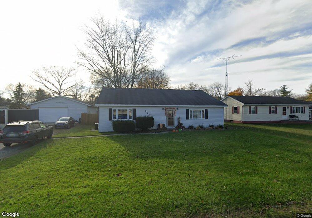
2585 Robbins Ct Port Huron, MI 48060
Estimated Value: $177,000 - $197,176
3
Beds
2
Baths
1,694
Sq Ft
$109/Sq Ft
Est. Value
About This Home
This home is located at 2585 Robbins Ct, Port Huron, MI 48060 and is currently estimated at $185,294, approximately $109 per square foot. 2585 Robbins Ct is a home located in St. Clair County with nearby schools including H.D. Crull Elementary School, Central Middle School, and Port Huron High School.
Ownership History
Date
Name
Owned For
Owner Type
Purchase Details
Closed on
Jun 2, 2021
Sold by
Duckworth Jessica
Bought by
Duckworth Jessica May and Duckworth Terry L
Current Estimated Value
Home Financials for this Owner
Home Financials are based on the most recent Mortgage that was taken out on this home.
Original Mortgage
$90,900
Outstanding Balance
$54,769
Interest Rate
2.27%
Estimated Equity
$130,525
Purchase Details
Closed on
May 31, 2013
Sold by
Liveranie Vivian M
Bought by
Duckworth Jessica
Home Financials for this Owner
Home Financials are based on the most recent Mortgage that was taken out on this home.
Original Mortgage
$104,000
Interest Rate
3.38%
Mortgage Type
Seller Take Back
Create a Home Valuation Report for This Property
The Home Valuation Report is an in-depth analysis detailing your home's value as well as a comparison with similar homes in the area
Home Values in the Area
Average Home Value in this Area
Purchase History
| Date | Buyer | Sale Price | Title Company |
|---|---|---|---|
| Duckworth Jessica May | -- | Liberty Title | |
| Duckworth Jessica | $104,000 | Liberty Title | |
| Duckworth Jessica | $104,000 | Liberty Title | |
| Duckworth Jessica | $104,000 | None Available |
Source: Public Records
Mortgage History
| Date | Status | Borrower | Loan Amount |
|---|---|---|---|
| Open | Duckworth Jessica | $90,900 | |
| Closed | Duckworth Jessica | $90,900 | |
| Previous Owner | Duckworth Jessica | $104,000 |
Source: Public Records
Tax History Compared to Growth
Tax History
| Year | Tax Paid | Tax Assessment Tax Assessment Total Assessment is a certain percentage of the fair market value that is determined by local assessors to be the total taxable value of land and additions on the property. | Land | Improvement |
|---|---|---|---|---|
| 2025 | $1,987 | $88,400 | $0 | $0 |
| 2024 | $1,046 | $91,400 | $0 | $0 |
| 2023 | $965 | $84,500 | $0 | $0 |
| 2022 | $1,783 | $72,100 | $0 | $0 |
| 2021 | $1,632 | $66,400 | $0 | $0 |
| 2020 | $1,632 | $62,400 | $62,400 | $0 |
| 2019 | $1,602 | $51,300 | $0 | $0 |
| 2018 | $1,564 | $51,300 | $0 | $0 |
| 2017 | $1,529 | $49,200 | $0 | $0 |
| 2016 | $792 | $49,200 | $0 | $0 |
| 2015 | -- | $49,000 | $49,000 | $0 |
| 2014 | -- | $44,600 | $44,600 | $0 |
| 2013 | -- | $42,500 | $0 | $0 |
Source: Public Records
Map
Nearby Homes
- 2566 Lewis Dr
- 3255 Harrington Rd
- 2636 Locust St
- 0000 Henry St
- 0000 Manuel St
- 00 Campau Ave
- 146 Taylor St
- VACANT Howard St
- 3335 W Water St
- 1825 Kern St
- 2940 Westland Dr
- 1819 Kern St
- 2650 Alger Rd
- 0000 Water St
- V/L #4 Water St
- V/L #6 Water St
- V/L #5 Water St
- V/L #8 Water St
- V/L #3 Water St
- 2475 Sharon Ln
- 2589 Robbins Ct
- 2573 Robbins Ct
- 2602 Robbins Ct
- 2576 Robbins Ct
- 2571 Robbins Ct
- 2649 Robbins Ct
- 2636 Lewis Dr
- 2650 Robbins Ct
- 2640 Lewis Dr
- 2642 Lewis Dr
- 2630 Lewis Dr
- 2563 Robbins Ct
- 2659 Robbins Ct
- 2654 Robbins Ct
- 2570 Robbins Ct
- 2566 Robbins Ct
- 2669 Robbins Ct
- 2620 Lewis Dr
- 2670 Lewis Dr
- 2679 Robbins Ct